Route 66 in Brentwood, Mo
Index to this page
- About Brentwood
- Brentwood's Weather
- Hotels and accommodation
- Map of US 66
- What to see and do in Brentwood
About Brentwood, Missouri
Facts, Trivia and useful information
Located within the Central Township district, it originated as a station of the Missouri Pacific Railroad: Brentwood station.
For the history of St. Louis County visit our St. Louis History section in our St. Louis webpage.
The name: Brentwood
It was named after the person who platted the town: Mr. Brent
"Brent" is a Middle English word that comes from the Old English "beornan" that means "to burn".
Getting to Brentwood
Reach Brentwood driving the historic 1926 - 1932 Route 66 now known as Missouri State Highway 100, or use Interstate I-44. I-270, US 50, US 61, I-55 and I-64 cross the area.

Hotels & Motels near Brentwood
Accommodation and hotels close to this town: just west is Kirkwood you will find plenty of motels and lodging options.
> > Book your accommodation in neighboring Kirkwood
More Lodging near Brentwood along Route 66
There are several hotels in the area close to this town. Alternatively you can also find your accommodation along Route 66 in the neighboring towns and cities in Missouri. We list them below (from east to west):
On Route 66's Main alignment in MO
Eastwards
Westwards
- Hotels in Kansas
- Baxter Springs KS
- Galena KS
- Riverton KS
- Hotels in Oklahoma
- Miami OK
>> Check out the RV campground in Fenton
Weather in Brentwood
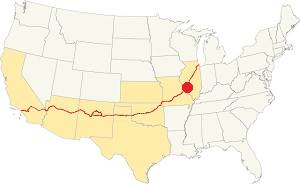
Location of Brentwood on U.S. Hwy. 66
Rainfall in Brentwood is, on average 41 in. (1.041 mm). The most rainy months are from May through July with more than 4.1 in per month (104 mm). Snow falls from Nov. to Apr.: 17.8 in. (45 cm).
Brentwood has four well marked seasons. It is located in the area where humid continental climate shifts towards a humid subtropical climate, so summers are hot and humid while winters are cold. It gets cold Arctic air and hot damp tropical air from the Gulf of Mexico. Spring is wet and may have extreme weather (tornados, thunderstorms and even winter storms). Fall is sunny and less humid, with mild weather.
The average winter high (Jan) is a chilly 39.9°F (4.4°C) and the winter low is on average 23.7°F (-4.6°C). The summer (Jul) average high is 89.1°F (31.7°C) and the average low is 71°F (21.7°C).
Tornado risk
Brentwood is inside Missouri's "Tornado Alley" and St. Louis County has around 7 tornados each year.
Tornado Risk: read more about Tornado Risk along U.S. 66.
Map of Route 66 in Brentwood Missouri
Route 66 was aligned along Manchester Road west of St Louis in 1926 and went west along what is now Missouri Hwy 100 to Gray Summit as shown in the map below published in 1931. In 1932 its alignment was moved further south, through Pacific, Eureka and Sunset Hills bypassing Brentwood.
Map 1931 showing the original US66 into St. Louis
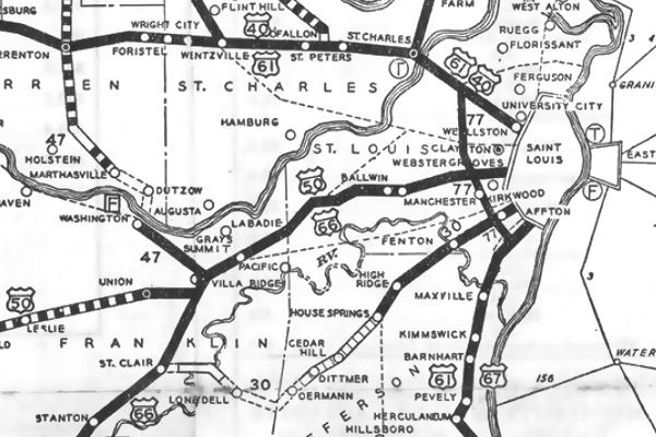
See this map showing the 1926-32 alignment of Route 66 through Brentwood.
The Route 66 alignment in Brentwood
Visit our pages with old maps and plenty of information about US 66's alignments.
- Gray Summit to Rolla (next)
- Route 66 St. Louis to Gray Summit (In Brentwood)
- Route 66 Hamel IL to St. Louis MO (previous)
Route 66 Sights in Brentwood
Landmarks and Places to See
Driving westwards from St. Louis, after crossing the bridge at Black Creek, you leave Maplewood and enter Brentwood. The first sight along the 1.2 mile-long stretch of Route 66 in Brentwood is Buckingham's:
Buckingham’s restaurant
To your right, at 8924 Manchester Rd.
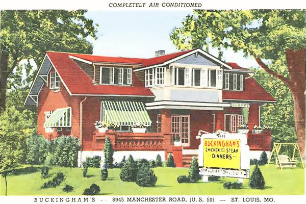
Clyde and Mable "Trixie" Ann Buckingham opened this restaurant in 1943, by then Route 66 no longer ran down Manchester Rd. (US 50 did). They operated it until 1962 when they sold it.
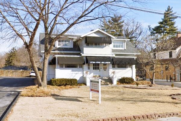
The building still stands, but is no longer a restaurant.
The Buckinghams had experience, Mable had ran a restaurant (Gray Goose Cafeteria) in Little Rock Arkansas back in the mid 1920s. Later they moved to St. Louis where Clyde worked as traffic representative for the McKinley bridge. When he retired in 1948 he worked with Mable running the restaurant.
Clyde passed away at the age of 92 in 1969 and Mabel died in 1986 (she was 103 years old!). Below is a "Then and Now" sequence of the site:
Buckingham's Restaurant, postcard 1946, Brentwood MO
Buckingham's building in 2022, Brentwood MO
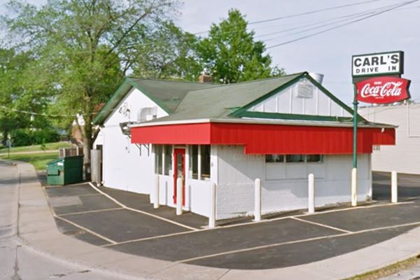
Carl's Drive-In
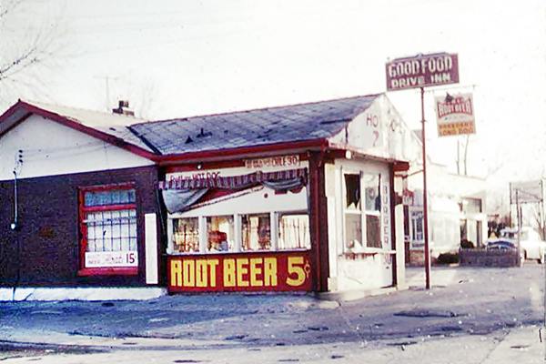
Continue west and on the next block, to your right, on a corner at 9033 Manchester Rd. It began as the Lubrite gas station in 1918 and evolved into a hot dog stand in 1943. In 1950 it was owned by Walter Breeden abd became Breeden's Long Dog, also known as the Good Food Drive Inn.
It was hit by a tornado in 1959, Breeden rebuilt it and sold it that year to Carl Meyer who ran it with his wife Pat. The place has been open since then. Below is a "now and then" set of photos:
Vintage picture of the Hot Dog stand in the 1950s
This leg of your Route 66 Road Trip ends here, continue your journey by driving west into Rock Hill.

Some sponsored content
> > Book your Hotel in Lebanon

Credits
Banner image: Hackberry General Store, Hackberry, Arizona by Perla Eichenblat

