Bypass Route 66 in Hazelwood, Mo
Index to this page
- About Hazelwood
- Hazelwood's Weather
- Hotels and accommodation
- Map of US 66
- What to see and do in Hazelwood
About Hazelwood, Missouri
Facts, Trivia and useful information
Elevation: 561 ft (171 m). Population: 25,703 (2010 census)
Hazelwood is located in St. Louis County, three miles south of the town of Florissant that shares a segment along old Route 66 with it.
History
This area has been inhabited for at least 11,000 years. The first Europeans to explore it were French trappers from the Great Lakes. They claimed the territory as Louisiana in the early 1700s and named it for their king, Louis XIV.
After being in Spanish hands for some years (1763-1802), the French recovered it and sold it to the US in 1803, as a cash-strapped Napoleon needed more money for his European wars.
A trading post (or Jesuit Mission according to other sources) was established nearby in Florissant in the 1760s, the area was known during the Spanish period as a "district of Ylinoa by the name of San Fernando."
The full name was "San Fernando de Florissant", now St. Ferdinand Township. The saint was the king of Castile and Leon, Spain (1198-1252) and Florissant came from Fleurissant (flourishing, flowery, prosperous). There was a church here since 1792, and a post office opened in Florissant in 1830.
The name: Hazelwood
The home of Major Richard Graham was name"Hazelwood". It was built in 1807 and is said to be the first brick house built on west of the Mississippi. Graham bought it in 1815. When Senator Henry Clay visited it in 1828 he remarked that it reminded him of his own estate in Kentucky, "Hazelwood". Graham named is property after Clay's.
It was part of the St. Ferdinand Township. The village incorporated as the Village of Hazelwood in 1949 after neighboring Florissant attempted to annex it after the Ford plant opened here. The city is located by the Lambert-St. Louis International Airport. The first settlement here was that of Florissant which began as a trading post and later became a Jesuit mission. It dates back to 1790 and was officially named San Fernando de Floirissant (the correct spelling would have been "Fleurissant" or florishing, prosperous in French).

Where to Lodge in Hazelwood, Missouri
Accommodation and hotels near Hazelwood
> > Book your accommodation in Bridgeton, St. Louis, or Kirkwood
More Lodging near Hazelwood along Route 66
There are several hotels in the area close to this town. Alternatively you can also find your accommodation along Route 66 in the neighboring towns and cities in Missouri. We list them below (from east to west):
On Route 66's Main alignment in MO
Eastwards
Westwards
- Hotels in Kansas
- Baxter Springs KS
- Galena KS
- Riverton KS
- Hotels in Oklahoma
- Miami OK
>> Check out the RV campground in neighboring St. Charles
Weather in Hazelwood
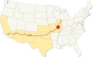
Location of Hazelwood on U.S. Hwy. 66
Rainfall in Hazelwood is, on average 41 in. (1.041 mm). The most rainy months are from May through July with more than 4.1 in per month (104 mm). Snow falls from Nov. to Apr.: 17.8 in. (45 cm).
Hazelwood has four well marked seasons. It is located in the area where humid continental climate shifts towards a humid subtropical climate, so summers are hot and humid while winters are cold. It gets cold Arctic air and hot damp tropical air from the Gulf of Mexico. Spring is wet and may have extreme weather (tornados, thunderstorms and even winter storms). Fall is sunny and less humid, with mild weather.
The average winter high (Jan) is a chilly 39.9°F (4.4°C) and the winter low is on average 23.7°F (-4.6°C). The summer (Jul) average high is 89.1°F (31.7°C) and the average low is 71°F (21.7°C).
Tornado risk
Hazelwood is inside Missouri's "Tornado Alley" and St. Louis County has around 7 tornados each year.
Tornado Risk: read more about Tornado Risk along U.S. 66.
Map of Route 66 in Hazelwood Missouri
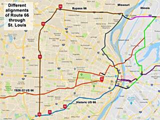
The map shows Route 66 in the St. Louis Region in both Missouri and Illinois. The color key for the map is:
Orange: is first, the original 1926-32 alignment of US66 through St. Louis
Brown is the Bypass US-66. Hazelwood is on the upper right side of the map.
Pale Blue: Is the Historic Route 66 alignment after 1932 into St. Louis, from the west. The gap in the alignment south of Crestwood MO is where I-40 overlaps the old alignment.
Blue, Green, Gray, Pink, Yellow, and Violet show different courses taken by US 66 over the years.
Black: missing segments (For instance, at the airport in neighboring Hazelwood).
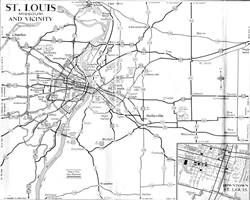
The following map from 1955 shows Route 66 in St. Louis vicinity. Hazelwood is located on the north side of the "St. Louis Municipal" airport.
This is a map with directions of the part that can be driven nowadays. The area at what is now Exit 25 of I-270 was disrupted when the freeway was built, and this custom map shows, with a red line, the original alignment. Parts of Route 66 along Dunn and Pershall Rd. can still be driven.
Bypass 66
There were two alignments of Route 66 in St. Louis, the "City 66" that ran into downtown St. Louis -hence its name- and one that ran around the metro area, on its northern and western sides, "BYP 66" (Bypass 66).
Route 66 runs across the bottom of the map:
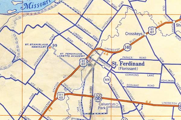
The Route 66 alignment in Hazelwood
Visit our pages with old maps and plenty of information about US 66's alignments.
- Gray Summit to Rolla (next)
- Route 66 St. Louis to Gray Summit (In Hazelwood)
- Route 66 Hamel IL to St. Louis MO (previous)
Route 66 Sights in Hazelwood
Landmarks and Places to See
We will begin our journey, coming from the east, from the Chain of Rocks Bridge where the old highway split from City 66, and took Lindbergh Ave., nowadays Dunn Rd. that runs along the north side of I-270.
The highway crosses the district of Bellefontaine Neighbors, but there are no remaining Route 66 sights or attractions along this segment until you reach Florissant, where you will spot a Historic Building from the mid 1800s.
Florissant
The southern fringe of this city -the 12th-largest city in Missouri- runs along old Byp 66 for 2.3 miles (see map).
The downtown area is one mile north of the highway. It has 52,533 residents and is an inner suburb of St. Louis.
John B. Myers House and Barn
Listed in the National Register of Historic Places
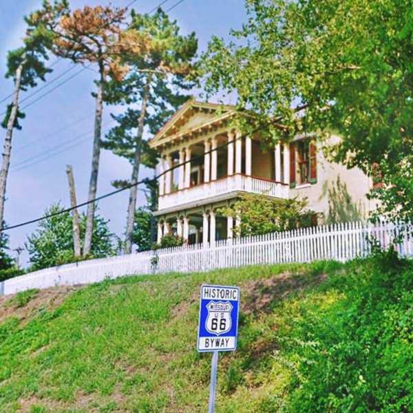
To your right above a grassy promontory overlooking the freeway at 180 Dunn Rd. it is a "Palladian" or "Classic Revival" home from the mid Victorian Period, built in the 1860s as John B. Myers home. It has a two-story portico, with paired columns on each side and a classical pediment. It stood on the 50-acre property of Myers.
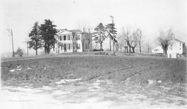
Same spot nowadays, seen from Route 66
Site of the Wayfarer Inn
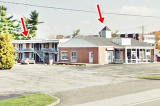
The Wayfarer Inn opened in 1961, it was located at 8840 Dunn Rd. and was ran by Carl Riegel and his wife Della Mae. The place was later known as the Budget Host Motel and was torn down in the mid 2010s.
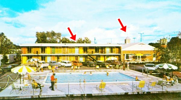
The motel was modified later, but some features survived. The red arrows mark the eastern two-story building and the cupola over the office that can be seen in the 1960s picture above and the 2012 iage below. The pool was on the left side of the image, where the pine tree can be seen. Now it has been razed (street view of the vacant lot).
Route 66 curves around St. Louis
Head west and ahead, at 9015 Dunn is an RV sales agency, the Apache Village. This was the site of Knotty Pine Lodge that opened in the 1930s with "showers, radios and heat." It closed in the mid 1960s.
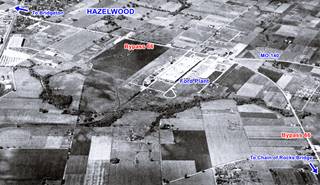
Ahead is the exchange at I-270s Exit 25, with US 67. This is where Bypass 66 coming along Dunn Rd. with an east-to-west course curved south towards Kirkwood, running through Hazelwood. The image above (click on it to see the full size picture) shows this spot in 1949. Mostly open fields and one large Ford plant. Now it is all built up as you can see in this satellite view showing the same place nowadays.
At the curve there were several buildings the first is a classic 1960s motel complex.
Howard Johnson's
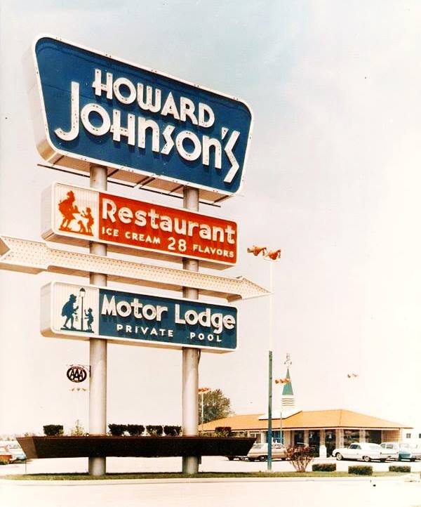
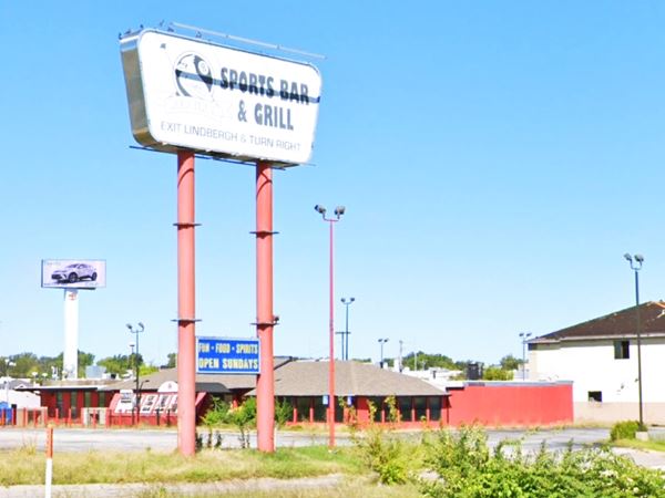
To your right, at 9085 Dunn Rd, Hazelwood, MO. Though most of the old Howard Johnson's has gone, the massive neon sign is stil standing and one of the buildings too.
Below is a "then and now" sequence with the neon sign.
Postcard with the old hotel's neon sign, Hazelwood MO
The sign nowadays, Hazelwood MO

1960s color postcard Howard Johnson's motel. Source
The long and low, hipped roof building behind the sign (but now without the steeple) is still there, but the classic Howard Johnson's office with four crossed gables to the east (right side) has been torn down.
The link between Dunn and Lindbergh has been cut by the modern exchange. Cross the freeway and head south (map with directions) and visit another motel.
Airport Motel
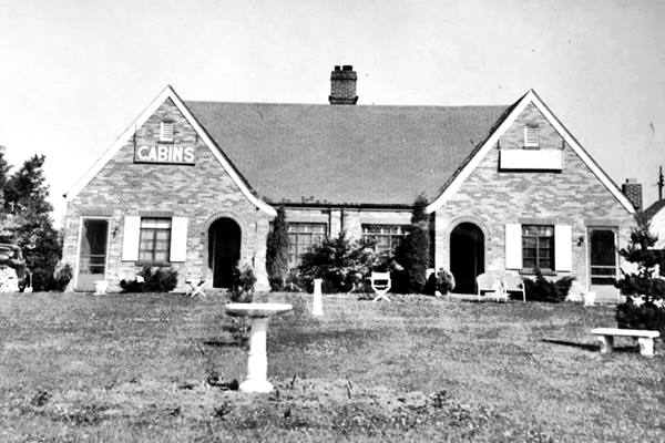
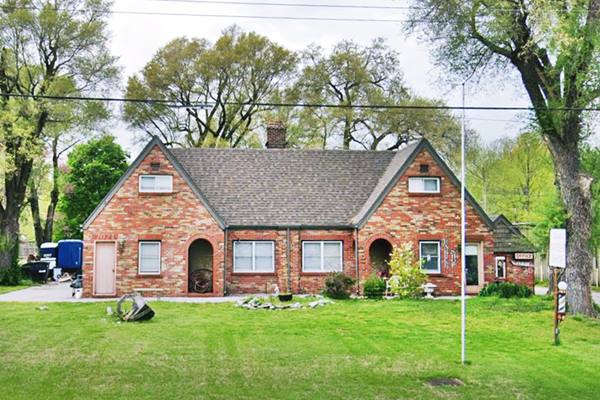
On Brookes Drive, originally 6221 N Lindbergh Blvd, Hazelwood. Its postcard announced it as having "Ranch House Deluxe Cabins -best in the midwest- Private bath to each cabin Hot Water Heat, Rt.3 - Florssant (sic)... Mr. & Mrs. Ed. Holtzman, Owners".
It opened in 1936 with ten rooms, four in the front, two behind and another four units in a building at the back of the property. Below is a "then and now" sequence of images of this classic site:
Postcard of the Airport "Motel", Hazelwood MO
Present appearance of the airport "Hotel", Hazelwood MO
Head west and see the last local attraction at a car body shop.
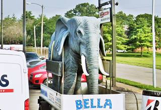
Bella the Elephant
Wacky sights on Route 66
6041 N Lindbergh Blvd, to your right you will see a small fiberglass statue of an elephant mounted on a trailer. Bella was made in the Philippines, and arrived at the Complete Auto Body and Repair in 2009.
This is where your Route 66 Road Trip through Hazelwood ends. Continue west along Bypass 66 into the next town Bridgeton.

Some sponsored content
> > Book your Hotel in Lebanon

Credits
Banner image: Hackberry General Store, Hackberry, Arizona by Perla Eichenblat
Nat. Register entry for Myers House
New resident Guide, hazelwoodmo.org.
Hazelwood in The descendants of John Mullanphy: Saint Louis philanthropist
by Hardaway, Harriet Lane Cates (1940). pp 75


