Route 66 in Manchester, Mo
Index to this page
- About Manchester
- Manchester's Weather
- Hotels and accommodation
- Map of US 66
- What to see and do in Manchester

TheRoute-66.com is reader-supported. When you buy through links on our site, we may earn an affiliate commission at no additional cost to you.
About Manchester, Missouri
Facts, Trivia and useful information
Learn more about the history of St. Louis County in our St. Louis History section. It is the oldest settlement on Manchester Road; it was a place frequented by travelers because there was a spring with a good supply of water for them and their animals. It served as a tax collection point in 1823
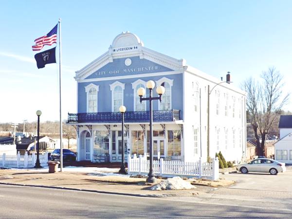
Old City Hall Building ereceted in 1894, Manchester MO

First settled by Bryson O'Hara in the early 1800s, he was followed by Jesse Hoard. This led to the township to be known as Hoardstown. Later an English settler renamed the place after his hometown (Manchester). The first post office opened in 1831, named Manchester.
The trail that led to it, and continued west to the state capital city was named after the town.
By 1838 it had 12 log houses, one tavern and 2 stores. It grew slowly; the WPA travel book of Missouri, written in 1939 recorded a population of only 600 at that time. Seven years after Route 66 was realigned south of it.
Getting to Manchester
Reach Manchester driving the historic 1926 - 1932 Route 66 now known as Missouri State Highway 100, or use Interstate I-44. I-270, US 50, US 61, I-55 and I-64 cross the area.

Where to Lodge in Manchester, Missouri
Accommodation and hotels close to Manchester
> > Book your accommodation in Bridgeton, St. Louis, or Kirkwood
More Lodging close to Manchester along Route 66
There are several hotels in the area close to this town. Alternatively you can also find your accommodation along Route 66 in the neighboring towns and cities in Missouri. We list them below (from east to west):
On Route 66's Main alignment in MO
Eastwards
Westwards
- Hotels in Kansas
- Baxter Springs KS
- Galena KS
- Riverton KS
- Hotels in Oklahoma
- Miami OK
>> Check out the RV campground close by, in Fenton
Weather in Manchester

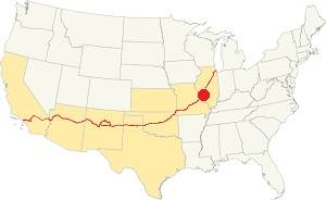
Location of Manchester on U.S. Hwy. 66
Manchester has four well marked seasons and is located in the area where humid continental climate shifts towards a humid subtropical climate, so summers are hot and humid while winters are cold. It gets cold Arctic air and hot damp tropical air from the Gulf of Mexico. Spring is wet and may have extreme weather (tornados, thunderstorms and even winter storms). Fall is sunny and less humid, with mild weather.
Rainfall averages around 41 in. (1.041 mm). The most rainy months are from May through July with more than 4.1 in per month (104 mm). Snow falls from Nov. to Apr.: 17.8 in. (45 cm). Relative humidity is on average 69.7% throughout the year.
The average winter high (Jan) is a chilly 39.9°F (4.4°C) and the winter low is on average 23.7°F (-4.6°C). The summer (Jul) average high is 89.1°F (31.7°C) and the average low is 71°F (21.7°C).
Tornado risk
Manchester is inside Missouri's "Tornado Alley" and St. Louis County has around 7 tornados each year.
Tornado Risk: read more about Tornado Risk along U.S. 66.
Map of Route 66 in Manchester Missouri
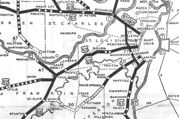
The following map was published in 1931, and it shows Route 66 running between St. Louis and Stanton. The paved sections are marked with a dark black line. Manchester appears in the middle along US66 and US50. In 1932 this alignment was replaced by the new one that ran further south through Eureka, Pacific, and Fenton.
Map 1931 showing US66 into St. Louis

See this map with US66 1926-32 alignment in Manchester, greatly modified since then, including an interchange with State Hwy. 141.
The Route 66 alignment in Manchester
Visit our pages with old maps and plenty of information about US 66's alignments.
- Gray Summit to Rolla (next)
- Route 66 St. Louis to Gray Summit (In Manchester)
- Route 66 Hamel IL to St. Louis MO (previous)
The now gone Route 66 Sights in Manchester
Some sponsored content
Landmarks and Places to See
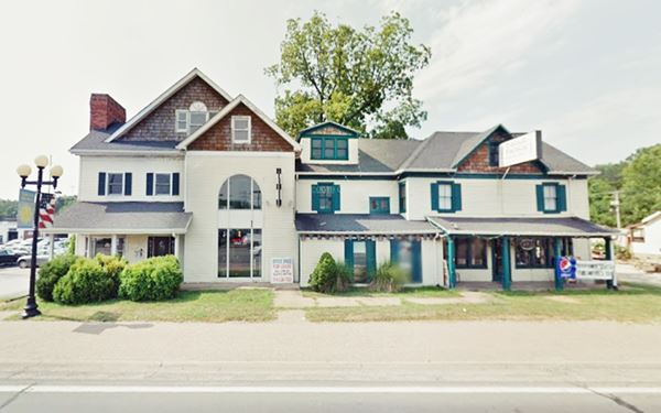
No motels or service stations or classic buildings survive from the 1926-32 US 66 in Mancheste: the Heggs Tourist Camp (Manchester Rd. 13980) was torn down, a car lot stands on the site. Further west at 14424 Manchester Rd. was the old Tourist Hotel torn down in 2018, pictured below while it was still standing, facing Route 66:
Former Manchster's Touris Hotel before being torn down

This leg of your Route 66 Road Trip ends here, head west into Ballwin to continue your journey.

Some sponsored content
> > Book your Hotel in Lebanon

Credits
Banner image: Hackberry General Store, Hackberry, Arizona by Perla Eichenblat

