Route 66 in St. Louis MO
Index to this page
About St. Louis, Missouri
Facts, Trivia and useful information
St. Louis is a city and a port in Missouri. It was founded by the French in their colony of Louisiana in the XVIII Century on the western bank of the Mississippi River. Its population in 2024 is around 275,506. The St. Louis metropolitan area includes the city as well as nearby areas in Missouri and Illinois; has a population of 2,805,473; which is the largest in Missouri and one of the largest in the United States.
History
This region has been inhabited for the past 11,000 years. The Native American people built mounds, massive earthwork structures along the eastern Mississippi region, facing St. Louis, until 600 years ago.
In the mid-1700s, the French trappers reached the area, advancing south from Canada. They settled Missouri from the Great Lakes region via Illinois. The confluence of the Missouri and Mississippi rivers was a strategic location, so they French coming from New Orleans founded St. Louis here, in 1764.
The region was known as Louisiana after the French King Louis XIV.
The name: St. Louis
The city was founded by three French fur traders Pierre Laclède, Gilbert de St. Maxent, and Auguste Chouteau. They named it after the French king, Louis IX (1214 - 1270). He was canonized in 1297, 27 years after his death and became Saint Louis.
France ceded the territory to Spain after the Seven Years' War (1763), but Napoleon recovered it in 1800, but, needing cash for his European wars, he sold it to the U.S. in 1803.
It became the starting point for the pioneers heading west, hence its name "Gateway to the West". Lewis and Clark's Expedition to Oregon set out from this city.
The region became the Missouri Territory in 1812 and it was accepted as a state of the Union in 1821. A series of treaties expelled the native Osage and Kickapoo people, who were relocated to reservations in what is now Oklahoma.
The native "traces" or trails from St. Louis to Springfield and SW Missouri became dirt roads and a stage coach service ran along them. Route 66 would be aligned along one of them in 1926.

Hotels in St. Louis
> > Book your accommodation in St. Louis
More Lodging near St. Louis along Route 66
There are several hotels in the area close to this town. Alternatively you can also find your accommodation along Route 66 in the neighboring towns and cities in Missouri. We list them below (from east to west):
On Route 66's Main alignment in MO
Eastwards
Westwards
- Hotels in Kansas
- Baxter Springs KS
- Galena KS
- Riverton KS
- Hotels in Oklahoma
- Miami OK
Weather in St. Louis
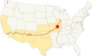
Location of St. Louis on U.S. Hwy. 66
There are four well defined seasons in St. Louis because it is located in the area where humid continental climate shifts towards a humid subtropical climate. This means that summers are hot and humid while winters are cold.
Cold Arctic air and hot damp tropical air from the Gulf of Mexico blow into St. Louis. Spring is wet and may have extreme weather (tornados, thunderstorms, and even winter storms). Fall is sunny and less humid, with mild weather.
The average high in winter (Jan) is a cool 39.9°F (4.4°C) while the average low is a chilly 23.7°F (-4.6°C). The summer (Jul) average high is 89.1°F (31.7°C) and the average low is 71°F (21.7°C).
Rain is on average 41 in. (1.041 mm) with the rainiest months being May through July with over 4.1 in monthly (104 mm). Snow falls between Nov. and Apr., with a total snowfall of 17.8 in. (45 cm). Relative humidity ranges averages 69.7% and is fairly stable year round.
Tornado risk
St. Louis is located in Missouri's "Tornado Alley" and St. Louis County is hit by an average of 7 tornados every year.
Tornado Risk: read more about Tornado Risk along U.S. 66.
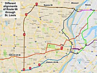
Map of Route 66 through St. Louis
These alignments are based on the data provided by the Missouri Department of Transport historic maps (See their collection here), and the United States Geological Survey Historic maps (USGS) which you can also find online by searching in the USGS historical maps collection.
Click on the Map to see a large sized map showing Route 66 alignments through St. Louis MO
The following color key applies to this map:
Orange: is first, the original 1926-32 alignment of US66 through St. Louis
Brown is the Bypass US-66.
Pale Blue: Is the Historic Route 66 alignment after 1932 into St. Louis, from the west. The gap in the alignment south of Crestwood MO is where I-40 overlaps the old alignment.
Blue, Green, Gray, Pink, Yellow, and Violet show different courses taken by US 66 over the years.
Black: missing segments.
Visit our St. Louis Route 66's alignments page for a detailed description of the map above.
You can also check out our Route 66 Map of Missouri, with the complete alignment and all the towns in MO, including St. Louis.
Route 66's alignment in Missouri
Historic Route 66 through St. Louis
Historic U.S. highway 66, "Route 66" has been designated as an All-American Road and National Scenic Byway in the state of Missouri.
Read our Full description of Route 66 across the state of Missouri.
Route 66 Sights in St. Louis
Landmarks and Places to See
Sponsored
Safety Tip - Crime rate
See the Route 66 sights during daytime and then move on to stay in accommodation outside the city. St. Louis has a very high crime rate and travelers don't feel safe to spend the night here.
The North Side of the city lost jobs during the recession so you may encounter people who are potential drug users. Use common sense as you would in any large city. Park in a covered garage if you can, nevertheless you can park on the street in the town but only do so if visiting for a few hours and during daylight hours.
The Route 66 alignments and their landmarks
Into the City from the North
South of the City
The 1926 Alignment
City 66 from Chain of Rocks to downtown
From the Chain of Rocks Bridge, which was built in 1929 and closed to traffic in 1968 (though it re-opened to bikes and pedestrians in 1999), head south.
This is the Map marking the point where your southbound journey into St. Louis begins. Take Riverview Drive.
Bypass 66
If you head north, and then west (north frontage Rd. of I-270), you will drive the Bypass 66 alignment -shown with a Brown line in the map. We describe it, starting at Hazelwood all the way to Kirkwood.
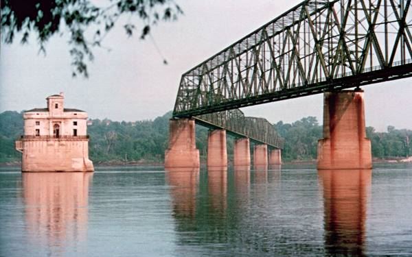
Chain of Rocks Bridge
The steel bridge is a 5-span Subdivided Warren Through Truss with Verticals and three spans at each end that are Warren Through Truss Approaches.
Historic Route 66 runs next to the North Riverfront Park, in a semi-urban area. You can catch glimpses of the Mississippi River to your left. After 3.7 miles, take a left (southwards) along North Broadway.
Former 1960s Shell station
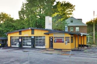
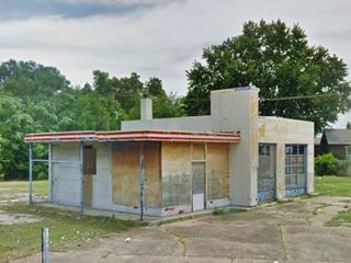
As you turn, on the SW corner is a ranch-style former Shell gas station. This style was introduced in 1957 and has a low-sloping, two-part gabled roof and a chimney-like extension above it which displayed the Shell logo. It is a tire repair shop, pictured below.
Vintage Gas Station
Drive 0.4 miles south, to your left (8624 N Broadway) is another service station, pictured above. It has two garage bays and its office is curved in a streamline Moderne style. The curved design on an oblong box station was used by Conoco, Sinclair and Chevron.
Another old Shell Station
Head south and 0.3 miles ahead, to your left at 8420 N Broadway is another 1950s gas station. The vertical element in the middle and the short cantilevered canopy across office and across side with restrooms was typical of Shell stations. This one has two garage bays, no canopy or pumps.
Continue south for a 3 mile drive; after the railroad underpass, take a right into Busche Park along Cavalry Ave. and at W. Florissant Ave. turn left at the southern tip of the Park, after the overpass at I-70 on the SE corner of W Florissant Ave. and E. Taylor Ave. are two more landmarks (Map with directions).
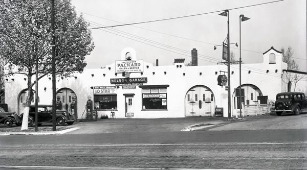
Nelson's Garage
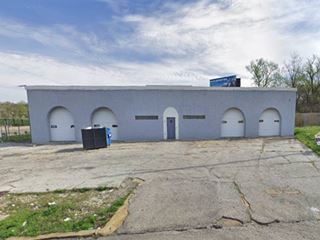
To your left, the four arched bays at either side of the main entrance to the office are still there. It was a Packard dealership and gas station. The building is in good shape although the crests atop the parapet have gone. Further down is its current appearance.
Nelson's Garage in a 1930s photo
Taylor Gas
Adjacent to Nelson's, at 4457 W Florissant Ave is an ice-box shaped gas station (pictured above) it had enamel panels, and a two bay garage. The office had a small awning (no canopy) and clean, crisp Streamlined Moderne lines. It was probably a Texaco.
As you drive south, the neighborhood changes from residential to derelict. There are many abandoned red-brick buildings from the late 1800s and early 1900s.
Side Trip to Miller's Phillips 66 Station
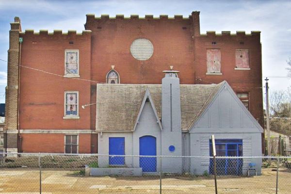
Just 0.2 mi. to your right to 4250 Warne Ave. (Map). This is a classic cottage style gas station from the late 1920s. Steep gabled roof and a chimney.
Miller's Phillips 66
Return to Florissant Ave and head south.

1940s gas station.
1940s Gas Station
There is another Gas Station at 3780 W Florissant Ave, to your right which has seen better times -see picture and Street View.
Continue heading south into the city for one mile, and at Salisbury St. (Map with directions) you will cross the Original 1926 Route 66 alignment into St. Louis
City 66 meets the US 66 1926 Alignment
Shown in the map with an Orange line, its course from east to west was the following: It crossed the Mississippi River from Venice, Illinois along what nowadays is the McKinley Bridge.
On the Venice IL side of the river the old road link with the bridge has been modified and cut by a realignment of 4th St. The grade crossing was replaced by an underpass to the north, so this segment that can't bee driven and is shown with a Black in the map (click image to enlarge the thumbnail).
McKinley Bridge
This bridge dates back to 1910, and was originally used by the railroad. It carried US 66 as from 1926 and was closed to traffic from 2001 to 2007. It has three spans with 18 panel Pennsylvania Petit Through Truss. You can still use it, it is open.
The original 1926 US 66 alignment bypassed the downtown area of St. Louis, and headed west along Salisbury St., crossing what would be the later City US66 alignment (in Gray in the map) at W. Florissant Ave., and continuing west before heading south again.
We describe the 1926 Alignment further down.
US City alignment enters the downtown district
Five blocks further south, the 1940s City 66 alignment took a left along Herbert St. and then a right along N. 13th Street. Four blocks further south, you can take a short detour to visit a local attraction.
Crown Candy Kitchen
St. Louis' oldest Soda Fountain.
Turn left along St. Louis Ave, and on the second block's NE corner, to your right (1401 St Louis Ave)
In an original 1900s red-brick building, it serves housemade chocolates plus the classic American lunch and dinner menus. It was opened in 1913 by Harry Karandzieff and his best friend Pete Jugaloff.
Gateway Arch
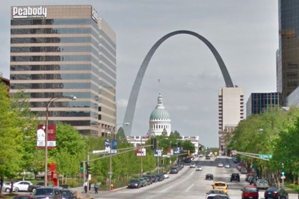
Return to your previous course head south along N 13th St. At its junction with N Tucker Blvd. continue south along the boulevard. At the intersection with Market St. to your left you will have a great view of the old Courthouse and the Gageway Arch.
The Arch is a monument shaped as a weighted catenary arch that is 630 feet high (192 m). It is lined with stainless steel and is the Tallest man-made monument in the Western Hemisphere.
It was designed in 1947 and built between 1963 and 1965. It cost roughly $200 million in 2021 dollars.
End of the City 66 alignment and US 66's Mississippi Bridges into Downtown St. Louis
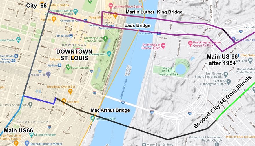
At its intersection with Washington Ave. City US 66 met the "Main alignment of US 66" that coming from Illinois crossed the Mississippi using two bridges to enter St. Louis. (in Violet in the map -click it to enlarge).
This alignment is shown in Violet in the map. On the Illinois side of the river, the 4-lane highway split into two to allow traffic to cross the Mississippi River using two narrow toll bridges:
- Veterans Memorial Bridge, to the north. Built in 1951, it was renamed after Martin Luther King Jr. in 1968. This steel bridge is a Cantilevered Subdivided Warren Through Truss with a 2-span Warren Deck Truss approach. It is open and you can drive across it. Its eastern approach in Illinois, from US66 along Missouri Ave. was cut off by I-55 (in Black in the map).
- Eads Bridge, 800 feet to the south of the other bridge. It was named after its designer and builder, James B. Eads and built between 1867 and 1874. It was the first bridge across the Mississippi south of the Missouri River. It is an Arch bridge 6,442 ft long (1,964 m).
Once across the river, the traffic headed west along Washington Ave. and met the City 66 which ended at this point.
From this point westwards, the "Main US 66" continued as shown in the map with the Pale Blue line.
This is the end of your journey into the city along City 66.

Westbound on City 66
From N Tucker and Washington head south (westbound) along Tucker. At Choteau Ave. you will meet the Second City 66, coming from Illinois, shown in Green in the map above.
Second City 66 from Illinois
This branch split from the other Illinois alignments and then crossed the Mississippi into Missouri alongside the railway on the "Municipal Bridge" which was toll free.
The elevated viduct (see imgage) ended at S 7th St. in St. Louis. These viaducts and the bridge were cut off in 1981 and are shown in Black in the map. Now the bridge only carries rail traffic.
From here US 66 went down Chouteau Ave. (shown in Blue) to meet the other westbound "US 66" alignment.
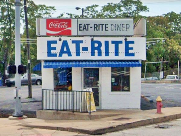
There is a Classic Diner on Choteau Ave, and 7th Street, two blocks east of Tucker. Below is a "Then and Now" sequence at that very corner, looking north from Choteau Ave. towards the railroad bridge across 7th St. The sign reads "City Route 66" and on the next block, an arrow points right, for US66 towards the Municipal Bridge.
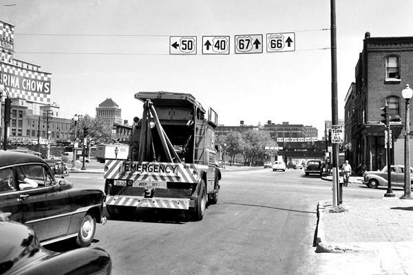
The same spot today. The railroad (red arrow) is still there. The "Eat-Rite Diner" is to the right.
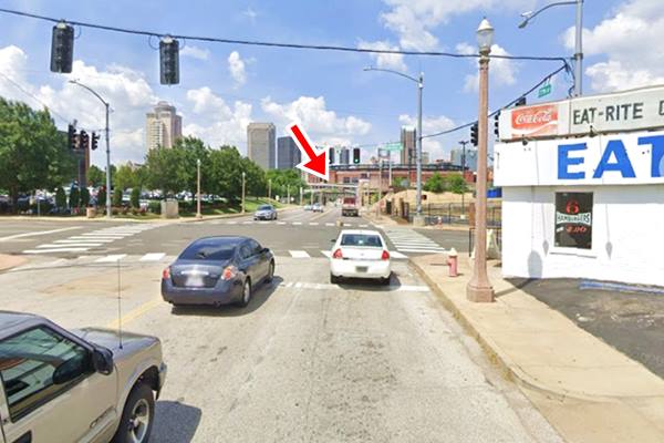
Eat-Rite Diner
622 Chouteau Ave. The famous diner was built in 1908 and proclaimed "Eat-Rite or Don't Eat at All" It got its name in 1940 catering to drivers along the Municipal Bridge. It closed for good during the pandemic in 2020.
To the Southwest of Saint Louis along Main Route 66
Continue along Historic 66 (Tucker Ave.) which splits from US66 as you cross I-55. Route 66 becomes Gravois Ave. (MO-30).
Gravois Avenue
Originally a road in the early 1800s that led to the Salt Spring of Clamorgan close to Fenton. In 1839 it became a state road, authorized by the state. Gravois, in Fench means "of course gravel". In 1914 it was paved with concrete. In 1930 Route 66 was aligned along it.
Gas stations on Gravois Avenue
There are many service stations along Gravois. We will give a short description and a picture of some of them below.
1853 Gravois. Jim King Motors. A former ranch style Shell station. Gabled roof and three bay garage. Pictured below.
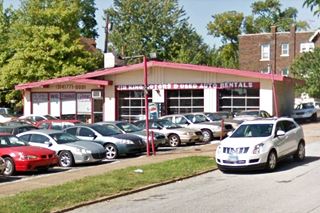
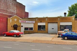
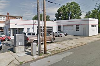
2240 Gravois. Emmons Auto. A 1930s station, in brick, roof parapets with a corner office and a garage bay. Maybe adjacent Mike's Auto Service was part of the same outfit. Pictured above.
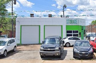
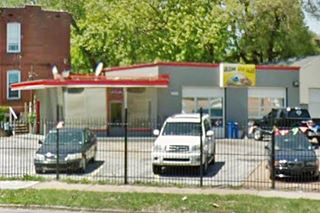
3001 Gravois. Taylor Auto Storage. Oblong box with angled corner office, two bay garage and enamel panels. Texaco and Gulf used this design in the 1940-50s. Picture below.
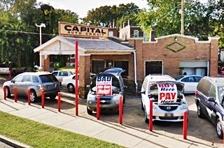
3115 Gravois. Capital Auto. It has a gabled canopy over the pumps, with box brick columns. Angled side wall with garage bay. A flat roof with decorated parapets, and diamond brickwork. See image above.
Marty Filing station
3299 Gravois. Listed as the historic Robert Marty Filling Station, a cottage-style service station. Photo below.
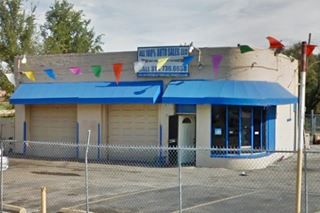
3315 Gravois. Arizona Auto. This is a former Phillips 66 with a "Rock Frame" desig (early 1950s), it has large canted plate-glass windows and a two bay garage. Photo above.
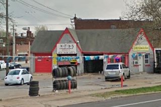
3330 Gravois. NADS Auto. Facing the Phillips, is a former cottage style gas station from the 1930s, with two gables cross on the front facade and a steep gabled roof. Pictured below.
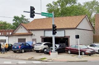
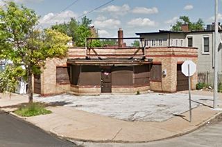
3460 Gravois. Corner station. It maybe was a gas station. It has two large doors on each street with the office in the middle. Photo above.
"Seat Covers" Neon Sign
4017 Gravois Ave, to your right, just before the junction with Chippewa, is a great neon sign. See picture.
Ahead, at Chippewa take a right along Historic Route 66, leaving Gravois Ave.
Underpass on Chippewa
Chippewa just W. of Gravois Jct. It was built in 1936 as a railroad underpass. At one time it had a pedestrian underpass (Street View).
Chippewa Phillips Gull Wing
Drive for 1.5 miles, and at Chippewa 5412 & Macklin Ave, you will see a former Gull Wing Phillips 66 service station. It is now an auto repair shop. Well kept, with its original gull-wing (or bat-wing) slanted canopy, plate glass office and two bay garage.
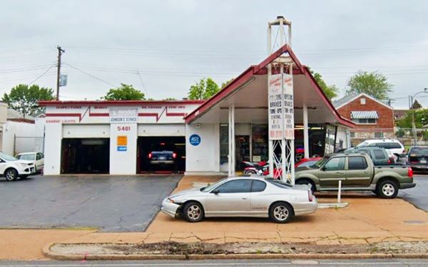
>> Read all about the Gull Wing stations on Route 66
Mobil Station
Drive 0.4 mi. to 5760 Chippewa. To your left is a coffee shop that at one time was a gas station. With an L-shaped layout, three garage bays and a plate glass office facing Route 66.
Across the street from the station, to your right, standing on the NW corner, all alone is a former Route 66 restaurant. Bauer's.
Bauer’s Ranch House
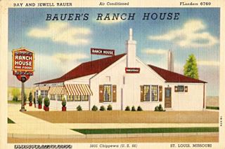
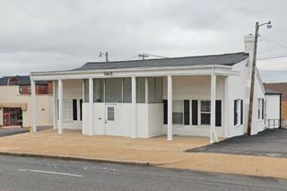
5805 Chippewa. The old Restaurant building is stil standing, the postcard below shows it has changed little (the portion facing US 66 has changed). It dates back to the early 1940s when it was known as "Telthorsts Restaurant".
Continue west. The road curves 45° to the SW and just ahead, to your right is a classic donut shop.
Donuts Drive In
6525 Chippewa. Its neon sign is amazing and they are supposed to be the best donuts on Route 66. They are still using some of the original family recipes from the early 1950s in their chocolate Long John and cinnamon rolls.
Donuts Drive-in, St. Louis, Missouri
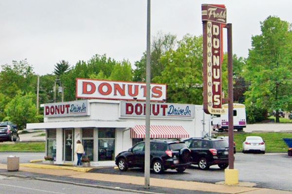
Facing the Donut Drive In is another ranch-style station (Shell) like the ones we have seen further up (see Shell station and King Auto). This is its street view. It is still operating as a gas station, and has a separate flat topped canopy.
Keep westbound and after 0.3 miles, to your left, is the iconic and must-stop-at Frozen Custard shop.
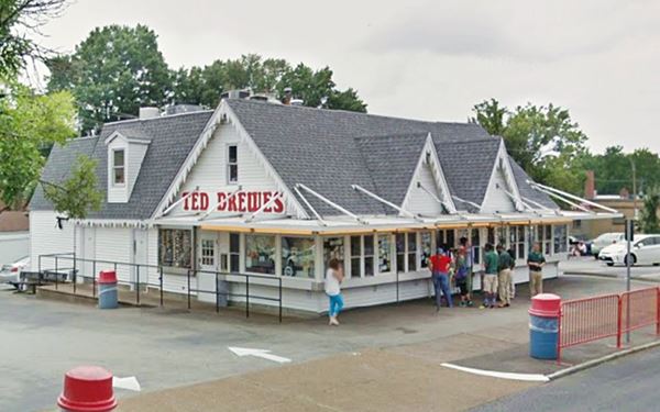
Ted Drewes Frozen Custard
At 6726 Chippewa. Ted Drewes Sr., who was a renown tennis player opened his first Frozen Custard store in 1929 in Florida, it was followed by another three, of which the last survives till this day. It opened in 1941. The 1993 Survey of Route 66 in Missouri listed it as the SS.001 historic reference.
Ted Drewes Frozen Custard in St. Louis, Missouri
Ahead the road leaves the City of St. Louis after crossing the Des Peres river, and enters Shrewsbury, followed by Marlborough. This is the end of the alignment in St. Louis.
End of this itinerary along the Main Route 66 in St. Louis.
The 1926 Route 66 Alignment
Above we mentioned the point where the City 66 and the 1926 alignments crossed each other. The first route through the city, laid down in 1926 didn't go through the center of the city, instead it headed west until it was realigned in 1933 to the southeast and went through the downtown district.
Below we describe its main attractions-
Old Phillips
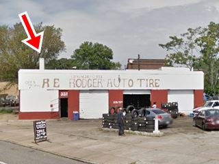
Head west along Salisbury and as you turn into Natural Bridge Ave., to your right, on the corner (R & E Rodgers Tire Services) is an oblong box former Phillips 66 service station from the 1940s. It has a three bay garage area, no canopy, and a small faux chimney above the corner office (red arrow), typical of this type of Phillips 66 stations. Picture below.
Drive along Natural Bridge Ave. and just ahead, at Glasgow, turn left and drive two blocks south to see a vintage Texaco gas station.
1920s Texaco
On Glasgow & Herbert. It is a "Denver-style" Texaco station now in bad shape, it has a cottage style gabled roof. See picture above.
Head back to Natural Bridge Ave., take a right along N Grand Blvd. following the 1926 Alignment. Ahead, on the third block, to your right is an old school.
Speedwa School
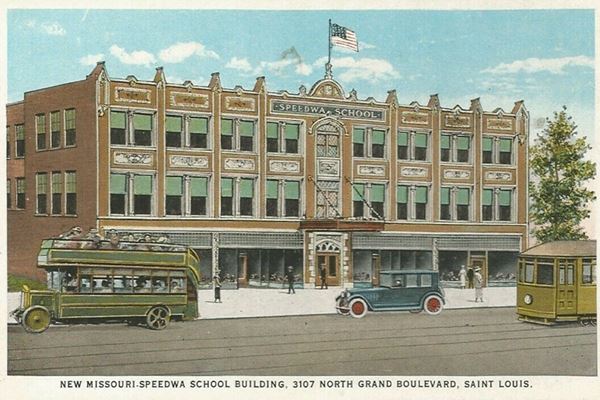
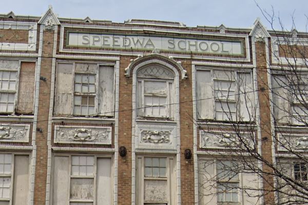
3101 N Grand Blvd. The postcard from the 1920s shows Route 66 traffic in front of the modern building. It states "Speedwa School has the distinction of being the largest business school in St. Louis, although the youngest." Now it is decaying and abandoned.
1920s postcard of Speedwa School. The traffic shown, is driving along Route 66.
Speedwa School as it looks nowadays
St. Louis Phillips Gull Wing
Keep south along Grand Blvd. at Page Blvd. take a short 0.4 mi side trip (Map with directions) to visit a Phillips 66 Gull Wing Station.
1300 Vandeventer Ave. This station though still standing, has seen better times. It is quite well kept though.
St. Louis gas station
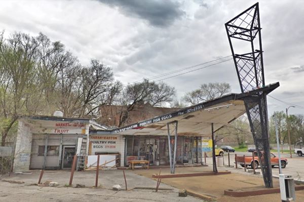
To follow the 1926 alignment turn left along Delmar Blvd. This section of the original road is cut off by a Highschool nowadays -so the gap is shown in Black in the map. Then head south along N. Sarah St., and west along Lindell Blvd, running along the north side of Forest Park. At the western tip of the park the old highway turns right.
Head south along S. Skinker Blvd. and then at the corner with Skinner, before heading south along McCausland there is an example of Americana and Kitsch; a giant gas station sign.
Giant Gas Station Sign
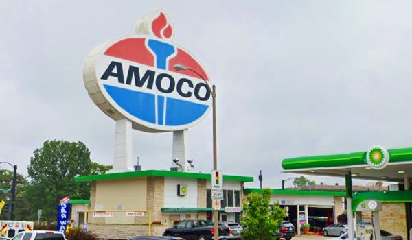
World's Largest Amoco Sign
This used to be a Standard Oil gas station, and it sported a gigantic sign promoting the Red Crown Gasoline. The original sign built in 1932 lasted until 1959, when it was taken down.
It was replaced by another mammoth sign, the Standard sign, which despite having changed brands, is stil standing, now over the Stevenson’s Hi-Pointe Service & Wash.
The original Red Crown sign was built so that it could be seen from the Red Feather Expressway (now I-64). In the late 1990s, BP took over Amoco but even though the service station sells BP gasoline, the sign still reads "AMOCO".
Standard Sign 1961 view in St. Louis, Missouri

The same sign but the word "Standard" has been changed for "Amoco".
Amoco Sign today in St. Louis, Missouri
Drive south along McCausland where few original Route 66 buildings have survived. Below are those that can still be seen.
Dodson Service Station
2159 McCausland Ave. Listed as SS.004 by the 1993 Route 66 survey, it is a cottage style building, with a gable roof canopy, and the sign is still there (yellow arrows).
Facing it, across Bruno Ave. is an oblong box gas station from the 1940s (Street View).
Take a right on Manchester and you will leave St. Louis city limits, entering Maplewood, where just ahead is the Ozark Trail Garage.
This is the End of this itinerary but you can head west along Manchester Rd., continuing all the way (now it is MO-100) through Manchester and Ballwin, and onwards to Gray Summit where this alignment meets the later alignment of Route 66 (built in 1932).
Some sponsored content
> > Book your Hotel in Lebanon

Credits
Banner image: Hackberry General Store, Hackberry, Arizona by Perla Eichenblat
Jack DeVere Rittenhouse, (1946). A Guide Book to Highway 66.


