Route 66 Road Trip in Gillespie:
Index to this page
- About Gillespie
- Weather
- Hotels in Gillespie
- Map of US 66 in Gillespie
- What to see and do in Gillespie
All about Gillespie, Illinois
Trivia, Facts and Useful Information
Elevation: 663 ft (202 m). Population 2,977 (2020).
Time zone: Central (CST): UTC minus 6 hours. Summer (DST) CDT (UTC-5).
Gillespie is a city in Macoupin county, Illinois. On the original Route 66.
The History of Gillespie
The first inhabitants of what is now Illinois, arrived when the ice sheets retreated some 11,000 years ago, at the end of the last Ice Age. These Paleoindians were the ancestors of the modern Kickapoo, Illinois and Miami natives that were the historic natives encountered by the first European explorers in the mid 1600s.
France claimed the region as part of "New France" (now Canada) but lost it to Britain during the Seven Year War (1763). The independence of America (1776) saw the land change hands again; it became a territory of the U.S.
The first settlers arrived to this part of the prairies the mid 1810s and Illinois gained statehood in 1818. The first settler in this region was John Woods, who came from Virginia in 1817. Macoupin County was established in 1829 and was named after Macoupin Creek (the word is a Miami-Illinois term for the American lotus Nelumbo lutea).
The original community was known as"Prairie Farm" but changed to Gillespie in 1854. The town was platted in 1851 in advance of the arrival of the Chicago & Alton Railroad.
The name Gillespie
Named for Judge Joseph Gillespie (1809-1885) an Illinois state politician who founded the Illinois Republican Party, was representative in the local Legislature and Senator in the Illinois Senate.
Gillespie is the Anglicised form of "Mac Gille Easbuig" (Scottish Gaelic for "servant of the bishop").
Originally a farming community, the discovery of coal led to an influx of European migrants to work in the mines during the 1880s.
Route 66 was aligned through the city in 1926 but only four years later it was moved eastwards through Litchfield and therefore it bypassed Gillespie.

Hotels and Motels in Gillespie
Lodging & accommodation in Gillespie; sponsored content. Find a room in neighboring Staunton, just a few miles to the south:
> > Book your hotel nearby, in Springfield
More Accommodation near Gillespie on Route 66
Below you will find a list of some of the towns along Route 66 east and west of this town; click on any of the links to find your accommodation in these towns (shown from east to west):
Along Route 66 in IL
- Hotels in Illinois
- Route 66 Starting point ▸ Chicago
- Lockport
- Willowbrook
- Bolingbrook
- Plainfield
- Romeoville
- Joliet
- Wilmington
- Dwight
- Pontiac
- Chenoa
- Normal
- Bloomington
- Atlanta
- Lincoln
- Springfield
- Raymond
- Litchfield
- Staunton
- Williamson
- Hamel
- Edwardsville
- Collinsville
- Troy
- Glen Carbon
- Pontoon Beach
- Granite City
- East St. Louis
West in Missouri
- Hotels in Missouri
- Florissant MO
- Bridgeton MO
- St. Louis MO
- Kirkwood MO
>> Check out the RV campgrounds in Springfield and Litchfield.
The weather in Gillespie
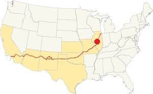
Location of Gillespie on U.S. Hwy. 66, Illinois
Gillespie's climate is a "humid continental type", its summers are humid, long and hot. Its winters are short, very cold, with a lot of snow and quite windy.
Its average yearly temperature is around 52.4 °F (11.3°C). The winter averages (Jan) are: low 21°F (-6°C) and high 35°F (1.7°C). The average summer (Jul) high is 86°F (30°C), and a low is 68°F (20°C).
Snow falls during more than 4 months with an average snowfall of 22 inches (56 cm) yearly. Precipitation is 35.3 in. (895 mm) per year.
Tornado risk
The May 31, 2013 tornado that struck Gillespie was an EF" with winds of up to 115 mph. It blew off the roof of the Gillespie High gymnasium and crumbled its walls.
The are around Gillespie may get around 7 tornado strikes each year. Tornado Risk: learn more about the Tornado Risk on US 66.
Map of the 1926-30 Route 66 through Gillespie
1926-1930 US 66
This first alignment of Route 66 south of Springfield had a winding course following the former county lanes and lot demarcation trails. It had many sharp 90° curves. This made it unsafe and also long.
Route 66 after 1930
Seeking a straighter alignment the Illinois Division of Highways led by Thomas Sheets moved Route 66 eastwards through Mt. Olive and Litchfield and Divernon along Stae Highway 126.
The 1930's alignment branched off from the older one in Staunton in the south, and reunited with it further north, in Springfield. It bypassed Carlinville.
Carlinville to Gillespie
Drive southwards from Carlinsville to Gillespie: The highway curves to take a north-south alignment and reaches an abandoned segment.
See it in this 1956 aerial view, and in our custom map marked with a purple line it was widened to its current position in the 1960s.
Deerfield Drive Segment
As you approach Deerfield Dr. there is an "original '66 section" along Deerfield Drive that curves around the modern (1932 alignment) to the west and then to the east at Honey Creek. This is a Map with directions from the Macoupin Creek segment to here.
Deerfield Route 66 segment in Carlinville, Illinois (modern IL-4 is on the left)
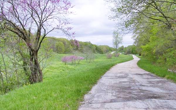
This section can also be seen in the 1956 aerial photo (scroll down) so the new highway was built after that date and before 1958 (the new IL-4 appears in a USGS map published in 1958). We put a marker by the purple line in our custom map to mark the spot.
Below is a USGS map showing the course of the highway here, crossing Honey Creek:

USGS map Deerfield Rd. alignment at Honey Creek

USGS map of Gillespie IL (1912)
Across Gillespie
Into Gillespie: State Highway 4 and the first Route 66 ran across the town along Elm St. and it met IL-16 as it turned to the SE along McCoupin St. On its southern end it did a dog leg along W Easton St and south along S Jersey St. You can see this in the map above where the red arrows mark Route 66 north and south of Gillespie.
It ran south in a straight line towards Benld; see the orange line in our custom map.
The Route 66 alignment in Gillespie
Visit our pages with old maps and plenty of information about US 66's alignments.
- Route 66 Hamel IL to St. Louis MO (Next)
- Springfield to Staunton IL (1926-30 US66 near Gillespie)
- Springfield to Hamel IL (1930-77 US66 to the east of Gillespie)
- Route 66 Pontiac to Springfield IL (Previous)

Gillespie: classic US 66 Sights
Landmarks and Attractions
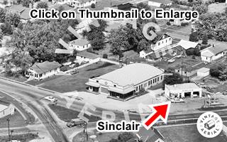
Enter the town along Springfield Road from Carlinville, the original Route 66. It meets IL-16 on the north side of the town. At one time there was a Sinclair box-shaped gas station to your right, on the western side of the intersection. It was torn down.
Then turn right along E Elm St. and after 5 blocks, left along the town's main street, Macoupin.
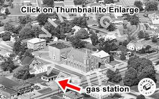
Across from the red-brick St. Simon and Jude Church, once stood another gas station, but it has also been torn down (Street view).
Ahead is the commercial district with red-brick buildings like the former "Gillespie National Bank" with a white stone portico on the SW corner of Macoupin and W Walnut.
Keep eastbound and don't miss the Historic Route 66 sign to your left, on the NW corner of Walnut and Macoupin:
Historic Route 66 sign and former "National Bank" in Gillespie, Illinois
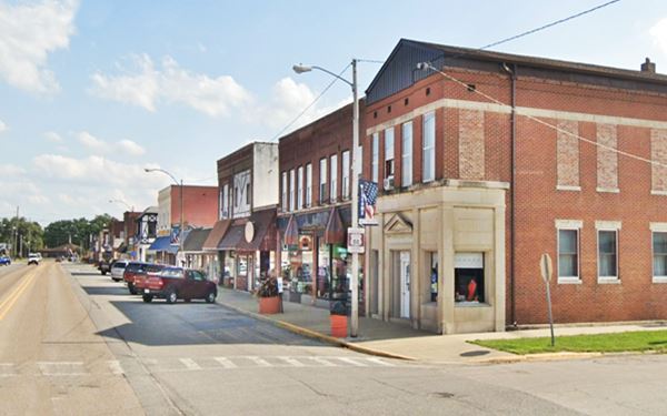
The American National Bank Of Gillespie
This bank was chartered by the U.S. Treasury and printed currency. During its existence, from 1923 to 1930, it printed over $314,000.
Coal Museum
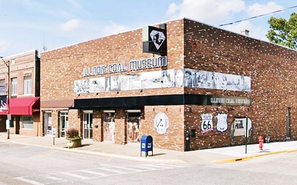
On the next block, to your left, is the "Coal Museum". It has exhibits, memorabilia, photographs and gear from the coal mining industry in "Coal Country"; visit their website for more information: www.gillespiecoalmuseum.org. Coal was an important part of Gillespie's history:
Coal Mining
During the late 1920s it was one of the busiest towns in the county: coal was mined at the Little Dog mine (which closed in 1968) and Superior Mines 1 to 4 in Eagerville (No. 1), Sawyerville (No. 2), Mt. Clare (No. 3) and Wilsonville (No. 4).
Many of the miners lived in Gillespie, and here they formed the Progressive Miners of America Union in 1932. They faced poor pay, death when they fought for their rights and death in the mines (more than 400 miners perished in Macoupin's mines due to explosions and inhaling coal dust "Black Lung").
The Annual Black Diamond Days
This is a three-day-long festival held in Gillespie ever year on the first weekend in June. It features a carnival, parades, contests , a Mine Rescue Demonstration, arts and crafts and more.
To your right, Across the street, on the SW corner of W Chestnut and Macoupin St. is a Route 66 Mural next to an ancient Pharmacy:
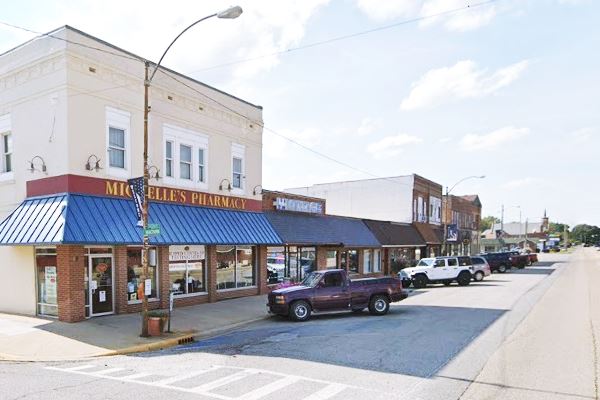
Michelle's Pharmacy
To your right, at 120 S Macoupin St, Gillespie. The old Pharmacy is on the NE corner facing Main St.
Dippold's Drugstore and the Doughboy Monument
There has been a drugstore on this corner since David B. Frey, who had worked with Steinmeyer’s Pharmacy at Carlinville until 1909 bought out the Behrens Drug and Mercantile Company of Gillespie and opened his pharmacy. Later it became Dippold Drugstore -pictured below. And Michelle Dyer purchsed it in 2009.
There was a World War I Doughboy monument (left side of the image) on Route 66. Doughboy was the nickname for the WWI infantrymen. The statue has been removed, but its pedestal is still in Gillespie, now it carries an eagle, it is on the corner of E Oak and Macoupin St., (street view).
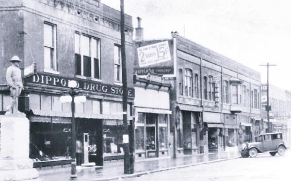
Same view nowadays:
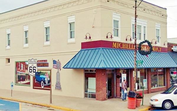
Michelle’s Pharmacy Mural
The mural is painted on the pharmacy's east facade facing W Chestnut St. It depicts the old Dippolds Drug Store, the "Doughboy" statye, and a 1920s car with Route 66's shield in the middle next to a "Welcome to Gillespie Illinois" greeting.
Michelle’s Pharmacy Mural in Gillespie, Illinois
Turn left, along Chestnut passing the Coal Museum to visit a "Classic Movie Theatre":
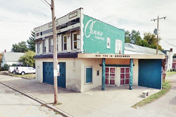
Canna Theater
At 110 E. Chestnut St. on the south (right) side of the street
It opened as the "Pert Theater" in 1921 and was renamed in 1928 ("New Pert") it could seat 603. Following the crash of 1929 it became the "Lyric Theater" which closed in 1953.
Reborn as the "Canna" in 1956 it later used the old "Lyric" name again. In 2003 it was deeded to the city which renovated it and leased it as a movie theater, it is once again being renovated.
Canna Theater, nowadays
Return to Macoupin St., turn left and go on for two blocks. At the junction of Pine St. and Macoupin are another two local attractions: the Silhouette and an old service station:
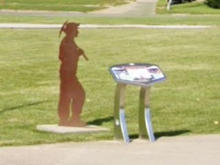
Coal Miner Silhouette
On the NW corner of E Pine and Macoupin St. Gillespie
The Silhouette depicting a miner with his pick axe and helmet is set beside a Wayside Exhibit with a panel describing the relationship of Gillespie with coal mining.
Gillespie High School's football team and the baseball teams are all called the Miners. Coal mining is deeply embedded in the local culture.
Across the street from the silhouette is the Vintage gas station:
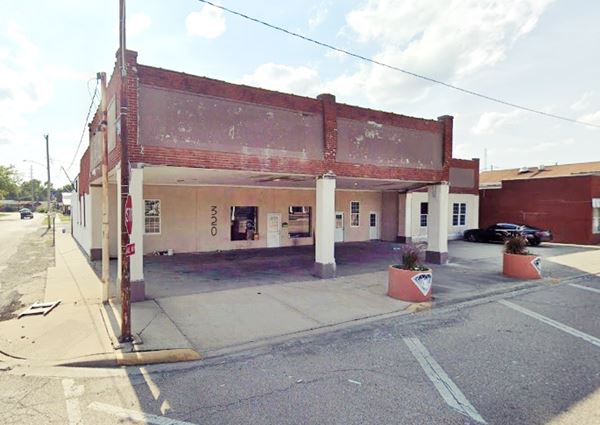
Former Service Station (1920s)

Former gas staton (Kals Custom). Source
320 S Macoupin St, Gillespie. Set on the SW corner of this strategic intersection where Route 66 entered the town from the south, the red brick building is clearly recognizeable as a gas station.
Three massive box columns support an imposing flato-roofed canopy. The parapet has inset panels for signage and a brick contour. The canopy extends from the office and service areas with the same proportions and lines. The columns extend past the roofline (this was a Gulf feature). The design was popular from 1920 to 1940 and used by Gulf, Magnolia - Mobil, Sinclair and Texaco.
In the late 1980s it was "Gus' Auto Service", now it is "Kals Customs" and has been recently painted gray.
Former Service Station (1920s) in Gillespie, Illinois
Turn right along West Pine Street (notice the brown and white "Historic Route 66" sign on the SW corner by the Shell sign. This was known as the "Hardroad". The concrete state highway that became Route 66 has always been called the Hardroad. At Madison turn right (north) and stop on the next corner:

Post Office Mural, Gillespie, Il. Source
Post Office Mural
To your left, on the corner at 200 W Spruce St, Gillespie
The mural in the post office's lobby is actually an oil on canvas, painted by Gustaf Dahlstrom in 1936. It is the "Illinois Farm", and was commissioned by the Treasury Department as a New Deal project.
Continue your Road Trip along Route 66:
This marks the end of your city tour of Gillespie, continue your Route 66 Road Trip by heading south (westbound) along Old Route 66 - IL-4 towards Benld.

Sponsored Content
>> Book your Hotel in Chicago

Credits
Banner image: Hackberry General Store, Hackberry, Arizona by Perla Eichenblat


