Coal mining town on U.S. 66
Index to this page
All about Virden, Illinois
Trivia, Facts and Useful Information
Elevation: 681 ft (208 m). Population 3,444 (2020).
Time zone: Central (CST): UTC minus 6 hours. Summer (DST) CDT (UTC-5).
Virden is a city in Macoupin and Sangamon counties is pronounced "Verd-n" in south-central Illinois.
The History of Virden

American lotus Nelumbo Lutea. Source
The first inhabitants of what is now Illinois, arrived when the ice sheets retreated some 11,000 years ago, at the end of the last Ice Age. These Paleoindians were the ancestors of the modern Kickapoo, Illinois and Miami natives that were the historic natives encountered by the first European explorers in the mid 1600s.
France claimed the region as part of "New France" (now Canada) but lost it to Britain during the Seven Year War (1763). The independence of America (1776) saw the land change hands again; it became a territory of the U.S.
Pioneers arrived in the mid 1810s and early 1820s, as farmers around the time that Illinois gained statehood (1818). The first settler in the region was John Woods, who came from Virginia in 1817. Macoupin County was established in 1829 and was named after Macoupin Creek, the word is a Miami-Illinois term "macoupin" or "macopine" for the American lotus Nelumbo lutea. See picture (1).
The Chicago and Alton railroad was completed through this area in 1852, and the town was founded that same year by Heaton, DuBoise, Chesnut, Hickox and Keiting. Its first building was John Virden's hotel.
The name Virden
Virden was named in honor of John Virden, who for a number of years had kept a popular stagecoach-stand some two miles south, and was the proprietor of the hotel. The surname is a locational name "of Verdun" the town in Meuse in north-east France.
In 1869 a coal shaft was sunk and was operated by J. W. Utt. The 31 mile long Jacksonville & South-eastern Railway shipped out coal of the Virden Coal Company, to Jacksonville. Coal has a deep link to the history of Virden, more on this below when we describe the battle of Virden.
Route 66 was aligned through the town along the original State Highway, SBI 4, in 1926. Four years later it was shortened and made straighter: it was realigned seven miles further east through Divernon, Farmersville and Litchfield, bypassing Virden.

Hotels and Motels close to Virden
Lodging & accommodation in Virden; sponsored content. Find a room in neighboring Springfield, just a few miles to the north:
> > Book your hotel nearby, in Springfield
More Accommodation near Virden on Route 66
Below you will find a list of some of the towns along Route 66 east and west of this town; click on any of the links to find your accommodation in these towns (shown from east to west):
Along Route 66 in IL
- Hotels in Illinois
- Route 66 Starting point ▸ Chicago
- Lockport
- Willowbrook
- Bolingbrook
- Plainfield
- Romeoville
- Joliet
- Wilmington
- Dwight
- Pontiac
- Chenoa
- Normal
- Bloomington
- Atlanta
- Lincoln
- Springfield
- Raymond
- Litchfield
- Staunton
- Williamson
- Hamel
- Edwardsville
- Collinsville
- Troy
- Glen Carbon
- Pontoon Beach
- Granite City
- East St. Louis
West in Missouri
- Hotels in Missouri
- Florissant MO
- Bridgeton MO
- St. Louis MO
- Kirkwood MO
>> Check out the RV campgrounds in Springfield and Glenarm.
Virden's weather
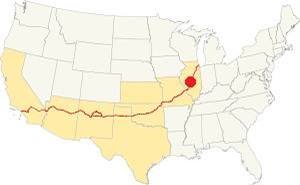
Location of Virden on U.S. Hwy. 66, Illinois
Virden's climate is a "humid continental type", its summers are humid, long and hot. Its winters are short, very cold, with a lot of snow and quite windy.
Its average yearly temperature is around 52.4 °F (11.3°C). The winter averages (Jan) are: low 21°F (-6°C) and high 35°F (1.7°C). The average summer (Jul) high is 86°F (30°C), and a low is 68°F (20°C).
Snow falls during more than 4 months with an average snowfall of 22 inches (56 cm) yearly. Precipitation is 35.3 in. (895 mm) on avg. each year.
Tornado risk
The are around Virden may get around 7 tornado strikes each year.
Tornado Risk: learn more about the Tornado Risk on US 66.
Map of the 1926-30 Route 66 through Virden
Route 66 was aligned along State Highway 4 in 1926. It ran from Springfield to Staunton crossing several towns, among them was Virden. Coming from Thayer in the north, its course is marked with a pale green line in our custom map.
On the south side of Virden Route 66 followed the "old" IL-4 westwards along W Loud St for nine blocks and then it turned sharply south along S Wrightsman St. till it met the C. B. and Q. railroad.
On the southern tip of Virden the highway had a grade crossing with an acute angle that made it unsafe (eliminated later -black line in our custom map). The 1932 alignment instead curved softly out of southern Virden, crossed the tracks almost at right angles and then curved south again.
The original 1926-30 Route 66 continued south after the tracks and then turned sharply west along Crown 2 Mine Rd. to turn, for the 4th time since downtown Virden, to head south once again towards Girard, brown line in our custom map.

1931 USGS map of southern Virden Il.
The Route 66 alignment in Virden
Visit our pages with old maps and plenty of information about US 66's alignments.
- Route 66 Hamel IL to St. Louis MO (Next)
- Springfield to Staunton IL (1926-30 US66 near Virden)
- Springfield to Hamel IL (1930-77 US66 to the east of Virden)
- Route 66 Pontiac to Springfield IL (Previous)

Virden's Route 66 Landmarks
Some classic attractions and sights
Site of former Texaco
As you drive into Virden coming from Thayer along State Hwy 4 from the north, you transition from open fields to a suburban setting. It is hard to imagine this was a coal mining town.
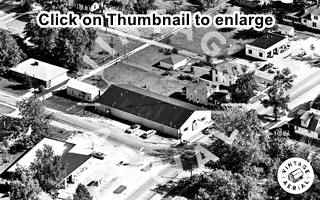
To your left on the NE corner of N Springfield and E Waverly once stood a Shell service station. Ahead, on the next block, at 314 N Springfield Ave is a tobacco shop, it used to be a Texaco station -typical icebox with two service bays and a corner office. You can see it in the aerial photo from 1968, click on the thumbnail to enlarge it. Texaco is upper right. Across E Prairie St., on the SE corner where the Subway is now located, was a Gulf gas station.
Virden History Mural
On the same block, facing the U.S. Post Office, to your left is a two story narrow red brick building, the mural is painted here, facing Route 66 at N Sprignfiedl and E Jackson.
The mural is on the western brick wall of the Sav-Mor Building it is the third one on that building. The first one was painted by Jim Palmer in around 1990. It fell into disrepair and in 2004 was replaced by a new one, pictured below:
Second Mural (2004-2018)
The second mural was the work of John Hubbell (2004) and measured 52 by 19 feet. The mural had four panels, one depicts a scene of a settler on the prairies, the second has John Virden and his hotel. The third portrays Melvin Vaniman a Virden native aviator and photogrpher. The last panel shows the downtown area, a train a Route 66 sign and an old car.
2004-18 Mural in Virden, Illinois
Current Mural (2018)
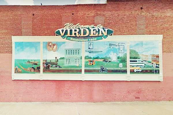
The newest mural (Learn more at its official website: virdenmural.com). was first presented to the lcal community in December 2017 and dedicated in 2018. It was painted by Bernie Gietl and his wife D.L. Whitlock-Gietl. It is 42 feet long and 13 high.
Current Virden History Mural in Virden, Illinois
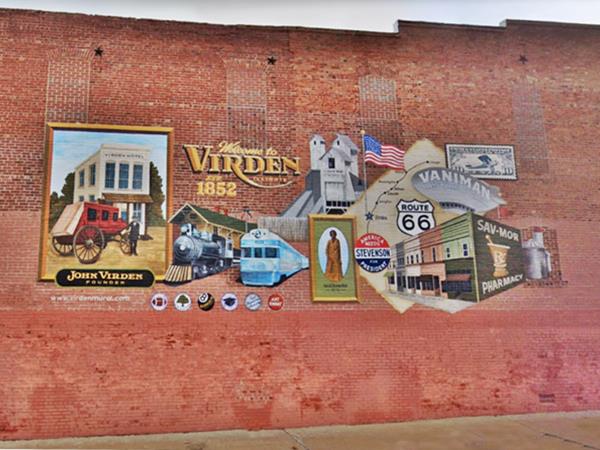
This mural depicts, from left to right: John Virden's stagecoach motel, the trains of the railroad and the ITC, the Coal Mines, Sarah Hall (born a slave, d.1936), Adlai Stevenson (1900-65), Governor of Illinois; Route 66 shield with a map plotting its course from Chicago through Virden (the latter marked with a blue star, with an American flag. Then comes Chester Melvin Vaniman's dirigible airship, the "Akron" in which he died attempting to cross the Atlantic Ocean in 1912; he was born in 1866. A 10 cent Lindbergh airmail postage stamp commemorating Charles Lindbergh's landing in Virden due to bad weather c.1920s; the last two images are the Sav-Mor pharmacy and grain silos as a symbol of Virden's farms.
Downtown Square
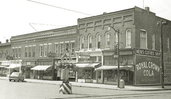
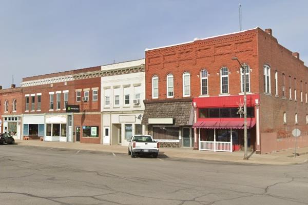
As you turn left along E Jackson you will see the town's square to your right. Park and visit this historic site. Below is a "Now and Then" view along East Jackson facing the square:
North side of the Square, 1950s. Virden, Illinois
North side of Square nowadays in Virden, Illinois
ITC railroad
The 1950s image shows a railroad crossing with the tracks running along Dye St. these were the tracks of the Illinois Traction or ITC, a heavy duty interurban electric railroad with passenger and freight service. The railway ran between 1904 and 1956 and had over 550 miles (900 km) of tracks in central and southwestern Illinois, from East St. Louis to Springfield along Route 66.
It had streetcars in the large cities and ran along the streets of the towns along the network. It had a cross-country passenger service. Popularity of cars in the 1940s and 50s led to its demise.
Route 66 Wayside Exhibit
The sleek stainless steel "Route 66 Coal Towns - The Battle of Virden" marker is located on the square's northwest corner (Location map) it commemorates the 1898 Battle of Virden -more on it below.
Virden Miner’s Riot Memorial

Virden Miner's Riot Memorial. Source
Walk east, on the NE corner Of E Jackson and N Dye Streets is the Virden Miner's Riot Memorial dedicated in 2006. It is a granite slab with a bronze bas-relief depicting the events of the Miner's Riot of 1898: The battle of Virden.
In the middle of the square is the monument remembering those brave men who fought in World War I (1914-18) many of them giving their lives for freedom. Next to it is an ancient bandstand.
Let's look into the historic miner's riot and its consequences.
The Battle of Virden

Leaflet offering mining jobs to "175 good colored miners". Source
Coal
Roughly two thirds of southern Illinois is underlaid with rich coal seams. The first mine opened around 1810 and over 4,500 coal mines have operated since then.
There are two coal mining areas along Route 66, one in the north near Wilmington, the other in the south, along Old Route 66 south of Springfield.
Coal mining was a dangerous job and mostly employed immigrants working under miserable conditions. By the late 1800s miners organized labor unions seeking safer working conditions and better pay.
Labor dispute over pay
In 1898 there was a dispute between the owners of the Chicago-Virden Coal Co. who refused to honor a nationwide agreement signed with the United Mine Workers: the company said that paying 40 cents per ton per day and accepting an eight-hour work shift would lead to bankruptcy.
The miners went on strike and the company hired non-unionized African-Americans from Alabama, offering 30 cents per ton per day (see the image with a job offering leaflet).
Picket
The miners blocked the entry of the southern black workers in September, but a second attempt in October, with a fortified stockade around the mine protected by 50 armed guards led to a gunfight between guards and miners.
This 10-minute clash is known as the "Battle of Virden", in which 13 men were killed: eight miners, four guards hired by the mine and a and Chicago and Alton Rialroad employee.
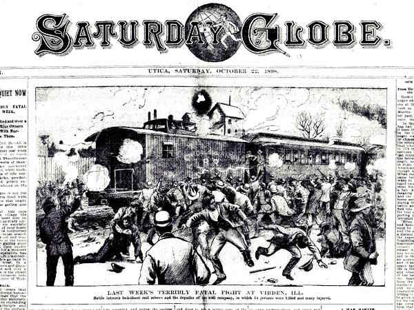
The miners killed during the Virden Mine Riot were denied burial in cemeteries of this part of Illinois, so the local miner union bought a plot of land and buried them there, in 1899, in neighboring Mt. Olive.
Mary "Mother" Jones (1837-1930) a labor union activist who defended the miners' rights requested to be buried with "her boys", as she called them, in Mt. Olive. Read More on Jones and the historic cemetery.
Aftermath
The Black workers with their families were victims of the white workers and the mining tycoons: they were unaware that their rates were lower or that they would be used as strikebrakers. Furthermore, they were beaten by the mobs who resented them being strikebreakers, but also for racial reasons: they didn'w want Black families moving into Virden. Many of them moved back to Birmingham or to other towns in Missouri.
The battle marked the beginnig of the end of the fierce capitalism of the nineteenth-century. Workers were not serfs or indented laborers, they had rights. The Chicago-Virden Coal Co. had to capitulate, they couldn't employ strikebreakers, the government withdrew its support so they agreed to pay the new wages.
More landmarks in Virden
Old Standard Station
Continue south along S. Springfield, and after four blocks, to your left, on the SE corner of E Holden and S. Springfield is a former Standard Station, you can see it in this 1967 aerial photo, and nowadays as "Paririeland Ambulance", the image below combies "Then and Now" views:
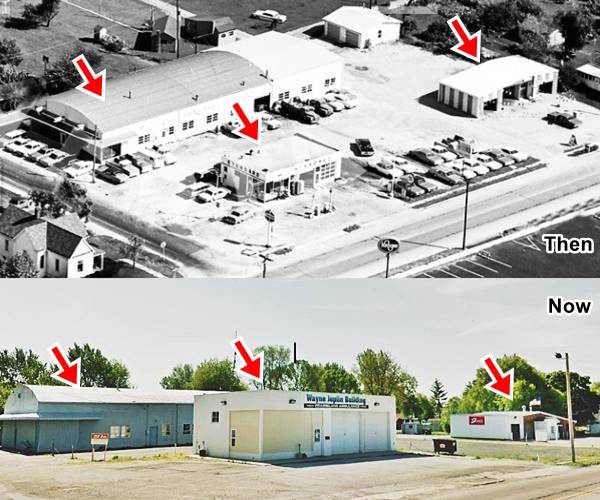
To the left at 112 E Holden was George Kruse Chevrolet dealership. Then the service station and to the right, a car wash.
Old Route 66 south of Virden
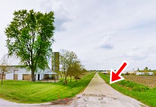
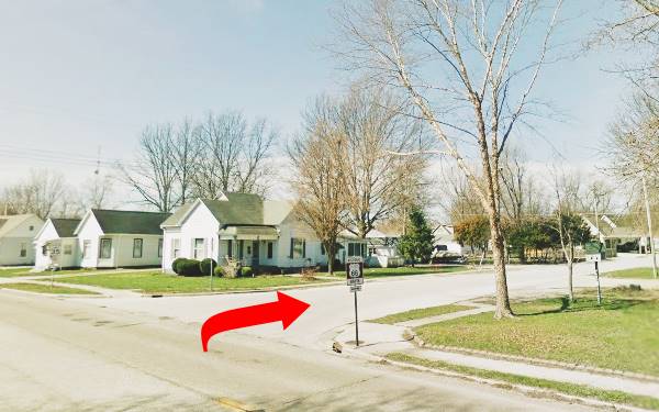
See this map with directions (2 miles). Follow the Original Route 66 by taking a right along W Loud St. and then head south along Wrightman St. at the grade crossing south of town, continue southwards along Old Route 4, a narrow highway, the original 1926-30 Route 66 it has two sharp 90° turns and then runs south into the next town.
Historic Route 66 sign showing alignment at the turn on Loud and S Springfield St.
Continue your Road Trip along Route 66:
This leg of your Route 66 Road Trip along the 1926-30 alignment across Virden ends here. Drive south into Girard to continue your adventure!

Sponsored Content
>> Book your Hotel in Chicago

Credits
Banner image: Hackberry General Store, Hackberry, Arizona by Perla Eichenblat


