Route 66 Road Trip in Girard:
Index to this page
All about Girard, Illinois
Trivia, Facts, and Useful Information
Elevation: 668 ft (204 m). Population 1,732 (2020).
Time zone: Central (CST): UTC minus 6 hours. Summer (DST) CDT (UTC-5).
Girard is a sity in Macoupin county, south central Illinois on the 1926-30 course of Route 66 south of Springfield.
The History of Girard
People have been living in what nowadays is the state of Illinois for over 11,000 years, since the last Ice Age ended. Later, when the first European explorers (French, coming from Canada) reached the area, they encountered the Illinoisian Indians. This took place in the 1600s.
The territory was ceded by France to England after the Seven Year War in 1763, and after the American Independence it became a Territory of the U.S.A, it was admitted into the union as the state of Illinois in 1818.
At that time the first settlers were arriving to the area where Girard is now located.
The first pioneer in Macoupin was John Woods, who came from Virginia in 1817. Macoupin County was created in 1829; it was named after Macoupin Creek, in turn a native- Miami ⁄ Illinois word for the American lotus (Nelumbo lutea).
At that time, a Frenchman named Girard set up a sawmill on what after then was known as "Mill Creek". By 1831 Girard, Warren, Ashlock, Cox and Harlan were living in a site known as "Girard Township". The stage line between Springfield and Alton followed the old indian trace through Girard and in 1835 Henderson built a "stage stand" roughly one half mile north of modern Girard. This route would become IL-4 and later Route 66.
In 1834 and again in 1835 a town was platted by Edwards and Mather but it was unsuccessful. But almost 20 years later, in 1853, Barnabas Boggess and Charles Fink laid out a town on the Chicago and Alton railroad that occupied the same area as the failed 1834 platt. They used the old name (Girard). It was incorporated in 1855 by the state Legislature.
The name Girard
Girard is named after the first settler in the area Mr. Girard. Surname which like Gerard or Gerald comes from the Germanic personal name Gerhard which means "brave spear".
State Highway, SBI 4 was built after 1918, paved in the early 1920s and in 1926 it became part of US 66. However it would not last long: in 1930 Route 66 was shortened, straightened and realigned to the east through Litchfield and Mt. Olive, bypassing Girard.
Coal Mine
The Girard Coal Mine dug its first shaft in 1869 and closed in 1922 with a negative impact on the local economy. The new "Coal Mine No. 2" opened in 1976 between Girard and Virden.

Hotels and Motels close to Girard
Lodging & accommodation in Girard; sponsored content. Find a room in neighboring Springfield, just a few miles to the north:
> > Book your hotel nearby, in Springfield
More Accommodation near Girard on Route 66
Below you will find a list of some of the towns along Route 66 east and west of this town; click on any of the links to find your accommodation in these towns (shown from east to west):
Along Route 66 in IL
- Hotels in Illinois
- Route 66 Starting point ▸ Chicago
- Lockport
- Willowbrook
- Bolingbrook
- Plainfield
- Romeoville
- Joliet
- Wilmington
- Dwight
- Pontiac
- Chenoa
- Normal
- Bloomington
- Atlanta
- Lincoln
- Springfield
- Raymond
- Litchfield
- Staunton
- Williamson
- Hamel
- Edwardsville
- Collinsville
- Troy
- Glen Carbon
- Pontoon Beach
- Granite City
- East St. Louis
West in Missouri
- Hotels in Missouri
- Florissant MO
- Bridgeton MO
- St. Louis MO
- Kirkwood MO
>> Check out the RV campgrounds in Springfield and Litchfield.
Girard's weather
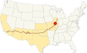
Location of Girard on U.S. Hwy. 66, Illinois
Girard has a "humid continental" climate with wet and hot summers (which are quite long) and short but very cold winters -with plenty of snow and bitter wind.
In Girard snow may fall for over four months with an average 22 inches (56 cm) of snowfall yearly. Rainfall averages some 35.2 in. (893 mm) yearly.
The average temperature is 52.4 °F (11.3°C). The average winter temperatures (Jan) are: low 21°F (-6°C) and high 35°F (1.7°C). The summer averages (Jul) are: high 86°F (30°C), and low: 68°F (20°C).
Tornado risk
The countryside near Girard is hit by some 7 tornados per year. Tornado Risk: learn more about the Tornado Risk on US 66.
Map of the 1926-30 Route 66 through Girard

1929 roadmap south of Springfield. Source
Click on Map to Enlarge
Route 66 was aligned along Illinois state highway #4 in 1926, and ran from Springfield to Staunton passing through Girard. The course of U.S. 66 southwards from neighboring Virden to girard is marked with a pale green line and a brown line in our custom map of the 1926-30 Route 66.
After turning south Crown 2 Mine Rd. it went straight southwards into the business district of Girard where it took a different course to modern IL-4: It turned west (right) on Madison and then south (left) along 6th Street. When it reached the railroad tracks south of town, it continued straight (the later 1930s IL-4 ran south till it met the tracks, and then took a NE-SW course into Nilwood.)
Route 66, Girard to Nilwood (1919-1931)
Listed in the National Register of Historic Places
This was a period of transition from cart, horse and mule to truck and cars. The old dirt track was replaced by a state of the art highway (by early 1920s standards): it was a concrete highway that had two eight-foot wide lanes and gravel shoulders 7 feet wide. The Portland concrete slab was 6 inches thick.
The original Illinois Route 4 in this area was paved between 1920 and 1922, it followed the former county lanes and lot demarcation trails and therefore had many sharp 90° curves.
This made it unsafe and also longer.
The pink line in our custom map shows how it zig-zagged its way across the farmland crossing the railroad three times! Also see this map with directions.
Old Historic Route 66 running through corn fields between Girard and Nilwood
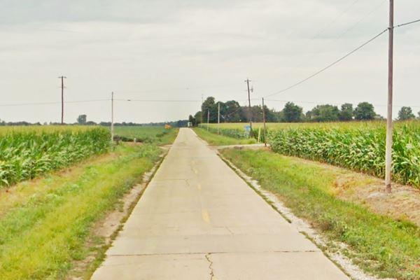
It has survived the wear and tear for 100 years and although it has cracks, it still has its original concrete paving plus the concrete box culverts.
The Route 66 alignment in Girard
Visit our pages with old maps and plenty of information about US 66's alignments.
- Route 66 Hamel IL to St. Louis MO (Next)
- Springfield to Staunton IL (1926-30 US66 near Girard)
- Springfield to Hamel IL (1930-77 US66 to the east of Girard)
- Route 66 Pontiac to Springfield IL (Previous)

Girard: classic US 66 Sights
Landmarks & Attractions
Coming from Virden in the north, drive into Girard along the "old" Route 66. It becomes N 3rd Street as it enters the town. In the central district, on the left side of the road you will see a 1950s Standard Oil service station.
Former Standard Oil Station
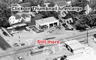
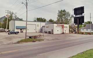
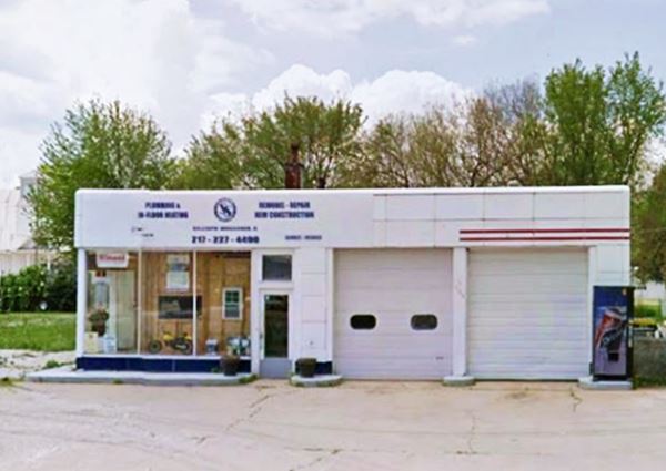
At 227 S 3rd St, Girard, on the NW corner of N 3rd and W Center St. This is a rectangular, box-shaped building from the 1940s o 50s with porcelain metal skin. Its former two-door garages are clearly visible. The original windowed office is untouched. It was located on the strategic intersection in downtwon Girard. The sign on the corner has repurposed the original gas station oval sign.
former Standard Station in Girard, Illinois
Check it out in the aerial photo thumbnail below (click on it to enlarge it).
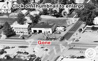
Former Texaco (Gone)
Pictured above in a 1984 aerial photo, it was located at 105 South Third St. opposite the Standard Station was Brett Barnes Texaco Station, another oblong-box styled station. It stood where the canopy and pumps are now located. Pictured above in an aerial picture from 1984. The Shell's building is new and unrelated.
Downtown Girard
Take a left along W Center St. and head east to visit the town's main square that is just one block away. Turn right at the square along South Second St., stop and visit a Classic Drug store and Soda Fountain, an memory for the good old days:
Deck's Drugstore and Soda Fountain - Doc’s Soda Fountain

View of Doc's Soda Fountain and a red Mustang. Source
Americana: Drugstore & Soda Fountain
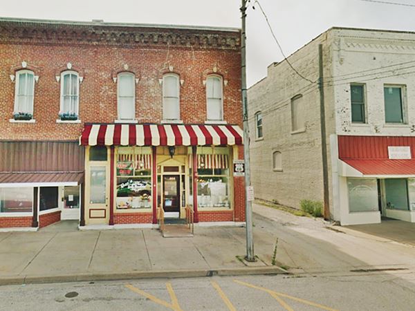
To your left, facing the square at 133 South Second Street.
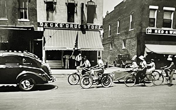
Dr. B.F. Clark opened the first drug store back in 1865. He was joined by Lewis C. Deck in 1884, and it became Deck's Drugstore. Deck later bought Clark's share. Then in 1929 (3 years after Route 66 was aligned through the town) the soda fountain was added.
The last generation of Deck's (Bill and Bob) retired in 2001 and closed the shop. In 2007 Bob and Renee Ernst bought it and reopened it under the name "Doc's Soda Fountain". Enjoy some ice cream, lunch or ice cream sodas.
The Bob and Bill Deck Pharmacy Museum displays artifacts from the late 1800s it is named after the third generation of Decks to run the store.
Vintage picture of Deck's Drugstore in the 1940s
Below is its current appearance:
Doc’s Soda Fountain in Girard, Illinois
Turn right on the south side of the town's square along W Madison. Route 66's original alignment runs along West Madison westwards, but before driving along it, take a short detour: two-block south along S 3rd St. Ahead, on the second block at its intersection with W Monroe St. are two landmarks:
Whirl-A-Whip Restaurant
It has a great Classic Sign pictured below. It opened originally in 1957.
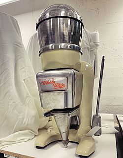
The restaurant got its name from the special ice-cream maker it used: the Whirl-A-Whip (pictured). This machine allowed preparing single servings with custom flavors and served soft ice cream.
After several owners, it closed for good but reopened in 2013, and still uses the original 1950s "Wirla Whip" ice cream machine, whipping each ice cream individually!
Its first owners were the Lockwoods. As it has an open dining area it is only open from March to October.
Whirl-A-Whip Ice Creams and Restaurant in Girard, Illinois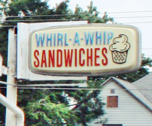
Former Shell station
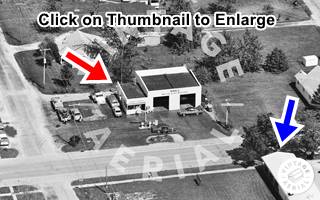
Across S 3rd St. to your left, on the SE corner is a former Shell gas station that has been heavily modified and unrecognizable. Now it is a welding shop. Click on the 1984 aerial photo thumbnail for a full size picture, the red arrow marks the Shell and the Blue arrow is the Whirl-a- Whip.
Leaving Girard along Old '66
Retrace your steps to W Madison and turn left heading westwards. The Brown "Historic Route 66" sign at S 6th Street (street view) will prompt you to turn left along S 6th.
After 0.7 miles the road meets the later IL-4 alingment running from NE to SW beside the railroad tracks. The intersection and railroad grade crossing here were modified for safety reasons: Skewed intersections with acute angles are a safety risk, specially for older drivers or people with limited neck mobility. Guidelines states that: "Crossing roadways should intersect at 90 degrees if possible, and not less than 75 degrees." (1).
So turn right onto State Hwy. 4, and then left to cross the railroad and drive the Historic Girard to Nilwood" Route 66 segment.
Continue your Road Trip along Route 66:
This leg of your Route 66 Road Trip along the 1926-30 alignment through Girard ends here. Drive south towards Nilwood to continue your journey.

Sponsored Content
>> Book your Hotel in Chicago

Credits
Banner image: Hackberry General Store, Hackberry, Arizona by Perla Eichenblat


