Small Village close to U.S. 66
Index to this page
All about Divernon, Illinois
Trivia, Useful Information & Facts
Elevation: 612 ft (187 m). Population 1,194 (2020).
Time zone: Central (CST): UTC minus 6 hours. Summer (DST) CDT (UTC-5).
Divernon is a village in Sangamon County, Illinois, located next to Route 66.
History of Divernon
This region was peopled about 12,000 years ago when the last Ice Age ended. When French explorers reached the area in the mid 1600s they encontered Illinois indians living in the area.
American and Europeans settled here in the early 1800s displacing the natives.
Sangamon County was created in 1821 and was named after the Sangamon River, which runs through it. The name Sangamon may be an Indian word of Pottawatomie origin (Sain-guee-mon = "where there is plenty to eat") or name given by the French explorers (St. Gamo, a French saint).
The first post office opened in 1887, the same year the village was founded. It was named by the town's founder, H.C. Barnes.
The Name:Divernon
The name Divernon comes from "Diana Vernon" or "Die Vernon", a character from the novel written by Sir Walter Scott (1771-1832), "Rob Roy". In this novel, published in 1817, the narrator, Frank Osbaldistone who is living at his uncle's Sir Hildebrand Osbaldistone, falls in love with Hildebrand's niece, Diana Vernon. After many adventures, Frank inherits Sir Hildebrand's property and marries Diana.
Vernon is a surname that combines a Celt word "Ver" = Alder and a suffix "O" of Gallo-Roman origin meaning "place": the place with alders.
Abraham Lincoln represented Sangamon County in the Illinois state Legislature. Route 66 has run past Divernon since 1930.

Divernon, its Hotels and Motels
Lodging & accommodation in Divernon; sponsored content. Find a room in neighboring Springfield, 16 miles to the north:
> > Book your hotel nearby, in Springfield
More Accommodation near Divernon on Route 66
Below you will find a list of some of the towns along Route 66 east and west of this town; click on any of the links to find your accommodation in these towns (shown from east to west):
Along Route 66 in IL
- Hotels in Illinois
- Route 66 Starting point ▸ Chicago
- Lockport
- Willowbrook
- Bolingbrook
- Plainfield
- Romeoville
- Joliet
- Wilmington
- Dwight
- Pontiac
- Chenoa
- Normal
- Bloomington
- Atlanta
- Lincoln
- Springfield
- Raymond
- Litchfield
- Staunton
- Williamson
- Hamel
- Edwardsville
- Collinsville
- Troy
- Glen Carbon
- Pontoon Beach
- Granite City
- East St. Louis
West in Missouri
- Hotels in Missouri
- Florissant MO
- Bridgeton MO
- St. Louis MO
- Kirkwood MO
>> Check out the RV campgrounds in Springfield, Lichtfield, and also in Raymond
The weather in Divernon
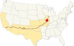
Location of Divernon on U.S. Hwy. 66, Illinois
Summers in Divernon tend to be warm and wet. And its winters are short and freezing and also windy.
The average summer (Jul) high is 86°F (30°C), and its low is 68°F (20°C). The January (winter) average low is 21°F (-6°C) and the average high is 35°F (1.7°C).
Snow falls for around 4.3 months, and Divernon's average snowfall is 22 inches (56 cm) per year. The yearly rainfall is 37.5 in.(952 mm)
Tornado risk
Sangamon county, where Divernon is located gets hit by around 7 tornados each year. Tornado Risk: read about the Tornado Risk on US 66.
Map of Route 66 through Divernon in Illinois
From Glenarm to Divernon
Head south from Glenarm along Douglas St. which then becomes Frazee Rd (the West Frontage Rd.) and runs south till it meets State Highway 104.
To the south of Exit 82 at I-55 and IL-104 there is no Western Frontage Rd. and Old US 66 is buried under the Freeway. So here you must get on the freeway and get off it at Exit 80 to head into Divernon.
It is a 5 mile drive from Glenarm to Divernon (map with directions).

USGS map of Divernon and US66
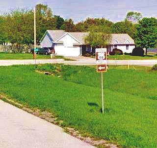
As you drive into Divernon there are brown-colored Historic Route 66 signs to guide you on your journey. But Route 66 never entered the town, it ran along its eastern side, now buried by I-55 or survives as its west frontage road in some parts. Rittenhouse wrote that the town was "a half mile to the west", and the map shows just that. The town wasn't close to the highway.
Divernon to Farmersville
Follow the freeway south or take the West Frontage Rd. towards Farmersville.
South of Divernon, it is a 9 mile drive to Farmersville (map with directions).
The Route 66 alignment in Divernon
Visit our pages with old maps and plenty of information about US 66's alignments.
- Route 66 Hamel IL to St. Louis MO (Next)
- Springfield to Staunton IL (1926-30 US66 to the west of Divernon)
- Springfield to Hamel IL (1930-77 US66 near Divernon)
- Route 66 Pontiac to Springfield IL (Previous)
Divernon: classic US 66 Sights
Landmarks and Attractions
Historic Context: The Town in 1946
Jack D. Rittenhouse describes Divernon in his 1946 Guidebook of Route 66 as follows:
SUNDOWN CORNER, at a junction with a road to DIVERNON, a half-mile west. Gas stsation at intersection. Divernon... is a small, quiet town. Garage here. Rittenhouse (1946)
He mentioned that two miles north of the town at the junction with state highway 104 there were "Gas stations and cafe." and this is where our tour begins:
Round Barn
The Old round barn is locted on the north side of Divernon, at Gaffney Rd. and Frazee Rd (Original US66, now the west Frontage Rd.) on the north side of I-55's exit 52 (map with directions).
Here, in a field on the western side of old Route 66 is a round barn. It appears in an 1946 aerial photograph yet Rittenhouse did not mention it.
Sangamon County plat map shows that it belonged to M W Frazee back in 1957. The Frazee farm is known as "Round Barn Farms Inc." Charles Joseph "Chuck" Frazee (b.1940) was named
2016 Farmer of the Year.
The farm is has metal siding. It lacks a cupola. instead it has a two-ptich conical foof. It is in good condition and used for breeding hogs.
There are other round barns on Route 66: the Round barn in neighboring Glenarm, the Historic Raymond Schulz Round Barn in Pontiac Il, the other on is the famous round barn in Arcadia Oklahoma.

At the crossroads further south, the gas stations and cafe mentioned by Rittenhouse were located on the north side of Hwy 104, on both sides of Route 66. The Chicago and Illinois Midland railroad runs parallel to higway 104 and there was a grade crossing here. The interchange eliminated all the original buildings at exit 82. Pawnee is located to the east and Pawnee railroad junction, to the west.
Old Roadbed
The original Route 66 ran where the W Frontage Rd is now located, but some sections are missing (south of Hwy 104). On the north side of Divernon is a dead-end segment of the 1930s US66; it is just 0.7 miles north of the town, next to the western side of the modern freeway.
This concrete-paved 0.8 mile-long segment belongs to the original 1930 alignment. There is a steel beam bridge on Bush Creek on this section that was built in 1949.
See this map with directions for the old segment.
1930 Route 66 roaddbed north of Divernon, Illinois
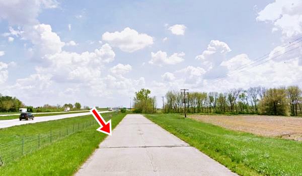
Follow this map with directions to reach it and drive it (it is not accessible from the W Frontage Road!)
Sundown Corner
Marathon gas station
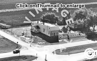
In 1946, there was a gas station on the southeast corner of Divernon Rd and Route 66; Rittenhouse mentioned it. You can see it in the 1956 aerial photo of the junction (lower right side).
The 1966 picture below shows it sold Marathon gasoline and had a cafe in the old woodframe two-story box-shaped building. When the four-lane highway was built, the new northbound lane was built across the property and the station was razed.
This land belonged to the McMurray farmily (1957 Sangamon plat), and Hayward McMurray and his wife Isabelle and children figure in the 1940 Divernon census.
Standard gas station
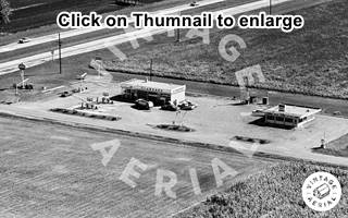
On the southwestern corner was another gas station also torn down in 1970; but this one was more recent. It does not appear in the 1956 aerial picture, and we only have a view of it in 1966 showing a Standard Station and a cafe on the eastern side of the premises (click on the thumbnail to enlarge). The 1971 roadworks at Divernon's exit razed the property.
Reichert Rd Station
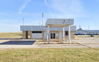
On the SE corner of E Brown and Reichert St. is another gas station, from the 1970s. You can see it in this 1981 aerial view. It was a Standard station -perhaps it was the old one further east relocated here (?), and a "Hen House" on its southern side. Only the old gas station remains.
Herman's Garage
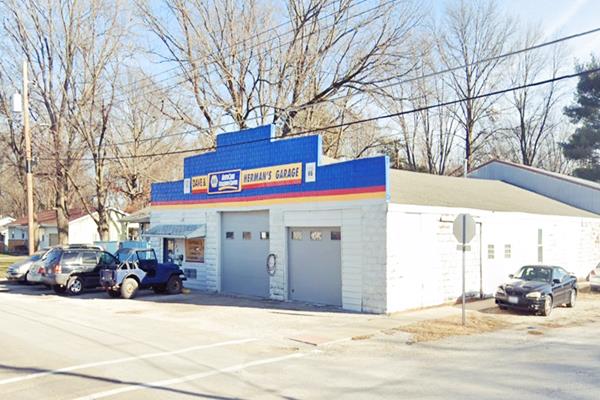
Drive west into Divernon, and at 318 S State St, Divernon. This garage has been in operation since 1961, located in the town proper and not on the highway, it is a small shop that served drivers with minor reparis and light mechanics.
Herman’s Garage in Divernon, Illinois
Thomas Country Estate
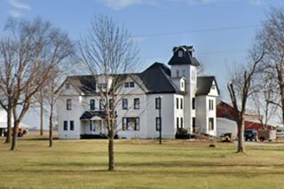
Five miles south of Divernon, on the eastern side of the freeway (see this map with directions) it is a country mansion, a red brick building with two stories and a tower. Red tiled gable roofs. It was built in 1863 by Elijah E. Myers (1830-1909) a well known architect from Springfield. Mr Thomas lived here until 1909, when he passed away. A fire gutted the place and it has been repaired.
This leg of your Route 66 Road Trip at Divernon ends here, continue your journey by heading south along the 1930-77 US66 alignment into neighboring Farmersville.

Sponsored Content
>> Book your Hotel in Chicago

Credits
Banner image: Hackberry General Store, Hackberry, Arizona by Perla Eichenblat
Jack DeVere Rittenhouse, (1946). A Guide Book to Highway 66


