Small Village bypassed by US Hwy 66
Index to this page
All about Waggoner, Illinois
Trivia, Useful Information & Facts
Elevation: 640 ft (200 m). Population 187 (2020).
Time zone: Central (CST): UTC minus 6 hours. Summer (DST) CDT (UTC-5).
Waggoner is a small village located in Montgomery County, Illinois just 1⁄2 mile west of Route 66.
History of Waggoner
The area was settled some 11,000 years ago after the Ice Age glaciers retreated north. The early French explorers encountered Kickapoo Indians in the late 1600s. These were later displaced across the Mississippi by a growing number of pioneers.
Main Street Waggoner. Illinois
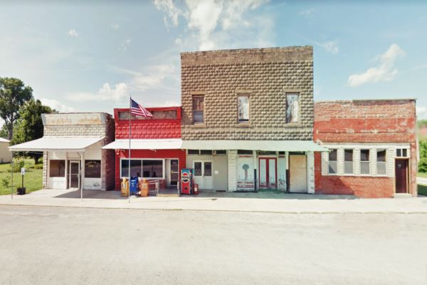
After the 1812 War with Britain, Congress awarded land to veterans in Illinois and part of this land became Waggoner.
Montgomery County was established in 1821. Its name honors Richard Montgomery, an American Revolutionary War general who died during an attack on Quebec in 1775.
The Name:Waggoner
It was named for George Waggoner who was one of the first settlers in the area. He came from Kentucky.
The Waggoner post office opened in 1886. Route 66 was aligned just east of the town in 1930.

Waggoner, its Hotels and Motels
There is no Lodging & accommodation in Waggoner, but you can find your hotel in neighboring Litchfield. Sponsored content.
> > Book your hotel nearby in Litchfield
More Accommodation near Waggoner on Route 66
Below you will find a list of some of the towns along Route 66 east and west of this town; click on any of the links to find your accommodation in these towns (shown from east to west):
Along Route 66 in IL
- Hotels in Illinois
- Route 66 Starting point ▸ Chicago
- Lockport
- Willowbrook
- Bolingbrook
- Plainfield
- Romeoville
- Joliet
- Wilmington
- Dwight
- Pontiac
- Chenoa
- Normal
- Bloomington
- Atlanta
- Lincoln
- Springfield
- Raymond
- Litchfield
- Staunton
- Williamson
- Hamel
- Edwardsville
- Collinsville
- Troy
- Glen Carbon
- Pontoon Beach
- Granite City
- East St. Louis
West in Missouri
- Hotels in Missouri
- Florissant MO
- Bridgeton MO
- St. Louis MO
- Kirkwood MO
>> Check out the RV campgrounds in Lichtfield and also in Raymond
The weather in Waggoner
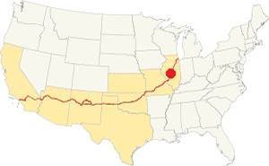
Location of Waggoner on U.S. Hwy. 66, Illinois
Waggoner has wet, warm and long summers, and its winters are short and freezing. They are also windy.
The average temperatures range from 21°F (-6°C) to 86°F (30°C).
Summer (Jul) average high is 86°F (30°C), and the avg. low is 68°F (20°C). The winter (Jan) averages are: low 21°F (-6°C) and high 35°F (1.7°C).
Snow can fall for about 4.4 months. The average snowfall is 22.2 inches (56.3 cm) yearly. Annual rainfall is 38 in. (965 mm)
Tornado risk
Waggoner suffers about 7 tornado hits per year.
Tornado Risk: learn more about the Tornado Risk on US 66.
Map of Route 66 through Waggoner, Illinois
1930-1940 US 66 to Waggoner
The 1930 alignment was built along the "secondary route" that ran parallel to the tracks of the Illinois Central from North of Farmersville past Waggoner and on to Litcfield. It linked several schools and churches. See the 1925 Raymond USGS map.
This is the Map of 1930-77 of US66 from Farmersville to Waggoner.
The 1958 USGS map of Decatur shows a "Four Lane - Dual" highway between Waggoner and Litchfield shared by US 66 and I-55. This highway didn't have exits like them modern ones, they were, at that time just simple grade junctions and crossings without overpasses.
Missing roadbed
From Waggoner to the rest areas south of the town, the original 1930 highway ran along what is now the West Frontage Road. The old roadbed became the southbound (SB) lanes of the four-lane alignment when two new northbound (NB) lanes were added in the 1950s. The Coaldfield Rest stop areas were built with the new I-55 when a new set of dual lanes were built on the eastern side of the old 4-lane US66. The rest area eliminated the original highway.
On the southern side of what is now the rest area, State Highway 126, and the 1930 Route 66 built along it, changed course and bent a bit to the west. You can see this in the map below and also in the aerial photo taken in 1956:
This custom map shows this alignment with a black line.

The Bend and modern alignments (USGS map 1925)

The Bend and 4-lane 66 of the 1950s, 1956 aerial photo
A 2022 view of this same spot reveals that the old roadway was removed, and grass grows where the highway once ran (satellite view).
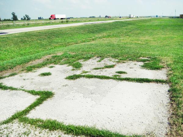
This alignment ran south and you can still see a Original Concrete slab of the 1930 Route 66 at the entrance to the Our Lady of the Highways Shrine -see image below and satellite view. The 1956 aerial photo shows that this alignment ended here.
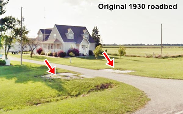
The Route 66 alignment in Waggoner
Visit our pages with old maps and plenty of information about US 66's alignments.
- Route 66 Hamel IL to St. Louis MO (Next)
- Springfield to Staunton IL (1926-30 US66 to the west of Waggoner)
- Springfield to Hamel IL (1930-77 US66 near Waggoner)
- Route 66 Pontiac to Springfield IL (Previous)
Waggoner Attractions & Sights
Historic Context Route 66 in 1946
In his classic "A Guide Book to Highway 66", published in 1946, Jack D. Rittenhouse tells us about US66 during its heyday. He mentions Waggoner as follows:
[it] is about a half-mile west of here Rittenhouse (1946)
Rittenhouse e adds that there was a gas station with a cafe and five tourist cabins five miles west of it; the place included a first aid station.
Waggoner was not located on the Mother Road, but to the west of it. It is a small town which must have been a stop for those needing repairs or in urgent need to buy food at a local shop. There was no gas station at the road leading into the town.
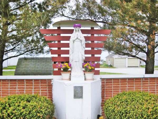
The best known landmark in Waggoner is the Shrine of Our Lady of the Highways:
Our Lady of the Highways
On the original Route 66 (W Frontage Rd.) just 3.7 miles south of town along Route 66: Map with directions
The shrine of Our Lady of the Highways was built in 1958 with the $900 raised by the Litchfield Deanery's Catholic Youth Council. The statue of the Virgin Mary was placed on the property of Francis Marten, who took care of it.
Dedicated in 1959, it still stands on its brick base nestled among trees with a cobbled path leading to it. The cararra mmarble statue of Virgin Mary is a replica of the statue of Our Lady of Lourdes in France, it was imported from Italy (This took up $400 out of the $900 that had been collected).
After Francis' death in 2002, the family has continued upkeeping the shrine.
Our Lady of the Highways, seen from Route 66 in Waggoner, Illinois
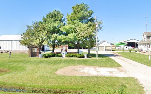
The marble statue of Our Lady of the Highways
Hail Mary signs
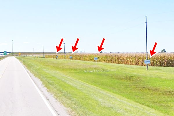
Southwards from the shrine, are a twelve signs with text from the Roman Catholic prayer to the Virgin Mary, "Hail Mary" or "Ave María" lined up along a field. Below is one of the signs and a panoramic view of them lined up by the barbed wire fence of the cornfield.
The text on these signs reads:
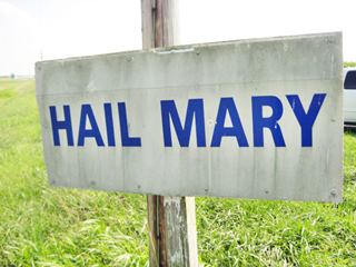
One of the "Hail Mary" signs. Source
Hail Mary
Ave Maria
Full of grace
The Lord is with thee
Blessed art thou
Among Women
And blessed is the fruit
Of thy womb Jesus
Holy Mary
Mother of God
Pray for us sinners
Now and at the hour
Of our death Amen."
Red arrows mark some of the signs
Original Concrete slab of the 1930 Route 66
Facing the shrine, cracked, and with some weeds growing through the cracks, is the original 1930 roadbed of Route 66. It ran here, parallel to the current Frontage Road. Then it became the southbound lanes of the four-lane Route 66 built after 1940 (current Frontage Rd. was the northbound lanes). When I-55 was built, the old highway was reduced to a two-lane road and these southbound lanes were abandoned.
This marks the end of your Route 66 Road Trip across Waggoner. Head south along the 1930-77 alignment into neighboring Litchfield to continue your journey.

Sponsored Content
>> Book your Hotel in Chicago

Credits
Banner image: Hackberry General Store, Hackberry, Arizona by Perla Eichenblat
Our Lady of the Highways Facebook page.
Jack DeVere Rittenhouse, (1946). A Guide Book to Highway 66

