Driving through a mining town
Index to this page
All about Thayer, Illinois
Trivia, Facts and Useful Information
Elevation: 645 ft (197 m). Population 622 (2020).
Time zone: Central (CST): UTC minus 6 hours. Summer (DST) CDT (UTC-5).
The village of Thayer hayer is located in Sangamon county on the 1926-30 Route 66 alignment.
The History of Thayer
People have been living in what nowadays is the state of Illinois for over 11,000 years, since the last Ice Age ended. Later, when the first European explorers (French, coming from Canada) reached the area, they encountered the Illinoisian Indians. This took place in the 1600s.
The territory was ceded by France to England after the Seven Year War in 1763, and after the American Independence it became a Territory of the U.S.A, it was admitted into the union as the state of Illinois in 1818.
Sangamon County was established in 1821 and named after the Sangamon River, which runs through it. "Sangamon" is probably a native American word (Pottawatomie), meaning "Sain-guee-mon" = "where there is plenty to eat", or maybe the name of a French saint (St. Gamo) given by the French explorers.
It was a farming area, starting in 1828 when the Dunkards of the German Batist Bretheren settled the area.
Coal mining town

Nathaniel Thayer II (1808-1883)
Coal-bearing rocks cover about 68% of Illinois' area, and there are some 210 billion tons of coal undeground. They formed some 300 million years ago when vast forests bloomed during the wet and hot Carboniferous times. The decaying vegetable matter formed peat, and this in turn was compressed and morphed into coal.
The area around Thayer only grew when the Wilmington & Vermilion Coal Co. opened a mine here in 1901. The company started in 1866 mining coal in Wilmington, a town located on Route 66, close to Chicago.
The town was platted and built exclusively to house the miners. The workers lived here. The coal was shipped out by railroad, using the depot of the Chicago and Alton RR. Coal moved the machinery and the industry in the early 1900s: steam ships, locomotives, power plants were coal powered. The mine was exhausted in 1914 and closed. Thayer's population fell as miners moved out to work in other towns.
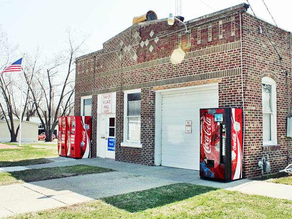
The only building from those boom days is the village's hall. The taverns, stores and buildings that lined Main Street closed when their customers left town.
The name Thayer
Two of the Wilmington & Vermilion Coal Company's Directors were Nathaniel Thayer II (1808-1883), and his son Nathaniel Jr., the latter was the company's President in 1891. Eugene V. R. Thayer also served as Director, from 1904 to 1937 (1).
The Thayers were bankers and philanthropists from Boston, and the mining village was named after Nathaniel Thayer. The surname Thayer is of French origin, derive from Thierry or Thierre which mean: "the son of Theodorie".
Route 66 was aligned through the city following the first State Highway, SBI 4, in 1926, but it was short lived as in 1930 it was shortened and made straighter, realigned to the east through Litchfield, bypassing Thayer.
Getting to Thayer
Reach Thayer driving along Historic U.S. 66 or from the freeway I-55 (via Divernon Rd.) State Hwy 4 lies on the original Route 66 alignment and goes by Thayer.

Hotels and Motels close to Thayer
Lodging & accommodation in Thayer; sponsored content. Find a room in neighboring Springfield, just a few miles to the north:
> > Book your hotel nearby, in Staunton or Springfield
More Accommodation near Thayer on Route 66
Below you will find a list of some of the towns along Route 66 east and west of this town; click on any of the links to find your accommodation in these towns (shown from east to west):
Along Route 66 in IL
- Hotels in Illinois
- Route 66 Starting point ▸ Chicago
- Lockport
- Willowbrook
- Bolingbrook
- Plainfield
- Romeoville
- Joliet
- Wilmington
- Dwight
- Pontiac
- Chenoa
- Normal
- Bloomington
- Atlanta
- Lincoln
- Springfield
- Raymond
- Litchfield
- Staunton
- Williamson
- Hamel
- Edwardsville
- Collinsville
- Troy
- Glen Carbon
- Pontoon Beach
- Granite City
- East St. Louis
West in Missouri
- Hotels in Missouri
- Florissant MO
- Bridgeton MO
- St. Louis MO
- Kirkwood MO
>> Check out the RV campgrounds in Springfield and Glenarm.
Thayer's weather
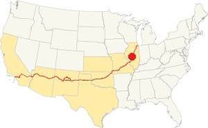
Location of Thayer on U.S. Hwy. 66, Illinois
Thayer has a "humid continental" climate with wet and hot summers (which are quite long) and short but very cold winters -with plenty of snow and bitter wind.
The average temperature is 52.4 °F (11.3°C). The average winter temperatures (Jan) are: low 21°F (-6°C) and high 35°F (1.7°C). The summer averages (Jul) are: high 86°F (30°C), and low: 68°F (20°C).
In Thayer snow may fall for over four months with an average 22 inches (56 cm) of snowfall yearly. Rainfall averages some 35.2 in. (893 mm) yearly.
Tornado risk
The countryside near Thayer is hit by some 7 tornados per year. Tornado Risk: learn more about the Tornado Risk on US 66.
Map of Route 66 (1926-30) in Thayer
The "Pontiac Trail" was built in the mid 1910s as a road that could be driven by cars, a "solid surface road". The state stepped in by issuing a State Bond to build a highway from Chicago to St. Louis, in 1918. It was known as SBI-4 (State Bond Issue Highway 4) and it was paved between 1923 and 1926. Route 66 was created in 1926 and was aligned along the newly paved SBI-4.
1926-1930 US 66
Route 66 ran from Springfield to Staunton through Thayer from 1926 to 1930, then it was realigned 8 miles to the east (where I-55 is now located), running north to south here between Divernon and Farmersville.
Driving southwards from Auburn there was a set of consecutive right angle turns on the old Route 66 at Panther, Ackerman, and Tiller Roads. They were eliminated in the early 1930s to make the road straighter and safer. The alignment in 1926 (map) changed into a soft "S" (map). See the dark blue line in our custom map.

1924 USGS map of Thayer Il.
After the two sharp turns at Panther, Ackerman and Tiller, the original 1926-1930 alignment entered Thayer along Harrison Ave. and W Sycamore St. with a sharp set of 90° turns on the south side of Thayer. The red line in the image map show this alignment.
During the 1932 upgrade IL-4 was made straighter by bypassing Thayer along its western flank. Then it ran straight south into neighboring Virden as marked with a pale green line in our custom map.
The Route 66 alignment in Thayer
Visit our pages with old maps and plenty of information about US 66's alignments.
- Route 66 Hamel IL to St. Louis MO (Next)
- Springfield to Staunton IL (1926-30 US66 near Thayer)
- Springfield to Hamel IL (1930-77 US66 to the east of Thayer)
- Route 66 Pontiac to Springfield IL (Previous)
Thayer: classic US 66 Sights
Landmarks and Attractions
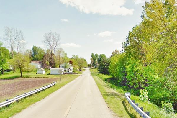
Driving south from Auburn, you will first pass by the two sharp turns of the original Route 66 course at Panther, Ackerman and Tiller Roads, head south and enter Thayer along Harrison Ave. This was the course followed by Route 66 in 1926. The modern highway that forks to the right is more recent.
Route 66 (1926 alignment) as it enters Thayer
Old Garage
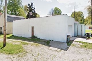
When you reach Ebony St, to your right is an old garage, on the SW corner with its service bay walled up. Turn here, along Ebony to the left to visit a classic eating spot.
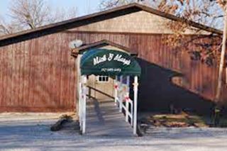
Former "Maggie’s", now Mick and Mary’s
It is located on the curve at the eastern tip of Ebony St. This is the main restaurant and watering spot in town has been open since 1926 close to the then brand new Route 66. It was known as "Maggie's" after Maggie Enrietta, who with her husband Dominik owned and ran it. Dominik is said to have been a bootlegger, to supply the bar during prohibition.
It was a roadhouse and a tavern. Later it became a restaurant specializing in fried chicken. It was razed by a fire in the 1940s or 50s.
Rebuilt at that time as the current building. Maggie sold it in 1957 to Mick and Mary Stankoven who ran it for another 26 years. Now it is ran by Josh Snodgrass. There are vintage black and white pictures decorating the interior.
Village Hall
Head to Main St. to visit the only original red-brick building that survived from the coal-mine days, the Village Hall, pictured below (Map with directions for your tour across Thayer).
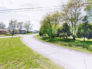
Head west along Main St. turn right along Harrison Ave. ahead the highway curves to the west with a wide curve (see picture).
Just ahead it meets the current alignment of IL-4, and turns sharply south towards Virden.
This vintage aerial photo taken in 1956 shows the original '66, the garage, and the later alingment along the Western side of town.
Continue your Road Trip along Route 66:
This part of your Road Trip along the 1926-30 Route 66 in Thayer ends here, head south along the highway to visit Virden.

Sponsored Content
>> Book your Hotel in Chicago

Credits
Banner image: Hackberry General Store, Hackberry, Arizona by Perla Eichenblat


