Illinois & Route 66
Index to this page
The State: Facts, Trivia and useful information
Area: 57,914 sq. mi. (148,998 km2). Population: 12.880.580 (2014 est.).
Width: 210 mi. (340 km). Length 395 mi. (629 km)
Time zone (along U.S. 66 alignment): Central (CST): UTC minus 6 hours. Summer (DST) CDT (UTC-5).
Some Facts:

The Neon Sign of the Historic Dell Rhea’s Chicken Basket, Willowbrook. Credits
- Nickname: "The Prairie State" in allusion to its flat topography, "Land of Lincoln"
- Motto: State sovereignty, national union
- Capital: Springfield (on U.S. Route 66)
- Highest point: Charles Mound, 1,235 ft. (376 m)
- 12th most populous state in the US
- 25th largest state in America
- Admitted as the 21st state of the Union on December 3, 1818
- Abraham Lincoln, was the 16th president of the United States, though not a native Illinoisan, he studied and worked there most of his adult life.
- Route 66 length in Illinois is 289 miles (465 km); 6th longest segment
Name: Illinois
In the late 1600s, French missionaries named the region (and the river) using a local Native American word, "irenwe-wa".
The word of Miami-Illinois origin meant "he speaks the regular way"; the word was later modified by Ojibwe speakers into "ilinwe" which the colonists and missionaries deformed by changing the "we" ending into "ois", same sound, different spelling.
The missionaries recorded the name that the Natives gave themselves: Inoka, whose meaning is unknown.
Illinois' History
Humans have been living in Illinois for over ten thousand years; a site at Koster had been inhabited for over 7,000 years. There are several burial mounds in the state; the most relevant are those in Cahokia in Collinsville on U.S. 66, covering an area of 50 acres (20 ha.)
In historic times, there were several tribes in the region: Shawnee, Winnebago, Fox, Miami, Sauk, Kickapoo, and Potawatomi.
The French explored the Illinois River in 1673, and settled it as part of Louisiana. In 1763 it was absorbed by the English after the Seven Years' War. During American Independence wars, it became the North west Territory (1783) and organized in 1809. Its first capital was initially at Kaskaskia, moved to Vandalia in 1819 and finally (backed by the then state representative Abraham Lincoln) to Springfield in 1837.
It became part of the Union in 1818, as the 21st state, and it banned slavery. It would fight on the side of the Union in the American Civil War.
The growing importance of farming, mining, and industry in Illinois coupled to its strategic location on Lake Michigan and, later as a railway hub, led to the growth of Chicago. Although a fire destroyed 4 sq. mi. (10 km2) of the city in 1872 (Great Chicago Fire), it resurged and was the birthplace of skyscrapers, and in 1926 it became the eastern terminus of US Highway 66, the place where Route 66 Begins.
The Geography of Illinois
Illinois is located between the Mississippi River and the Great Lakes. It has a very flat surface known as the "Interior Plains" not higher than 1,235 ft. (376 m). The Illinois River cuts across the state from the NE to the SW.
It is located on a geologically stable region and there are no volcanoes in the state. Earthquake risk is very low.
Climate: The Weather
The weather in the "Windy City":
Average High ⁄ Low Temperatures in Winter and Summer in Chicago:
Jan.: 31 ⁄ 16 °F (-1 ⁄ -9 °C)
Jul. : 84 ⁄ 64 °F (29 ⁄ 18 °C)
Its location in the middle of the North American landmass gives it a Continental climate, with hot and humid summers, and cold winters. Rainfall averages 48 inches (1.220 mm) yearly in the south to 35 in (890 mm) in the north.
It snows in Illinois with a marked increase towards the north of the state.
Thunderstorms take place about 51 days per year, which is above the U.S. average. And tornados strike often, experiencing 35 events per year with 1 tornado every 2,000 sq. mi. or 5.180 km2. The deadliest tornado to strike the U.S. hit Illinois in 1925. Illinois is part of Tornado Alley.
Tornado Risk: learn more about the Tornado Risk on US 66.
Winter Highs for Chicago and Springfield average 31°F (-1°C) with lows of around 18°F (-8°C); the summer highs are 86°F (30°C) with lows of 66°F (18°C).
Where to Stay in Illinois
Accommodation along U.S. Hwy 66 in Illinois
The towns along Route 66 offer different lodging options. Check out hotels and motels in the main towns clicking on the list below.
Hotels along Route 66, from East to West
>> Book your Hotel in Illinois
Map of Route 66 through Illinois
Interactive Route 66 map in IL
See our > >Illinois Route 66 map
It shows all the Route 66 alignments across Illinois.
Each of our individual town pages have maps with their alignments.
Itinerary with plenty of maps
Each leg of Route 66 described below has an interactive map and many image maps so you can follow the alignments of the highway along the way:
Towns located on Route 66 in Illinois
Population data is for 2023.
Joliet is the second largest city along Route 66 in Illinois (with 150,718 inhabitants it ranks 3rd in Illinois).
The first pace goes to Chicago which is the 3rd most populous city in the US with 2,608,425 inhabitants.
Springfield, the Capital city of Illinois is also on Route 66, and ranks 5th in IL. (pop. 111,711); it is followed by the 12th in the ranking, Bloomington with 78,397 residents.
Around one million people live along Route 66's corridor through Illinois.
Cities are listed from East to West
There are several alignments of Route 66 through Illinois, below are those on the 1930-1977 alignment.
We have listed the 1926-1930 alignment towns further down because they lie on a separate segment southwest of Springfield.
East
List of the 1926-30 Route 66 Towns from East to West
This segment lies between Springfield and Staunton west of the later 1930-77 US 66:
Route 66 itinerary across Illinois
Detailed description of the alignment of U.S. 66 through Illinois, from East to West:
Illinois
California ¦ Arizona ¦ New Mexico ¦ Texas ¦ Oklahoma ¦ Kansas ¦ Missouri ¦ Illinois
Route 66 in Illinois
Current mileage of US66: 289 mi.
General Overview of the alignment
Route 66 crosses the state with a Northeast - Southwest course, from Chicago to East Saint Louis, linking Lake Michigan with the Mississippi River.
Route 66 starts (or ends) at Chicago on the intersection of Jefferson and Jackson Boulevard. Grant Park is the official eastern terminus of Route 66. At the intersection of Jackson and Michigan you will find the End Historic Route 66 sign.
>> Read more: Where does Route 66 start and end?
Chicago

End of Route 66 in Chicago. Credits
From the starting point of Route 66, (mile zero), by Grant Park (historic site) take W. Adams St. west until reaching the diagonally oriented W. Ogden Ave, turn left (actually the alignment in 1926 was along W. Jackson Blvd., but it now runs west to east, that is why you must take the following street).
Follow Ogden as it crosses Cicero, Berwyn and Lyons (there are two alignments through Lyons the 1926-28 and the 1929-77 one). Take the first: and turn left on Lawndale Ave (11 miles)
At Joliet Rd., take a right and just keep on it. It is the Historic US 66 in Illinois.
Take a detour along W 55 St and East Ave. to bypass a closed section in McCook and return to Joliet Ave (14.8 miles). Cross Countryside, pass under I-294 and at Exit 276B access I-55.

The Neon Sign of Historic Dell Rhea’s Chicken Basket. Credits
Take I-55 westwards and leave it at Exit 274 to visit Dell's Chicken Basket in Willowbrook.
Ahead at Exit 267 you have two options: Due to the two alignments
- Go West along the 1940-77 alignment through Plainfield.
- Go West along IL-53, which was the 1926-39 US 66 and from 1940 to 1977 ALT US 66.

Gemini Giant, Wilmington IL
Both alignments meet at Braidwood. We will describe the second route:
Leave I-55 at Exit 267, and heading along S. Joliet Rd. towards the South. It becomes N. Independence Blvd. (IL-53) in Romeoville . Follow IL-53 towards Joliet, the highway overlaps with IL-7 (34 miles).
Joliet
Keep southwards, the road becomes N. Broadway St. and crosses the Des Plaines River via Ruby St. After the bridge turn right along IL-53 through downtown Joliet (39 mi.).
Follow U.S. 6 south which at 4th Ave. Becomes U.S. 52, cross I-80 and then leave US 52 and stick to IL-53 which splits towards the right. The road curves to the SW to reach the towns of Elwood (54 mi.) and Wilmington (68 miles), where it turns west and crosses the Kankakee River.
The road goes towards the SW again (IL-53) and at Braidwood (78 miles) it meets the later alignment coming from Plainfield. They run on both sides of the railroad tracks through two small former coal-mining towns: Godley and Braceville.
It reaches Gardner (104 mi.), going through the town along IL-29, (Main St.) and turning south along Historic Route 66 just before reaching I-55.
U.S. 66 runs on the eastern (south) side of I-55 next to the railroad. Near Dwight at 110 mi you will see the old paved surface of the original alignment of U.S. 66, to your right.
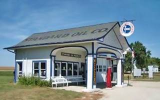
Historic Service Station in Odell, Illinois. Credits
Dwight
Keep on U.S 66, which passes around Dwight (111 miles) and keeps on running to the east of I-55 towards Odell, which it enters along N. West St. (121 mi.). Don't miss its Ambler's Texaco Gas Station (Historic Site).
Odell
Leave the later alignment of US 66 and go through the town along the original course of U.S. 66. See the Standard Oil service station (Historic Site) on S. West St. and Deer St. Outside of the town the road runs next to I-55 once again. Until they separate (127 miles) near Pontiac.
Pontiac
Once again leave the later alignment of Historic US 66 and take the old 1920s alignment through town: right onto Pontiac Road (131 mi.) and south down N. Division St., west along W. Lincoln Ave. and then again south along N. Ladd St.; you will reach the center of the city (139 miles), visit the Historic Illinois State Police Office.
The road crosses Tuttle Creek; at W. Reynolds St. take a left onto Historic US 66 and leave town. The highway keeps its southwestern course till it reaches Chenoa, (142 mi).
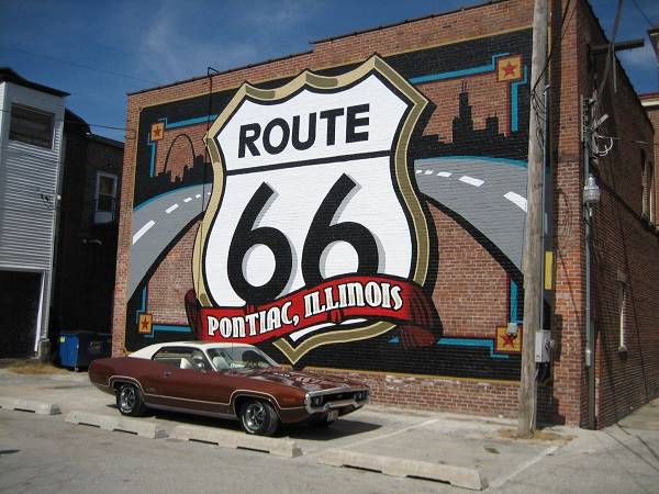
Chenoa
Cross the town via N. Morehead St. leaving US 66 and take a right at US 24 to return to the Historic US 66. The road now runs beside I-55 and reaches Lexington (150 miles).

Ambler’s Texaco Gas Station in Dwight, Illinois. Credits
Lexington
Go through the town along Parade Rd, Main St. and S. Grove St. to return again to Historic US 66 (152 mi.), follow it as it runs next to I-55 and reaches Towanda (159 mi.).
Towanda
Visit the dead mans curve on N. Quincy St. and follow Historic US 66 towards Normal and Bloomington.
Normal
Later alignments of US 66 went around the town along its eastern and southern sides on the corridor now used by I-55 Bus. Loop. We will describe the original 1926 alignment into Normal and Bloomington:
After reaching Veteran's Pkwy (I-55 Bus. Loop) (163 mi.), keep straight ahead, the road curves west and becomes Shelbourne St. west. Take a left along Henry St. south (164 miles) which curves into Pine St. west and ends at N. Linden St., where you must take another left southwards, until Willow St. (165 mi.). Take a right along Willow St. which will meet US Bus. 51 (166 miles). Take a left and pass through Illinois State University, heading southwards through Normal (visit Sprague's Super Service, a Historic Site.). Keep south towards Bloomington.
Bloomington
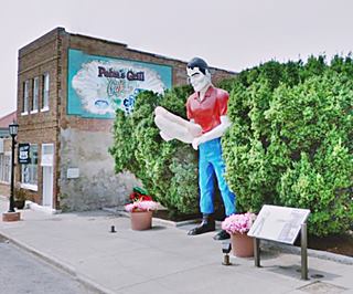
Paul Bunyon with giant hot dog in Atlanta
At Olive St. is the center of the city (168.5 miles). Keep southwards and at the crossing with S. Veterans Parkway (I-55 Bus. Loop) take a right along the later Historic US 66 (170 miles) take a right onto Fox Creek Road (171 mi.) to cross I-55 and take its west frontage road westbound passing through Shirley and Funks Grove, to reach McLean (184 miles).
Mc Lean
Crossing the town along N. Fisher St., Main St. and Dixie Rd. Keep southwest and reach Atlanta (190 mi.).
Atlanta
Pass through town along Arch St. but don't miss its Paul Bunyan holding a giant hot dog. Keep on Historic U.S. 66 pass by Lawndale, and cross I-55 at its Exit 133, (198 miles) accessing Lincoln.
Lincoln
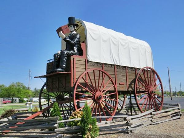
Abe Lincoln World’s Largest Covered Wagon
Leave Historic US 66 and take Kickapoo St., then west along Keokuk St. and southwest again via Sangamon St, taking 3rd St. west and Stringer Ave. to meet Historic Route 66 SW of the town (204 mi.).
As you approach Exit 123 of I-55 take a left along Historic U.S. 66, just before reaching the Interstate. It runs towards the SW, and passes through Broadwell (211 miles), Elkhart (215 mi.) and Williamsville (221 miles) where you will have to access I-55 South at Exit 109, through Stuttle Rd.
Leave I-55 at Exit 105 towards the town of Sherman, along I-55 Business Rd. (227 mi.). Pass through the town and keep on southwards towards Springfield.
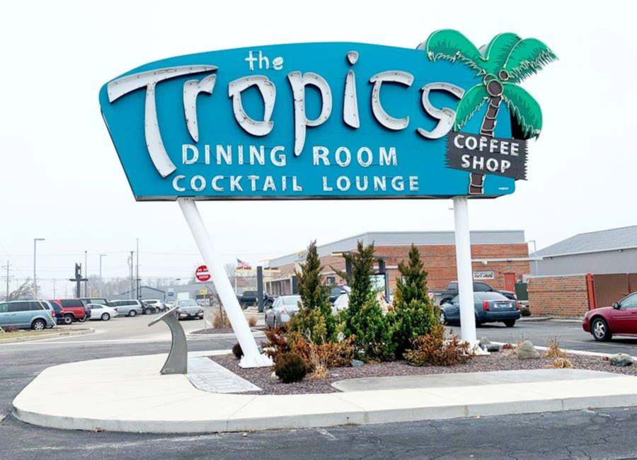
Springfield
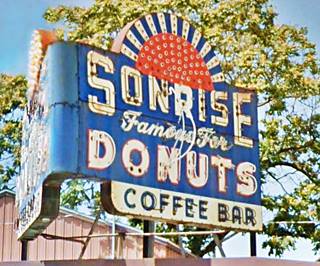
Sonrise Donuts neon sign, Springfield
After Sherman you reach the north side of Springfield; take a left (231 miles) along Historic US 66 Bypass (IL-29).
The state capital. Historic US 66 Bypass (IL-29) was the 1940s - 50s alignment, the previous ones entered the city along what is current I-55 Bus. Rd.
Go along IL-29 which until it turns left at S. Grand Ave., but keep straight along S. Dirksen Pkwy until it ends at Stevenson Dr., where you must take a right and continue until you meet I-55 Bus. and there take a left, southbound.
The road will reach the exchange between I-55 and I-72; there you should keep straight south along I-55 Bus. which will merge with I-55 proper, westbound. This is the old alignment of Route 66. At I-55 Exit 88 (245 mi.) take Palm Rd. South, to access US 66 which is the western ⁄ northern frontage road of I-55.
The 1926 to 1930 Alignment south of Springfield
The original Route 66 ran to the west of the later alingment, both split in Springfield and meet in south of Staunton.
Read about this alignment: Springfield to Staunton (1926-30) US66 and follow its course starting in Chatham; it has a red brick paved segment of Route 66 in Auburn.
The Brick Paved Route 66 on the 1926-30 alignment in Illinois
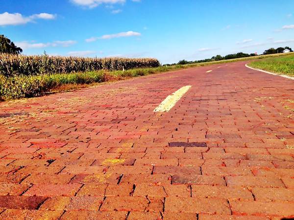
> Read more about Brick paved sections of Route 66.
Main 1930-77 Route 66 South of Springfield
After Springfield you pass by Glenarm followed by Divernon (254 miles) and Farmersville (263 mi.). After Waggoner, at IL-24, you will switch to the east Frontage Road (278 miles), reaching Litchfield (281 mi.).
Litchfield

Soulsby’s Service Station, Mt. Olive Credits
Cross the town along Old Rte. 66 (access it with a left at N. 13th Ave.), visit the Ariston Cafe and the Belvidere Cafe, Motel, and Gas Station, Litchfield, Historic Sites. At Co. Rd. 1000 a right and a left will keep you southbound along US 66 (285 miles), towards Mt. Olive.
Mt. Olive
At the north access to Mt. Olive (289 mi.) you can keep to Old Route 66 and bypass the town, or drive through it (city center 291 miles) and visit the Soulsby Service Station, a Historic Site (see image). South, along the main alignment is Livingston with its giant fiberglass statues:

Staunton

Cars buried in the ground, Route 66 at Henry's Rabbit Ranch, Staunton
After crossing the railroad, take the right fork (295 mi.) passing under I-55 along Old 66 into Staunton, passing along its eastern side (297 miles).
Keep south until Williamson Rd. forks to the right (299 mi.), take this road which will meet IL-4 (300 miles) and then take a left southbound. IL-4 meets I-55 at Exit 33, but stick to the west frontage Road, US 66 (303 mi.).
The road will take you through Hamel (307 miles).
Different Alignments to the Mississippi River
After Hamel, there were different alignments of U.S. Route 66 into St. Louis Missouri.
There were four different bridges across the Mississippi River, and at least 4 alignments into East St. Louis and St. Louis.
We will skip those going south into East St. Louis and take the 1930s- 50s alignment, across the Chain of Rocks Bridge. Which is the northernmost of these alignments.
Check our itinerary from Hamel to St. Louis with an interactive Map.
After Hamel keep SW along IL-157, which will take you to Edwardsville.
Edwardsville
At the crossing with IL-143 (315 mi.), take a right and keep along IL-157 Westwards and then SW, cross the S. University Dr. (321 miles) and continue along Chain of Rocks Road, crossing over IL-255 near its Exit 30. Keep your westerly course till IL-111, (324 mi.).
Keep west along the same road leaving IL-111 behind. The road meets the railway tracks (325 miles), and you must access I-270 to cross the tracks at Namekoi Rd. Right after crossing the railroad, take the exit to Old Alton Rd., turn right and pass under I-270, then a left to meet the W. Chain of Rocks Rd. which crosses the navigation channel of the Mississippi River (328 mi.) and keeps west.
Chain of Rocks Bridge
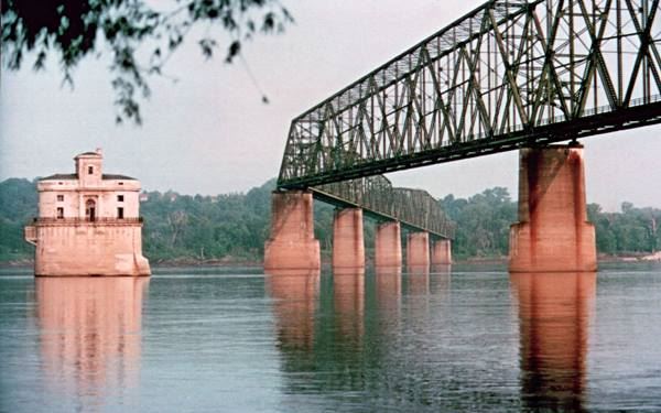
At 330 mi, you will reach the end of the road at the Chain of Rocks Bridge (A Historic Site - see image), with its bend in the middle. It does not allow heavy vehicle traffic. At this point Route 66 crossed the Mississippi River.
To cross the River you will have to go back along the same route, to Il-3, (332 miles), take a left and at Exit 3B head West along I-270, crossing the Mississippi River and leaving Illinois, to enter Missouri (335 mi.).
Chain of Rocks Bridge nowadays in Madison, Illinois
The last Alignment of US 66 into St. Louis
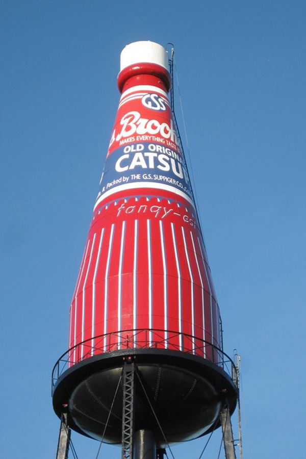
You can also drive from Hamel to Collinsville along the last US 66 alignment from the 1950s, and visit Cahokia Mounds State Historic Site close by, in Collinsville, a World Heritage Site of UNESCO.
It is also the site of
The Largest Catsup Bottle in the whole World
Some sponsored content:
>> Book your Hotel in Chicago

Credits
Banner image: Hackberry General Store, Hackberry, California by Perla Eichenblat

