How to Drive the whole of Route 66 in 7 days
Table of Contents
Index to this page: The Seven Day Road Trip itinerary:
- Can you do Route 66 in a week?
- Our 1 Week Route 66 Road Trip itineraries
- Day 1: Chicago to St. Louis
- Day 2: St. Louis to Joplin
- Day 3: Joplin to Clinton
- Day 4: Clinton to Albuquerque
- Day 5: Albuquerque to Winslow
- Day 6: Winslow to Needles
- Day 7: Needles to Santa Monica
Can you do Route 66 in a week?
Many visitors wonder if they can drive the whole of Route 66 in one week and have asked us to put a "one week Route 66 road trip" together.
We studied the matter in depth and put together this itinerary. It will let you drive from Chicago to Santa Monica in one week and see many of Route 66's key attractions.
So here it is, with a daily itinerary, with mileage, approximate times of arrival at each stop and landmark, and links to more information on these attractions, plus maps with directions.
So to those asking "Can you do Route 66 in a week?, the answer is yes! you can and have a lot of fun doing it.
Having said this, you should consider at least extending the ride to two weeks. This will give you time to do some side trips (like the Grand Canyon or Las Vegas) and to pack in more sights in smaller towns along the way.
Our one week Road Trip itinerary skips long sections of the original Route 66 and has long segments driven along the Interstate. We did this to gain time and get you quicker to each landmark. With more time you could drive more of the old US 66 roadbed.
Our 1 Week Route 66 Road Trip itineraries
Start in Chicago (Route 66 was historically a east-to-west drive) and go from the midwest to golden California.
We recommend that you take an extra day, the day that you arrive in Chicago to visit the downtown sights such as the End and Begin signs of Route 66.
Further reading: a Detailed Description of Route 66 with text and interactive maps showing the alignments and the gaps in the highway.
Day 1: Chicago to St. Louis
Morning drive: Chicago - Lincoln (Illinois)
>> This is the Map from Chicago to Atlanta

The Neon Sign of the Historic Dell Rhea’s Chicken Basket, Willowbrook. Source
7:30 AM: Leave Downtown Chicago early. You can bypass the city's avenues and incoming rush hour traffic by taking I-55 westwards. Leave at Exit 274 to visit your first Route 66 landmark: Historic Dell Rhea’s Chicken Basket in Willowbrook (8 AM, 22.5 miles) take 5 min. for photos.
Return to the freeway, leaving it at Exit 268 onto IL-53 towards Joliet; this state highway is the original 1928 - 1939 alignment of Route 66, and from 1940 to 1977 it was ALT 66.
Stop at the 1920s The White Fence Farm restaurant in Romeoville, and then as you approach Joliet along N. Broadway there are some classic spots:
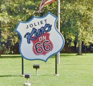
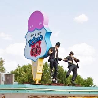
The Joliet Kicks on 66 Shield-sign, Rich and Creamy Ice Cream Standand Dick’s Towing heading into Joliet is the Site of World's First Dairy Queen and Route 66 meets Lincoln Highway marker.
8:30 AM. You are in Downtown Joliet. Total driving time roughly 1 hour. Distance 42 miles from Chicago.
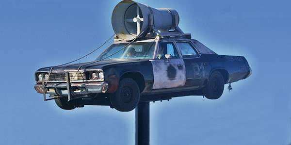
Head south along IL53 (Historic Route 66) past the Bluesmobile (photo stop). And continue all the way to Wilmington
The Bluesmobile, a replica in Joliet, Illinois

Gemini Giant, Wilmington
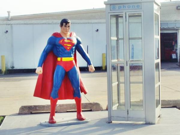
9:00 AM, must stop at the "muffler man": Gemini Giant (Distance driven 58.5 miles) (it is scheduled to be on exhibition during 2025 at the new Route 66 South Island Park.
9:15 AM. Keep on and stop for some photos at Polk-A-Dot Drive-In with its life-sized figures. (63.5 miles)
9:45 AM. Next stop is in Dwight, to visit the Historic Ambler’s Texaco Gas Station. Photos and 10 min. coffee break. Total Distance: 81 miles. Driving time: 2 hours.
10:00 AM At Odell visit the Historic Standard Oil Gasoline Station (90 mi. - 2 h 10 min driving since leaving Chicago).
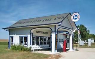
Historic Service Station, Odells. Source

Ambler’s Texaco Gas Station, Dwight. Source
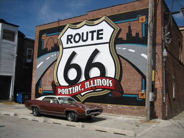
Head south along Route 66 into Pontiac and see the murals and other attractions don't miss at the Route 66 Association of Illinois Museum and Hall of Fame. 20 minute stop. (101 mi. driven).
Route 66 Shield Mural in Pontiac, Illinois
10:35 AM. Leave Pontiac to visit the Route 66 Memory Lane in Lexington (120 miles.) Stop for 10 minutes. Depart: 11:05 AM. Here you leave old Route 66 at Exit 178 and take the freeway (I-55) all the way to the next town, Atlanta.
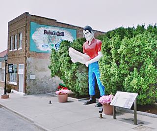
11:00 AM. Take Exit 140 into Atlanta to visit the Muffler Man Holding Hot Dog, and the American Giants Museum with giant Paul Bunyan statues (159 miles, 3h 25min drive). Return to I-55 head west.
> > This is the Map from Atlanta to St. Louis
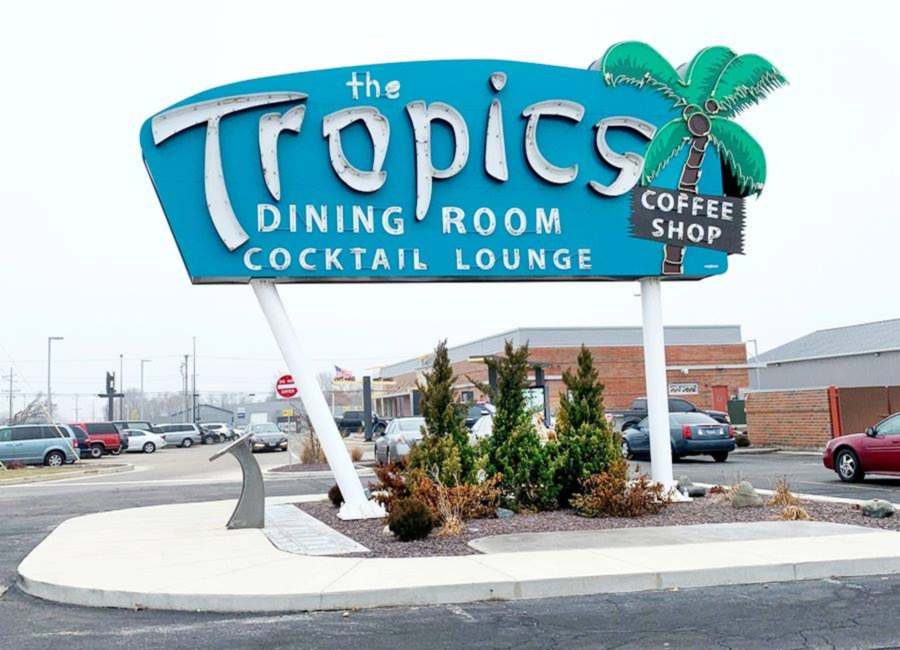
12:05 PM. You reach Lincoln. Take the old "beltway" around it to visit two classic sights: Tropics Neon Sign and the "wacky" World’s Largest Covered Wagon. Stop for one hour to rest, top up your gas tank and have lunch (172 mi. - 3h 40 min. Drive from Chicago).
Restored Tropics Neon Sign
Day 1: Afternoon drive Lincoln to St. Louis
1:15 PM. Start your second leg of the day: In Lincoln visit the The Mill Museum on 66. Then get onto I-55 at Exit 123.
You will bypass the state capital city of Springfield and stay on the freeway all the way to Mt. Olive.
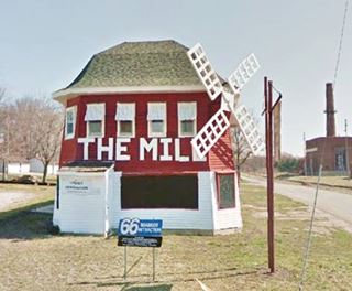
The Mill Museum on 66, Lincoln, IL.

Soulsby’s Service Station, Mt. Olive. Source
2:20 PM. Take Exit 44 to visit the Historic Soulsby’s Shell Service Station. (Driving time from Chicago 5 hours - 256 mi.)
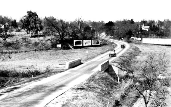
Stay on the old Route 66 into Staunton to visit Henry’s Rabbit Ranch (262 mi.) located on the 1930-40 alignment along the west side of Staunton.
The replica gas station at Henry's Rabbit Ranch:
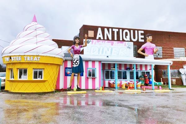
Visit another wacky spot on US 66, the Pink Elephant Antique Mall in Livingston (266 mi.); with giant fiberglass muffler men, a UFO and a Uniroyal Gal. Leave at 2:45 PM and take I-55 at Exit 33 all the way to Exit 15A.
Large sculptures at Twistee Treat diner

World's largest Catsup Bottle. Collinsville Il. Source
3:00 PM. Follow IL-259 into Collinsville to visit the Historic Largest Catsup Bottle in the World. (5h 40 min. drive from Chicago - 291 mi.)
Head towards the last stop for the day along I-255 and I-270. Then take Exit 3 onto Chain Of Rocks Rd. to visit the historic bridge:
3:45 PM It has been a long drive from Chicago (6h 05min behind the wheel and 309 miles) so enjoy the Historical Chain of Rocks Bridge (Madison). G
It is a 20 minute stop.
Tips for a Safe Visit to the bridge. Access to the bridge from the Missouri side is CLOSED due to severe issues with car vandalism. You can park on the Illinois access. Do not leave any valuables in your car. Park at your own risk. The bridge is open to bikers and pedestrians daily from 9:00am to dusk and is wheelchair accessible.
The Chain of Rocks Bridge
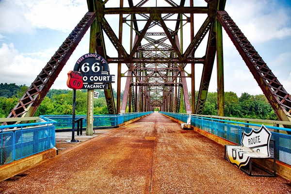
Retrace your steps and cross the Mississippi into Missouri along the new Chain of Rocks Bridge on I-270. Chose a hotel or motel along the north side of St. Louis along I-270 to spend the night, Hazelwood is ideal, close to St. Louis Airport (there are plenty of hotels there).
>> Book your Hotel near St. Louis Airport
End of Day 1. 4:30 PM.
- Total distance driven today: 328 miles
- Total Driving Time: 6h 30 minutes.
Day 2: St. Louis to Joplin Missouri
8 AM. Leave early and take the Interstate (I-270 south) then take I-44 westwarwds.
See the Map of this segment.
8:30 AM (28 mi. - 30 min. drive) Your first stop (10 min.) is at the Meramec River to visit the site of town of Times Beach which until its evacuation in 1983 due to contamination with dioxin was a town on Route 66. It was quarantined and later disincorporated. The buildings were razed and the former townsite was decontaminated. Now it is the Route 66 State Park.
Visit the 1935 Steiny’s Inn or Bridghead Inn, a 1932 section of the Mother Road and the now closed Historical Meramec River US 66 Bridge.

Keys Cafe at the Route 66 State Park.
Lit Beacon Neon sign, Route 66, Pacific Missouri. Source
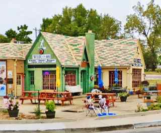
Phillips 66, Cuba MO.
Return to I-44. Ahead, take Route 66 leaving the freeway at Exit 261 drive into Pacific (8:50AM - 40 min drive time, 37.5 mi). Don't miss the historic Red Cedar or the Neon sign of Beacon Motel. Five minutes stop for photos.
Continue along Route 66 and stop at the Gardenway Motel in Gray Summit (9:05AM - 48 min, 43 mi.)
Stick to US 66 and see two more sights ahead in Villa Ridge: Tri County Truck Stop restaurant (9:14 AM - 52 min 44.9 mi) and the Sunset Motel (9:20 AM - 53 min driving time, 46 mi.). Stop at both for photos.
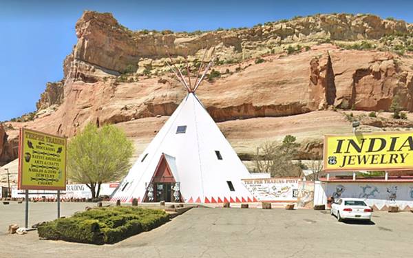
Keep on Rte. 66 and stop at the teepees of the Indian Harvest Trading Post (9:25 AM - 1h 4 min, 54 mi).
Return to I-44 and leave it at Exit 210 to visit Cuba. Consider a 20 min drive through town plus a 20 min. coffee stop. Arrive 10:15 AM (1h 37 min, 89 mi.)
See its Viva Cuba Murals, Route 66 sign on road Wagon Wheel Motel and 1932 Cottage style Phillips 66 gas station.
Historic Wagon Wheel Motel, Route 66 in Cuba, Missouri
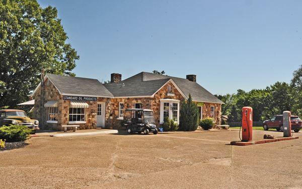
Route 66 Red Rocker
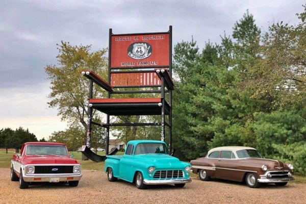
Leave Cuba at 10:55 AM and drive to Fanning to visit the World's Second largest Rocking Chair. 11:05 AM (1h 45 min, 93.4 mi). Five minute photo stop.
Head west, get onto I-44 and after passing St. James, take Exit 189 in Rolla to see the Mule Trading Post with its Hillbilly neon sign. Return to the freeway pass Rolla amd get off at Exit 176 to drive and visit the 1926-1977 Route 66 alignment, now abandoned, and since 2003, a bypassed section of I-44.
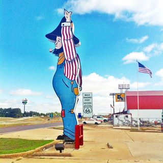
Hillbilly neon sign at The Mule Trading Post Rolla, Missouri. Source
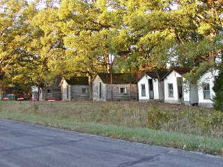
John’s Modern Cabins, Route 66. Newburg, Missouri. Source
Here in Newburg are the ruined remains of John's Modern Cabins built in 1942, and Vernelle's Motel. 11:30 AM (2 h 12 min, 122 mi.) 5 min. photo stop.
Retrace your steps back to I44's Exit 176; head west again to Exit 169 and drive Hooker Cut a segment of the four-lane Route 66 built during World War II.
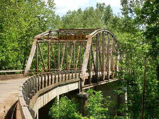
1923 Route 66 Bridge, Devil's Elbow, MO. Source
Ahead is the old narrow Route 66 1926-44 alignment into Devil's Elbow (bridge, café and restaurant). 11:50 AM (2 h 27 min, 134 mi). Stop for 10 minutes.
Stay on Old Route 66. 12:10 PM drive past Uranus Missouri with oddities and fun and a Mega Mayor "Muffler Man" (nice for a photo- 2 h 34 min 137 mi.) and head into St. Robert at I-44 Exit 161 for Lunch. 12:20 PM.
Total distance covered: 140 miles, driving time 2h 38 min. Lunch stop, fill up gas tank 1 hour relaxing time.

"Mega Mayor" muffler man, Uranus Missouri, St. Robert US 66. Source

Munger Moss Motel's neon sign, Lebanon
Source
Day 2. Afternoon Drive from St. Robert to Joplin
Leave at 01:20 PM and take I-44 all the way to Lebanon, take Exit 130 into the town.
> > This is the Map of this segment (Lebanon to Joplin)
See the great neon sign, old motel and US66 shield stencilled on the pavement at the Munger Moss Motel (01:50 PM - 3h 10 min, 172 mi).
Drive through Lebanon along Old Route 66, don't miss the 1935 Phillips Gas Station, leave town and return to I-44 at Exit 127 on the south side of town and drive west all the way to Springfield, Missouri.
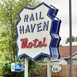
Leave the freeway at Exit 82A and drive south along US65 and MO-744 to visit a classic motel, the Rest Haven Motel with a great Neon Sign, then turn left to visit the Rail Haven Motel (2:55 PM - 225 mi.)
Now drive through Springfield along historic Route 66 to see Gillioz Theatre, the Rockwood court and the historic Rock Fountain Court as you drive westwards.

Continue along MO-266 (Historic Rte 66) and stop 5 min. for photos in Paris Springs (3:40 PM - 250 mi.) at Gay Parita Sinclair station.

Gary's Gay Parita Sinclair Gas Station
Paris Springs MO, Source

66 Drive-In Theatre, US 66, Carthage MO
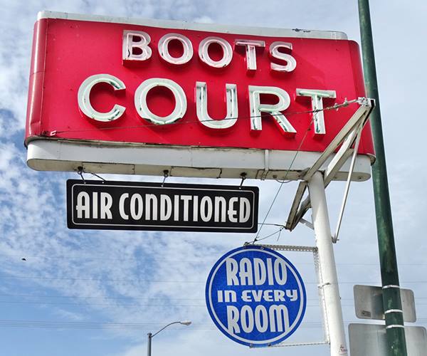
Head west along route 66 all the way to Carthage (4:25 PM - 286 mi.), in the downtown section is a classic stop, the 1939 Boots Court Motel.
Drive through Carthage to the (149 mi) Drive In Theatre (4:35 PM).
Neon sign of Boots Court in Carthage MO
Stick to Historic US 66 and drive through Carterville (it has an ancient gas station) and Webb City (in the latter drive throgh it's historic district and gas stations).

Dales Ole 66 Barber, Joplin
As you enter Joplin along the Mother Road see the former 1928 gas station and later barber shop: Dales Ole 66 Barber
Head straight into town. It marks the end of today's itinerary.
End of Day 2. 5:15 PM.
- Total distance driven today: 301 miles
- Total Driving Time: 5h 45 minutes.
>> Book your Hotel in Joplin
Route 66 American flag
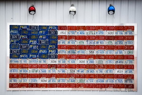
Source
Day 3: Joplin MO to Clinton OK
>> This is the Map from Joplin to Tulsa
Leave early, by 7:45 AM; today is a long drive across KS and most of OK. Head west along Rote 66, take the "right" branch to cross the state line and enter Kansas and head into Galena: check out its Main Street sights.like the Cars on the Route 66 gasoline station of "Cars" movie fame, or the Texaco Gas Station & Tag Flag.


Nelson's Old Riverton Store, Riverton KS

Rainbow bridge, side view of its arches, US 66 Riverton. Source
8:05 AM (8 mi.) head west into Riverton and visit the The oldest continuously operating store on Route 66, open since 1925 (11.5 mi.)

Independent Oil and Gas Service Station. Source
8:12 AM (14 mi.) Historic Rainbow Bridge across Bush Creek built in 1923. Don't miss the shields painted on the road next to it.
Drive through the town of Baxter Springs (18 mi.) and stop at a historic place, the Independent Oil and Gas Station with its cottage style building.
Into Oklahoma
8:30 AM, cross the state line into Oklahoma. Head south along Historic Route 66.
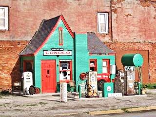
Hole in the Wall Conoco Station, Commerce. Source
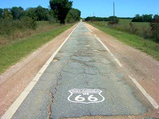
The 9 foot wide "Ribbon Road", Miami, Narcissa, Afton, Credits
8:45 AM, reach Commerce OK, (30 mi.) with its Dairy King and the classic Conoco Hole in the Wall gas station.
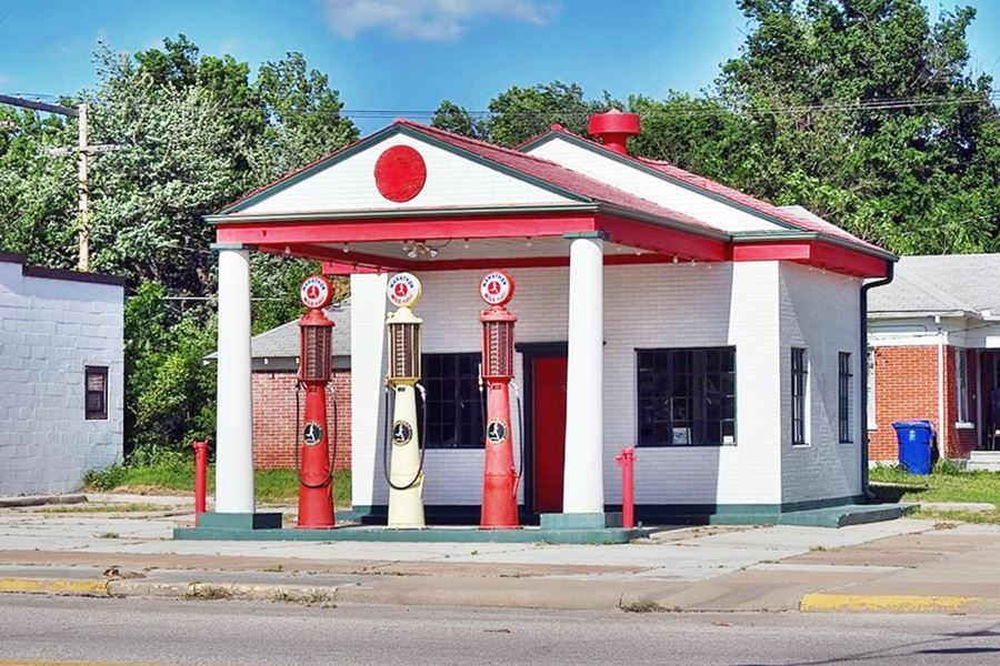
Drive through Miami (34 mi.) and don't miss the historic Marathon Oil Service Station.
Marathon Oil, a historic gas station from the 1920s
Head south leaving the main 1930s US 66 to drive the historic 1920s Nine foot wide Ribbon Road. It meets the 1930s alignment ahead; 9:20 AM (41 mi.)
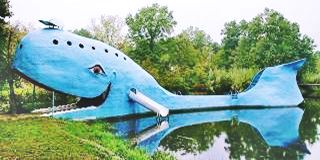
Blue Whale in Catoosa, Carol Highsmith
Head south and enter I-44 (Toll booth) at Exit 302 head west.
Alternative Routte. You have the option of driving the original 2-lane Route 66 from Afton all the way to Verdigris as shown in this map. It is 5 miles longer and will add 20 to 45 minutes to your drive depending on the traffic
If you take the turnpike, get off the Interstate at Exit 248 to drive by Verdigris and see the Historic Bridge. You will reach Catoosa at 10:22 AM (2h 11 min drive - 108 mi.) to visit the Blue Whale

Route 66 Rising. Source
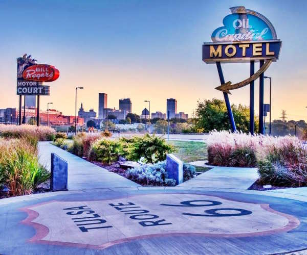
Now head west towards Tulsa: get on I44 at Exit 241 and leave it at Exit 236 to visit the Route 66 "Tulsa Rising" sculpture (117 mi.) and drive west down 11th St. (10:45 AM)
11th Street was the original Route 66 through Tulsa and it has plenty of sights, such as a muffler man, neon signs, classic motels and more. Driving it will add another 20 to 30 minutes to your trip.
Once you reach downtown Tulsa turn right along S. Elgin Ave. to visit to iconic gas stations: the Vickery Phillips 66 Station and the Blue Dome Service Station.
Vickery Phillips 66 Service Station, Tulsa, Oklahoma

At the Arkansas River, stop at the parking spot by the Cyrus Avery Centennial Plaza, there is an arch spanning the highway. Walk across the river using the historic bridge and visit the Route 66 Neon Sign Park on its western side.
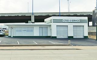
#8 Cities Service Station, Tulsa
Then you will drive across the Arkansas River stop at the Cities Service Station #8 Historic gas station. This marks the end of the Tulsa segment. You have driven for 2h 40 min. and 126 miles since you left Joplin this morning. Considering your stops in Tulsa to take photos and walk , it is now around 11:20 AM.
Westwards from Tulsa along Route 66
>> This is the Map from Tulsa to Clinton
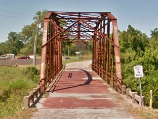
Rock Creek Bridge in Sapulpa
Notice the red brick deck
Click image for St. view
Head west driving past Route 66 Historic Village, Red Fork, and Oakhurst along old US66 and into the town of Sapulpa stop at the historic Waite Phillips Filling Station and head west to cross the historic Bridge #18 at Rock Creek with red-brick paving (140 mi. - 3h 10 min drive) 11:48 AM.
As this short stretch ends, turn right and take the Turnpike (I-44) westwards at Exit 211 (I-44 is a toll road.). Drive all the way to Chandler, Exit 166 to visit its classic Phillips 66 Station (Historic Site).
You have driven 190 miles - 4 hours driving time from Joplin. It is now 12:40. Stop 1 hour for lunch, fill up with gasoline.
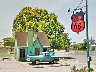
Phillips 66 Station, Chandler
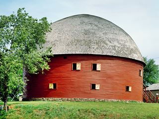
Round Barn, US 66, Arcadia OK. Carol M. Highsmith
Day 3 Afternoon Drive: Chandler to Clinton
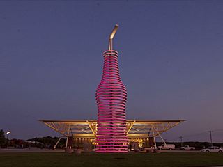
Pops Restaurant, Route 66, Arcadia
01:40 PM. Head west along Route 66 our of Chandler and stop at Warwick's Historic Seaba's filling staton (201 mi). Continue west on OK-66 to Arcadia and visit Historic Round Barn. (220 mi.) 2:10 PM, ten minute stop.

The Milk Bottle Grocery in Oklahoma City
Just ahead is the Futuristic Pops 66 Station.
Go west and get on I-35 at Exit 141 head south. Leave the freeway at Exit 130 head westwards into Oklahoma City along NE 23rd City.
Drive past the state Capitol and several Route 66 sights on NW 23rd. On N Classen turn right to visit the The Milk Bottle Grocery 2:50 PM (241 miles.)
Return to I-44 at Exit 125A and go west along the old US 66 alignment (OK-66) that goes through Bethany and Yukon to El Reno with its downtown sights: the Avant and the Jackson Conoco Service Stations plus the Route 66 Shield monument 3:35 PM.
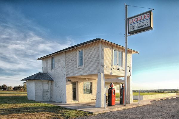
Get onto I-40 at Exit 119 and drive west to visit Provine Service Station - Lucille's Place in Hydro. (6 h. 10 min driving time - 304 miles). 4:15 PM.
Historic "Provine Station" also called "Lucille's Place"
Back on the freeway at Exit 84, head west all the way to Clinton, enter town at Exit 69.
Find your hotel, have supper and relax. Your drive for today is over.
The town's route 66 Museum opens at 9 and closes 5 PM so you will not have a chance to see it. But you can take photos of its facade.
End of Day 3. 4:50 PM.
- Total distance driven today: 326 miles
- Total Driving Time: 6h 40 minutes
>> Book your Hotel in Clinton
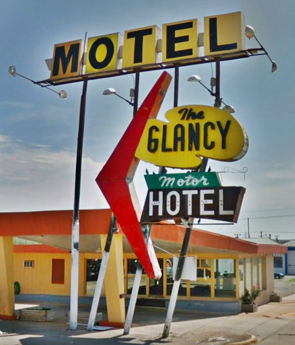
Neon sign of Glancy Motel, Clinton, Oklahoma
Day 4: Clinton OK to Albuquerque NM
>> This is the Map from Clinton OK to Adrian TX
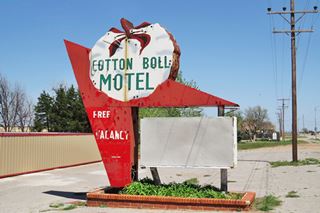
Cotton Boll Motel Neon sign. Canute. Source
Rise early and leave by 8:00 AM. Get onto I-40 W at Exit 65 and leave it at Exit 47 to enter Canute to visit the rusting neon signs of two iconinc motels.
8:22 AM. (21 mi.) the Cotton Boll and the Washita motel.

Canute Washita Motel Neon sign. Click for St. view, Source. Click for St. view
Return to the freeway and drive into Sayre (Exit 25). Visit its Historic Downtown District. 8:55 AM (46 mi.)
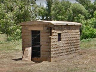
Now drive to Texola along I-40. 9:25 AM, visit its tiny Jail, Magnolia gas station and old diner.
Texas State Line

Restored Magnolia gasoline station. Route 66, Shamrock TX. Source
Return to the freeway and cross the Texas - Oklahoma state line 9:35 AM. Drive west and leave I-40 to enter Shamrock.
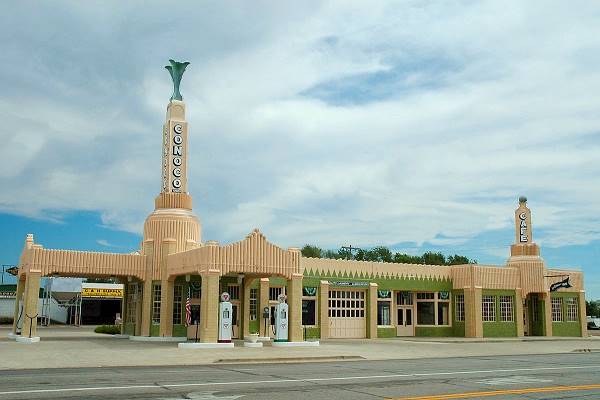
09:50 AM, visit its classic Art Deco styled Conoco Tower Station. (85 mi.) time for a 10 min. coffee break. Don't miss the Magnolia gas station.
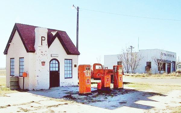
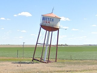
Return to the freeway to reach McLean, exit there into the town to see the Phillips 66 Cottage style Gas station 10:25 AM (105 miles); there are several gas stations along US 66 here. Return to the freeway, drive past Groom famous for its 198 foot tall Giant Cross, and its Leaning water tower (137 mi. - 2h 20 min drive).
Stay on the freeway all the way to Conway, leave I-40 to see the Buggy Farm (151 mi) 11:05 AM. From here you will drive the 7 mile-long historic segment of Route 66 in Conway and then after Exit 89, along I-40 into Amarillo
In Amarillo we will bypass the historic Sixth Street district (keep it in mind as an optional side-tour).
Drive past the Big Texan with its neon sign and gigantic bull 11:45 AM, (3 hours - 174 miles driven).
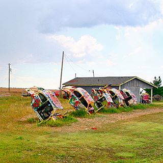
Bug Ranch, Conway. Source
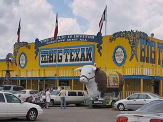
Big Texan Steak Ranch, Amarillo TX. Source, click for St. view
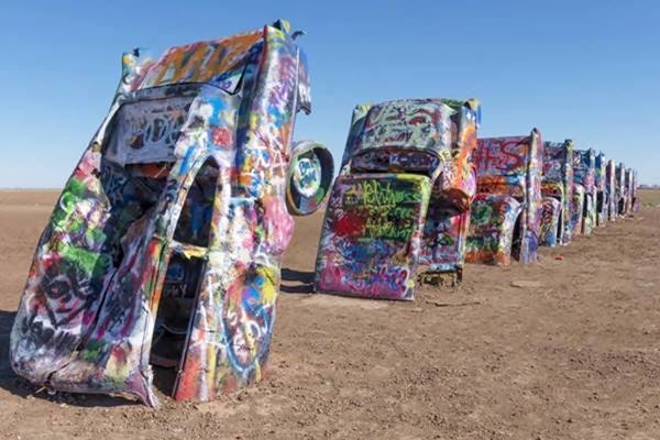
Drive along the south side of Amarillo heading westwards and stop at the Cadillac Ranch at 12:05 PM, ten minute stop. (188 miles).
Front view of the Cadillacs buried nose-down in the ground
Return to the freeway and drive all the way to Adrian Midpoint of Route 66, to see the midpoint sign, cafe. Stop for lunch (1 hour), fill tank. 12:52 PM (227 mi - 3 h 52 min drive).
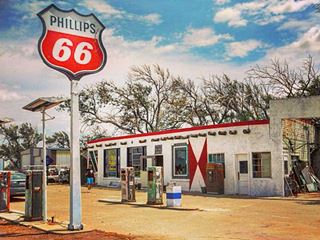
Bent Door Cafe, Adrian TX, Source
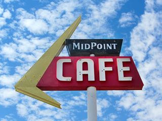
Midpoint Cafe in Adrian, Texas
Source
Day 4 Afternoon Drive: Adrian TX to Albuquerque NM
Bonus hour, you will cross the Time Zone and gain an hour on the TX-NM state line
>> This is the Map from Adrian to Albuquerque
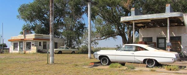
Leave Adrian at 01:55 PM for your long afternoon drive and head along the freeway to the ghost town of Glenrio (249 mi.) 02:20 PM stop for photos (5 min.) along old Route 66 and return to the freeway.
A view of vintage cars, a Route 66 diner, and gas station in Glenrio
New Mexico
Cross the state line into New Mexico and turn your watch back one hour (You leave the Central Time Zone and enter Mountain Time Zone so you left Texas at 2:30 PM and enter New Mexico at 01:30 PM - one hour less).
Drive past San Jon and leave the freeway at Exit 335 to enter Tucumcari 2:05 PM. Here there are plenty of old motels, neon signs, vintage gas stations to see driving along Route 66. So, spend some time in town sightseeing.

Blue Swallow Motel, New Mexico

Palomino Motel, Tucumcari
Palomino Motel, Tucumcari, New Mexico, Source

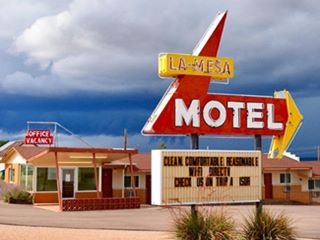
Neon Sign at La Mesa Motel, Santa Rosa. Source
2:45 PM Leave Tucumcari and drive west along I-40; leave it at Exit 275 to enter Santa Rosa; drive its main street stopping for photos on the way at the motels, gas stations, Route 66 Auto Museum. Leave 03:40 PM.
Take I-40 and pass through Clines Corners, Moriarty, stop at the Restored Whiting Bros station there.
Moriarty Whiting Brothers Service Station

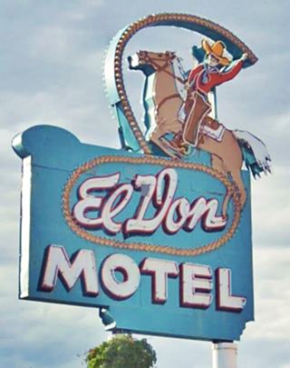
Iconic El Don Motel neon sign. Click for St. view
The road goes through Edgewood climbs the eastern flank of the Sandia Mountains, a prong of the Rocky Mountains, with forests. The road descends through the forested Tijeras Canyon crossing Tijeras, and Carnuel. Reaching the level floor of the Rio Grande River valley and, Albuquerque. Leave the freeway at at Exit 167 05:10PM to enter the city along Central Avenue, former 1937-85 Route 66. Stop along the way at the motels and classic sites. Check what ones you want to see during your stay in town with our five webpages on Albuquerque.
Index to our six pages on Albuquerque & Route 66
- Albuquerque (this page: an overview)
- Eastern Albuquerque
- Nob Hill
- Downtown
- Old Town & Western Albuquerque
- 4th St. Route 66 - 1926-37 Sights
Find your m hotel, have dinner and fill your tank for tomorrow.
>> Book your Hotel in Albuquerque
End of Day 4. 5:45 PM.
- Total distance driven today: 466 miles
- Total Driving Time: 7h 50 minutes.
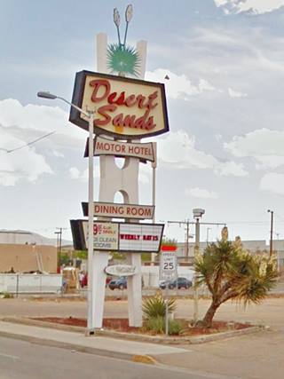
Neon Sign of the Desert Sands Motel in Albuquerque
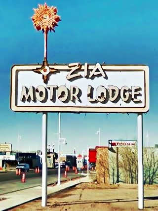
Neon Sign of the Zia Motel, Albuquerque
Day 5: Albuquerque NM to Winslow AZ
>> This is the Map from Albuquerque to Holbrook

Owl Rock by Route 66. Mesita. Perla Eichenblat
Leave Albuquerque at 8:00 AM and head west along Central Ave. Visit the "Old City" square, and the motels along the Avenue west of the Rio Grande. This was the "nine-mile hill." Get on I-44 at Exit 149. Leave the freeway at Exit 126 to drive an "original" section of Route 66.
8:45 AM, (33 mi.) crossroads with old gas station in Suwanee, drive past Mesita and see the Owl Rock and drive the sharp Dead Man's Curve to enter Laguna Pueblo. 9:15 AM. Stop in Laguna to see the old (1600s) old Mission church built in 1669, at the historic mission site (48 mi.)

Route 66 bar in Suwanee NM. A. Whittall

Laguna Mission Church
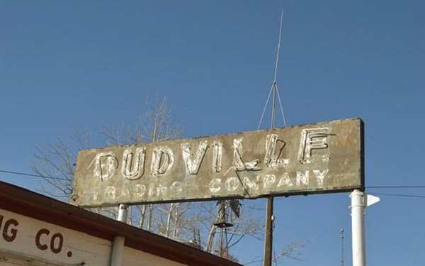
Cross San Jose River (268 miles). Don't access I-40, stick to NM-124, pass through Paraje, and Budville at the entrance to Cubero (277 miles) with its trading post. Ahead is San Fidel (281 mi.)
9:40 AM. See the Historic Acoma Curio Shop in San Fidel, and the Ruins of the Whiting Bros. Gas Station (64 mi. 1h 10 min drive to here).

Sands Motel Neon sign, Grants
Get back on the freeway and head west towards Grants (notice the lava flows on both sides of the freeway, only 3,000 years old).
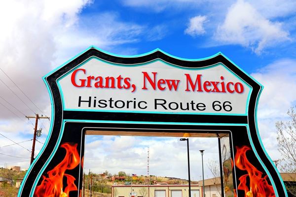
9:55 AM drive into Grants (78 mi.), the main street is old Route 66. See the motels along it like the Sands Motel. Stop and take a coffee break.
Return to the freeway and drive west; you will bypass Milan, Bluewater with its Historic Bowlin's Old Crater Trading Post, followed by Prewitt and just off Route 66, Thoreau at Exit 53 of I-40 with the Historical Site: Roy T. Herman's Garage and Service Station.

Dead End Sign on Route 66, Continental Divide. A. Whittall
Leave the freeway at Exit 47 in the Continental Divide, at 7,245 ft. (2.209 m), the rainfall goes west to the Pacific or east to the Atlantic from this point.
Go west along the Interstate.
It will pass by Wingate with the Historic District, Fort Wingate and Church Rock followed by Rehoboth.
Gallup
at Exit 22 leave I-40 to enter Gallup. 11:10 AM (140 mi.), here you can take photos of some classic motels neon signs, pictured below and the historic site, the El Rancho Hotel.
From Exit 20, head west using the freeway towards Arizona.
Arizona
At Exit 8 head onto old US 66 now NM 118, cross the state line into Arizona and stop by the base of the red cliffs at Lupton, Arizona 12:15 PM (2h 56 drive - 163 mi.).
Fill tank and have a quick (30 min.) lunch. Depart from Lupton at 12:45 PM
Day 5 Afternoon Drive: Lupton to Winslow AZ
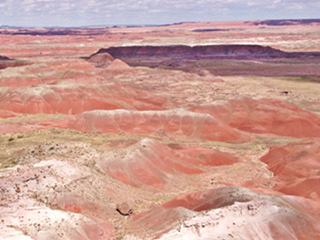
Painted Desert, Petrified Forest Nat. Park, AZ. A. Whittall
Leave 12:45 PM and drive west along the freeway for 47 miles. Leave it at Exit 311 to access the Petrified Forest National Park; the only National Park on Route 66. 1:25 PM (210 mi. - 3h 36 drive).
Dedicate 2 hours to visit Petrified Forest Nat. Park, walk some trails, see the historic Painted Desert Inn, the rusty car marking the old Route 66 alignment and of course the magic scenery with its petrified wood and colorfull rock formations in white, red, and ochre.

The "Tepees" Blue Mesa, Petrified Forest Nat. Park, AZ.
A. Whittall
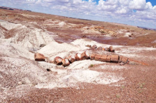
Petrified tree trunks. A. Whittall
Drive through the park (there is an entrance fee), stopping at the trails to see the petrified wood and trunks.
Leave it through its southern gate on US 180 and head west towards Holbrook, which is 20 minutes away.
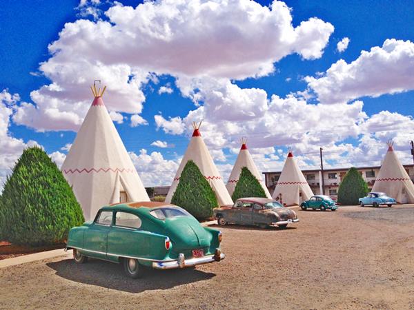
Drive into Holbrook, 03:45 PM (257 miles - 4 h 45 min driving time). Visit the main sights in town along Route 66: Historic Wigwam Motel, Rainbow Rock Shop with its dinosaur statues and Joe & Aggie's Cafe.
Historic Wigwam Motel: you could sleep in a teepee (wigwam) shaped room!
>> This is the Map from Holbrook to Winslow

Here it is! billboard, Jack Rabbit Trading Post
Leave town heading along the freeway and visit the Jack Rabbit Trading Post in Joseph City, use Exit 269 to reach it. (277 mi - 5h 14min drive) 4:10 PM 5 min stop.
Drive west, the last 16 miles into Winslow and spend the night there.
End of Day 5. 4:55 PM.
- Total distance driven today: 311 miles
- Total Driving Time: 5h 55 minutes.
>> Book your Hotel in Winslow Arizona
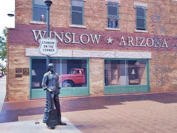
Don't forget to check out Winslow's classic attractions and of course its famous corner:
The statue at the famous "Corner" in Winslow Arizona. Route 66
Day 6 Winslow AZ to Needles CA
>> This is the Map from Winslow to Kingman
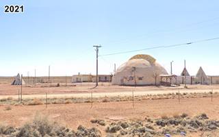
Meteor City
Leave Winslow at 7:45 AM and head west along I-40. After 15 min and 17 miles (8:00AM) at Exit 239 is what once was Meteor City, a dome-shaped trading post. Stop for photos. Head west again.
Side Trip: Visit Meteor Crater
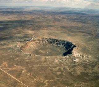
Barringer Meteor Crater seen from the air. Source
Just ahead at Exit 233 you can take a side trip to visit the meteor crater at Barringer, 6 miles south of the freeway. You have to pay an admission fee and the operators of this private natural landmark suggest that you take at least 2 hours to visit it.
It's diameter is 0.74 miles (1.186 m) and it is 560 feet (170 m) deep.
If choose to do this side trip, add 2 hours to the itinerary detailed below.
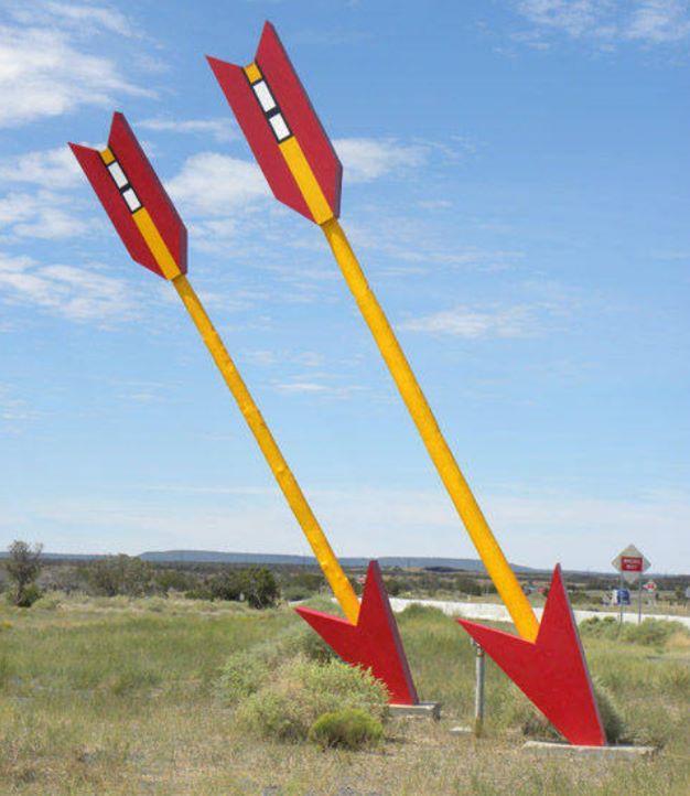
Head west again along the freeway to visit Twin Arrows (at Exit 219, 39 min. 36 miles). Take some photos, leave 8:35 AM.
Flagstaff
Drive west along I-40 to Flagstaff. Enter the town at Exit 201. 9:05 AM (61 mi.)
See some classic motels along Route 66 and the historic Downtown district. Stop at the Route 66 Visitor Center at the Railway Depot too. Notice the change in the scenery (pine trees and mountains have replaced the arid desert scenery).

Snow dusted San Francisco Peaks, Flagstaff AZ. Source
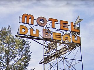
Dubeau Motel Neon Sign, Flagstaff
Grand Canyon
From Flagstaff you can visit the Grand Canyon.
But bear in mind that it is a full day excursion. If you have the time, we highly recommend it. The Grand Canyon is unique in many ways.
You can drive there from Flagstaff along US180 Spend the whole day there and drive back via US180 and AZ-64 to Williams, and spend the night there.
View of the Grand Canyon and the Colorado River, Arizona


General Store, Parks AZ. A. Whittall
9:30 AM, leave Flagstaff and head west onto the freeway. At Exit 178 leave I-40 along the old alignment of Route 66 and head right, into Parks and visit the Parks General Store, over 100 years old (79 mi). Leave 10 AM and drive down the old Route 66 into Williams, stopping on the way at the two floor log cabin: Wagon Wheel Lodge (85 mi.) 10:10 AM.
Williams
10:30 AM. After 2h driving time - 94 miles, you will reach downtown Williams. Spend at least 45 minutes in town, drive along the two streets that mark Route 66's alignment through the town and have a cup of coffee to take in the scenery.
Elvis Presley is alive in Williams Arizona!

Leave at 11:15 AM. Take the freeway westwards at Exit 161 and leave it at Exit 123 to begin driving the Historic Route 66 segment in Arizona.
Seligman is just ahead (2 h 42 min. 137 miles). Arrival at 12:15 PM. Stop for lunch, and stroll its Main Street. Leave at 01:15 PM.

Route 66 the Main Street, Seligman
A. Whittall

"Zoomie" the apatosaurus. Grand Canyon Caverns. Source
Day 6 Afternoon Drive: Seligman AZ to Needles CA
Now you will drive a very long stretch of the original Route 66 all the way into Kingman. Ahead are the Grand Canyon Caverns with dinosaur statues, and of course caverns.
Suggested stops along this part of the Mother Road:

Frontier Motel, Truxton
- John Osterman Shell Station in Peach Springs (173 mi.)
- Frontier motel in Truxton (182 mi.)
- Valentine Gas Station (194 mi.)
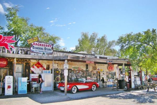
- Hackberry General Store in Hackberry (196 mi.) Take a 30 min coffee break.
- Giganticus Headicus in Antares (202 mi.)
A view of Hackberry's General Store
Kingman

Motel Sign, Kingman
3:15 PM enter Kingman (220 miles and 4 h driving time). Head into town along Andy Devine (Route 66), it is where the classic motels and the Historic Downtown district are located. Stop for photos on the way.
Dedicate 10 minutes to the Powerhouse Visitor Center (224 mi) on the south side of town.
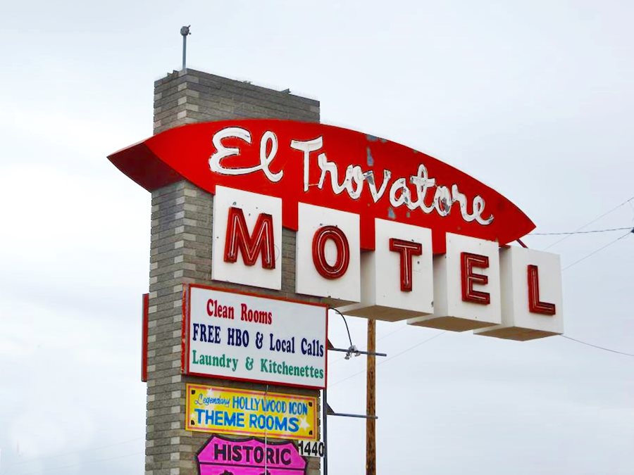
The Classic Trovatore Motel in Kingman
Final Segment of Day 6: across the Black Mountains; Sitgreaves Pass
>> This is the Map from Kingman to Needles
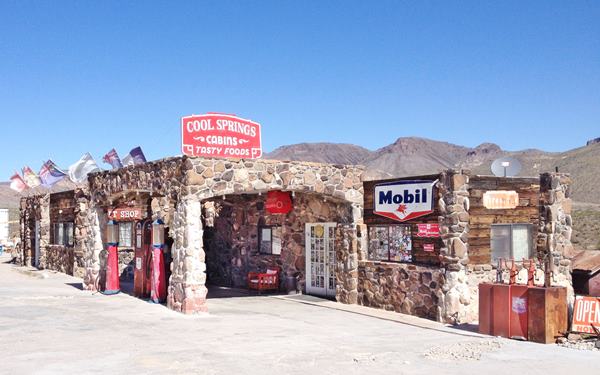
Cool Springs Gas Station, Austin Whittall
Leave Kigman along Route 66 westwards and follow AZ-10 towards Oatman. This is the Historic Route 66 National Back Country Byway. See the sign of the road as you turn left onto AZ-10.
3:50 PM. At Cool Springs a great vintage gas station (244 mi).
Drive up and across Sitgreaves pass (3,595 ft - 1.096 m) stop for some good photos (248 mi, 4 h 47 min. drive), 4:05 PM, and drive down falling 915 ft. in a winding course along 4 miles into Oatman.
4:25 PM, you reach Oatman, a gold rush mining town on the Black Mountains. (252 mi.) Stop for 20 minutes to enjoy the sights.

Watch out for Burros sign near Oatman Arizona.
Perla Eichenblat

Oatman Hotel sign. A. Whittall
Two burros in Oatman, on Route 66.
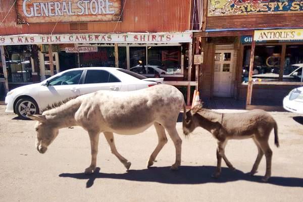
Now head straight south along old US 66 all the way to Topock, where you get on the interstate (I-40), to cross the Colorado River and enter California.
California
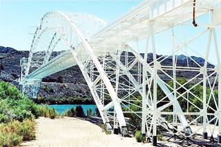
The Trails Arch Bridge, Topock AZ- Source
To your left is the "Trails Arch Bridge", the first bridge that carried Route 66 across the river, now it carries a natural gas pipeline.
Bonus Hour! Crossing Time Zone
As you cross the river you shave off one hour from your itinerary! (if it is 5:30 in Topock, it is 4:30 on the other side of the Colorado River)
Drive into Needles. Stopover for the night.
>> Book your Hotel in Needles
End of Day 6. 4:40 PM.
- Total distance driven today: 291 miles
- Total Driving Time: 5h 51 minutes.
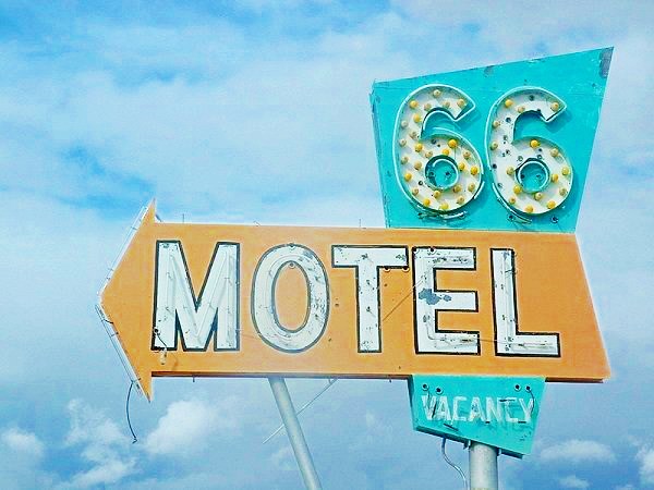
The Route 66 Motel Sign
Day 7: Needles to Santa Monica
Last day of your Road Trip!
> This is the Map from Needles to Rancho Cucamonga

Fender's neon sign. Needles. Source
Leave Needles at 8:00 AM and head west along the freeway (I-40) to exit 78 and head south to visit the Road Runner's Retreat at Chambless (1h 13 min - 79 miles) 9:15 AM.
Turn around and drive west along Route 66 into Amboy (89 mi.) 9:35 AM Stop for photos at the "Googie" styled Café and motel.

Road Runner Restaurant, Chambless. Source
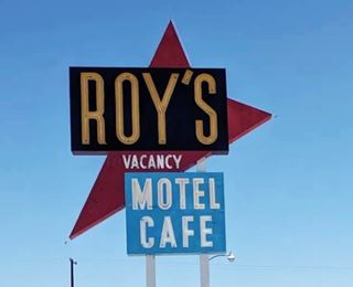
Roy's Motel neon sign . Source
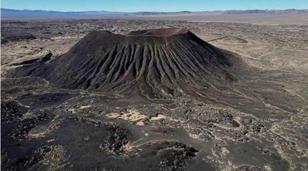
Drive west from Amboy and don't miss the Volcano to your left.
Keep on Old Route 66 all the way to Ludlow and stop for coffee at Ludlow Cafe (117 mi. - 2 h drive time).
Leave at 10:20 AM return to I-40, but leave it at Exit 33 to stop at Bagdad Cafe, and the fading Henning Motel neon sign near Newberry Springs (150 mi.) 10:50 AM.

Henning Motel Sign. Newberry Spgs.
Austin Whittall
Barstow
Take I-40 and leave it at Exit 1 to head into Barstow (178 mi.) 11:20 AM. Drive through town along Route 66 stopping for pics. at the motels along National Trails Hwy. (the original Route 66).
Head south along Route 66 (now CA-66) and visit Elmer's Bottle Ranch in Helenale (203 mi.) 12 PM midday. Stop for 20 minutes.

Drive into Victorville for a one hour lunch stop.12:45 PM. Refuel.
Day 7: Afternoon Drive. To the Ocean
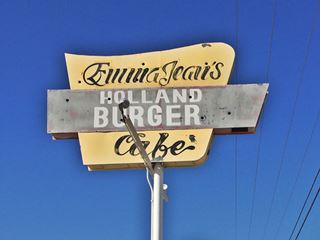
Neon Sign at Emma Jean's Cafe, Victorville. Source
Leave Victorville at 1:45 PM (215 mi.) and hit the freeway all the way to San Bernardino, you will cross the San Andreas Fault at Cajon Pass.
Stop at San Bernardino's First Ever McDonalds site, now a museum (215 mi.) 2:30 PM, ten min. stop for photos.
Drive in to Rialto (259 mi.) 2:50 PM to see the #7 Wigwam Motel.

The Wigwam Motel Route 66, San Bernardino. Source
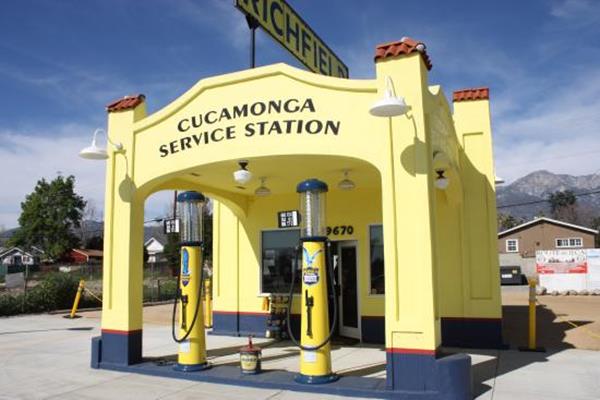
Richfield Service Station, Rancho Cucamonga. Source
Take the freeway (CA-210) to visit a classic gas station in Rancho Cucamonga (Exit 58) 3:15 PM, the Cucamonga Richfield station, built in 1915.
Return to CA-210 and drive all the way to Monrovia 3:55 PM (304 mi.) and visit the Historic Aztec Hotel with its richly decorated facade.
>> This is the Map from Rancho Cucamonga to Santa Monica
Drive into Los Angeles along I-210 and in Pasadena take the Historic Arroyo Seco Parkway segment used by Route 66 from 1940 to 1964, now CA-110, it will cross the "Four Level Interchange". Here instead of following Route 66 along Hollywood Freeway and Santa Monica Blvd. to avoid traffic continue west along CA-110 and I-10.
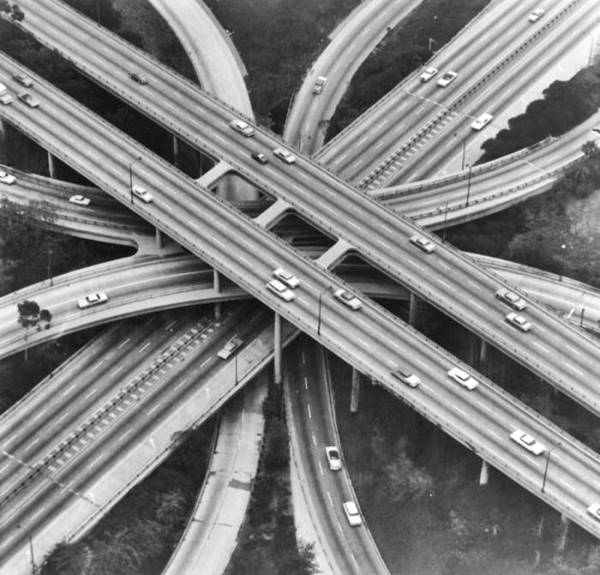
See this aerial view of the stacked interchange nowadays. Below is another view of it, seen from the lowest level.
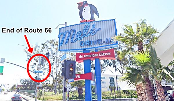
Leave I-10 at Exit 1B. Here next to Mel's Drive In (with a nice neon sign) is the formal & official End of Route 66 see the Sign there (337 mi. 6h 24 min drive time) 4:44 PM.
Photo of Mel's Drive In and the End of the Road sign on Lincoln and Olympic Blvds.
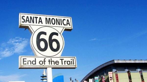
Continue the last mile of your journey to the "popular" End of the Trail Sign on Santa Monica Pier.
Your journey ends here.
End of Day 7. 5 PM.
- Total distance driven today: 338 miles
- Total Driving Time: 6h 35 minutes.
Enjoy the sunset on the Pacific Ocean. Stroll, relax, you've made it!! You have driven Route 66 all the way from Chicago to Santa Monica in seven days!
The "End of the Trail" sign on Santa Monica Pier
Some sponsored content
>> Book your Hotel in Santa Monica
Comments on our 1 week U.S. 66 itinerary
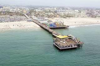
Aerial view of Santa Monica Pier, Santa Monica.
To do the whole of Route 66 in only one week is tight. And won't give you time to visit many attractions as you will have to drive long sections along the Interstate.
You will be bypassing many towns whose Main street was Route 66
Driving along the Interstate also means you won't actually drive along most of Route 66's original roadway.
But, there are several sections in our itinerary where you do drive along the old roadway Route 66: the long one in Arizona (Seligman to Topock), and also Conway in Texas, all of Kansas, and some segments in the other states.
It will be tyring, because you will be driving long hours. Your days will start at 8 AM and end at 5 PM. But, it will be worth the effort.


Credits
Banner image: Hackberry General Store, Hackberry, AZ by Perla Eichenblat


